TopoQuest Logo
Do you find TopoQuest useful?
Help keep TopoQuest running and adding new maps/features by donating!
Bitcoin:  19c7KJd3qBynnjoSw5npx9KScwjBe4ifkT
Litecoin:  LXs6TkuXGGXo1vDsWCkWVdjQX94eUKd6ui
Home View Maps Find Maps Find Places Resources & Links


Ireland Mesa, Utah Topographic Map

USGS Map Title: Ireland Mesa, UT
USGS Map MRC: 38111F1
DRG (GeoTIFF) Download: o38111f1.tif


Neighboring USGS Topographic Map Quads:


  Mesa Butte, UT  
38111G2
 

  Big Bend Draw, UT  
38111G1
 

  Copper Globe, UT  
38110G8
 

  Mussentuchit Flat, UT  
38111F2
 

  Ireland Mesa, UT  
38111F1
 

  Tomsich Butte, UT  
38110F8
 

  Salvation Creek, UT  
38111E2
 

  The Frying Pan, UT  
38111E1
 

  Hunt Draw, UT  
38110E8


Map MRC Location:

N39°
W112°
N39°
W111°
H8 H7 H6 H5 H4 H3 H2 H1
G8 G7 G6 G5 G4 G3 G2 G1
F8 F7 F6 F5 F4 F3 F2 F1
E8 E7 E6 E5 E4 E3 E2 E1
D8 D7 D6 D5 D4 D3 D2 D1
C8 C7 C6 C5 C4 C3 C2 C1
B8 B7 B6 B5 B4 B3 B2 B1
A8 A7 A6 A5 A4 A3 A2 A1
N38°
W112°
N38°
W111°

Ireland Mesa, UT USGS 1:24K Topographic Map Preview:
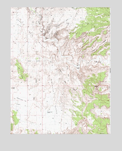
Ireland Mesa, UT USGS Topographic Map
Click on map above to begin viewing in our Map Viewer.

This topographic map contains these locations and features:
Feature Name Type Latitude Longitude GNIS ID View Map
Cat CanyonValleyN38.7453°W111.0943°1426400View Map
Dizzy Trail CanyonValleyN38.7497°W111.0913°1450334View Map
Hebe CanyonValleyN38.6972°W111.0941°1435663View Map
Hebes MountainSummitN38.6772°W111.1066°1428630View Map
Ireland MesaSummitN38.6833°W111.0513°1429035View Map
Ireland Mesa CanyonValleyN38.6547°W111.0354°1435744View Map
Lone Tree WedgeCapeN38.7250°W111.1007°1435894View Map
Pitchforth SpringSummitN38.6703°W111.1227°1438010View Map
Poncho WashValleyN38.7216°W111.0835°1436156View Map
Poor CanyonValleyN38.6972°W111.0216°1428628View Map
Prickly Pear BendBendN38.6908°W111.0435°1436175View Map
Slaughter SlopesSlopeN38.6516°W111.0624°1432536View Map
Slaughter Slopes ReservoirReservoirN38.6467°W111.0791°1436370View Map
The DikeSummitN38.7414°W111.0174°1433299View Map
The HonduArchN38.6725°W111.0160°1433339View Map
The Merry-Go-RoundSummitN38.6964°W111.0188°1435933View Map
The WedgeCapeN38.7258°W111.1113°1433447View Map
Willow Springs WashValleyN38.7005°W111.0616°1434367View Map

Note: Coordinates in the location and feature list above are referenced to NAD83 datum.


Copyright (C) 2008-2025 Ryan Niemi / Sunset Dynamics ... All Rights Reserved