TopoQuest Logo
Do you find TopoQuest useful?
Help keep TopoQuest running and adding new maps/features by donating!
Bitcoin:  19c7KJd3qBynnjoSw5npx9KScwjBe4ifkT
Litecoin:  LXs6TkuXGGXo1vDsWCkWVdjQX94eUKd6ui
Home View Maps Find Maps Find Places Resources & Links


Iris, California Topographic Map

USGS Map Title: Iris, CA
USGS Map MRC: 33115B4
DRG (GeoTIFF) Download: o33115b4.tif


Neighboring USGS Topographic Map Quads:


  Wister, CA  
33115C5
 

  Iris Wash, CA  
33115C4
 

  Lion Head Mountain, CA  
33115C3
 

  Niland, CA  
33115B5
 

  Iris, CA  
33115B4
 

  Tortuga, CA  
33115B3
 

  Westmorland East, CA  
33115A5
 

  Wiest, CA  
33115A4
 

  Amos, CA  
33115A3


Map MRC Location:

N34°
W116°
N34°
W115°
H8 H7 H6 H5 H4 H3 H2 H1
G8 G7 G6 G5 G4 G3 G2 G1
F8 F7 F6 F5 F4 F3 F2 F1
E8 E7 E6 E5 E4 E3 E2 E1
D8 D7 D6 D5 D4 D3 D2 D1
C8 C7 C6 C5 C4 C3 C2 C1
B8 B7 B6 B5 B4 B3 B2 B1
A8 A7 A6 A5 A4 A3 A2 A1
N33°
W116°
N33°
W115°

Iris, CA USGS 1:24K Topographic Map Preview:
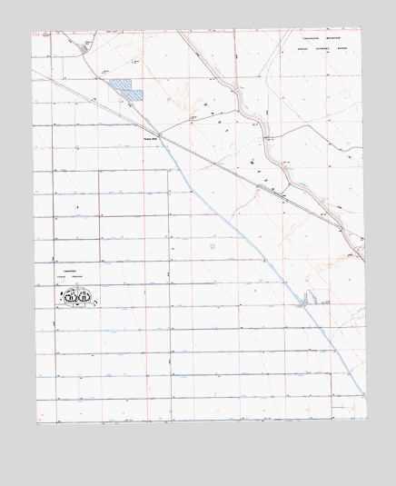
Iris, CA USGS Topographic Map
Click on map above to begin viewing in our Map Viewer.

This topographic map contains these locations and features:
Feature Name Type Latitude Longitude GNIS ID View Map
Calipatria State PrisonBuildingN33.1630°W115.4847°2739982View Map
Calipatria State Prison Fire DepartmentBuildingN33.1636°W115.4928°2665292View Map
City of CalipatriaCivilN33.1693°W115.4922°2409962View Map
D DrainCanalN33.1259°W115.4347°241202View Map
D LateralCanalN33.1259°W115.4758°241203View Map
E DrainCanalN33.1331°W115.4328°241698View Map
E LateralCanalN33.1328°W115.4250°241699View Map
East Highline CanalCanalN33.1675°W115.4044°241774View Map
F DrainCanalN33.1403°W115.4317°242127View Map
F LateralCanalN33.1398°W115.4530°242128View Map
F-I LateralCanalN33.1398°W115.4033°242130View Map
Flowing WellsLocaleN33.2161°W115.4528°242329View Map
G DrainCanalN33.1475°W115.4539°242556View Map
G LateralCanalN33.1470°W115.4172°242557View Map
G-I LateralCanalN33.1470°W115.3966°242559View Map
H DrainCanalN33.1550°W115.4603°243096View Map
H LateralCanalN33.1545°W115.4803°243097View Map
I DrainCanalN33.1620°W115.4558°243759View Map
I LateralCanalN33.1617°W115.4769°243760View Map
IrisPopulated PlaceN33.1953°W115.4044°252909View Map
J DrainCanalN33.1695°W115.4650°243943View Map
J LateralCanalN33.1686°W115.4833°243945View Map
K DrainCanalN33.1764°W115.4753°244187View Map
K LateralCanalN33.1761°W115.4783°244189View Map
L DrainCanalN33.1842°W115.4800°244377View Map
L LateralCanalN33.1836°W115.4505°244379View Map
M DrainCanalN33.1911°W115.4886°245331View Map
M LateralCanalN33.1909°W115.4694°245332View Map
N DrainCanalN33.1984°W115.4828°246421View Map
N LateralCanalN33.1981°W115.4667°246422View Map
O DrainCanalN33.2059°W115.4933°246692View Map
O LateralCanalN33.2053°W115.4786°246693View Map
P LateralCanalN33.2131°W115.4730°247059View Map
R Side Main CanalCanalN33.2248°W115.4725°247899View Map
Siphon FiveCanalN33.2150°W115.4122°254268View Map
Siphon FourCanalN33.2050°W115.4053°254267View Map
Siphon SixCanalN33.2300°W115.4225°254269View Map
Siphon ThreeCanalN33.1945°W115.3919°254266View Map
Siphon TwoCanalN33.1789°W115.3789°254265View Map

Note: Coordinates in the location and feature list above are referenced to NAD83 datum.


Copyright (C) 2008-2024 Ryan Niemi / Sunset Dynamics ... All Rights Reserved