TopoQuest Logo
Do you find TopoQuest useful?
Help keep TopoQuest running and adding new maps/features by donating!
Bitcoin:  19c7KJd3qBynnjoSw5npx9KScwjBe4ifkT
Litecoin:  LXs6TkuXGGXo1vDsWCkWVdjQX94eUKd6ui
Home View Maps Find Maps Find Places Resources & Links


Iron Spring, Montana Topographic Map

USGS Map Title: Iron Spring, MT
USGS Map MRC: 45107H2
DRG (GeoTIFF) Download: o45107h2.tif


Neighboring USGS Topographic Map Quads:


  Hope Ranch, MT  
46107A3
 

  South Bear Creek, MT  
46107A2
 

  Minnehaha Creek North, MT  
46107A1
 

  Hammond Ranch, MT  
45107H3
 

  Iron Spring, MT  
45107H2
 

  Minnehaha Creek South, MT  
45107H1
 

  Padlock Ranch, MT  
45107G3
 

  Iron Spring SW, MT  
45107G2
 

  Wolf School, MT  
45107G1


Map MRC Location:

N46°
W108°
N46°
W107°
H8 H7 H6 H5 H4 H3 H2 H1
G8 G7 G6 G5 G4 G3 G2 G1
F8 F7 F6 F5 F4 F3 F2 F1
E8 E7 E6 E5 E4 E3 E2 E1
D8 D7 D6 D5 D4 D3 D2 D1
C8 C7 C6 C5 C4 C3 C2 C1
B8 B7 B6 B5 B4 B3 B2 B1
A8 A7 A6 A5 A4 A3 A2 A1
N45°
W108°
N45°
W107°

Iron Spring, MT USGS 1:24K Topographic Map Preview:
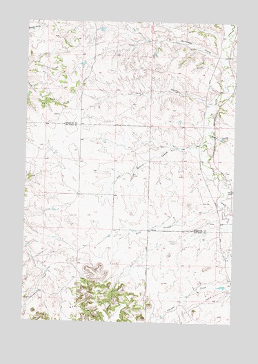
Iron Spring, MT USGS Topographic Map
Click on map above to begin viewing in our Map Viewer.

This topographic map contains these locations and features:
Feature Name Type Latitude Longitude GNIS ID View Map
02N36E11AACD01 SpringSpringN45.9389°W107.1998°813468View Map
02N36E11ADAA01 WellWellN45.9386°W107.1987°813465View Map
02N36E12ABDC01 WellWellN45.9467°W107.1839°813503View Map
02N36E14ABAB01 SpringSpringN45.9278°W107.2042°813403View Map
02N36E23AADB02 SpringSpringN45.9111°W107.1992°813308View Map
02N36E26BCDB01 WellWellN45.8933°W107.2151°813153View Map
02N36E28DDAC01 WellWellN45.8872°W107.2409°813092View Map
02N37E04BDCD01 WellWellN45.9508°W107.1284°813520View Map
02N37E05C___01 WellWellN45.9442°W107.1512°813496View Map
02N37E08ADDC01 WellWellN45.9355°W107.1289°813446View Map
02N37E08BDAD01 WellWellN45.9372°W107.1373°813459View Map
02N37E17ACCC01 WellWellN45.9214°W107.1439°813369View Map
02N37E18CCAD01 WellWellN45.9155°W107.1714°813342View Map
02N37E18CCCD01 SpringSpringN45.9138°W107.1744°813331View Map
02N37E19CDDC01 SpringSpringN45.8994°W107.1678°813200View Map
02N37E20ABDB01 WellWellN45.9114°W107.1417°813314View Map
02N37E20ABDC01 WellWellN45.9103°W107.1417°813298View Map
02N37E21CAAC01 WellWellN45.9050°W107.1262°813239View Map
02N37E28ACCB01 WellWellN45.8930°W107.1328°813149View Map
02N37E28ACCB02 WellWellN45.8936°W107.1251°813161View Map
02N37E29CADD01 WellWellN45.8886°W107.1464°813112View Map
02N37E32BBBB01 WellWellN45.8839°W107.1556°813060View Map
Adams School (historical)SchoolN45.9780°W107.2278°1721556View Map
Coxs CouleeValleyN45.9669°W107.1426°770244View Map
Dawes CouleeValleyN45.9294°W107.1287°770481View Map
Iron SpringSpringN45.9363°W107.1862°772730View Map
Iron Spring CouleeValleyN45.9475°W107.1531°772731View Map
Iron Springs School (historical)SchoolN45.9361°W107.1978°1716433View Map
Kray CouleeValleyN45.9219°W107.1345°773132View Map
Lubbock-Wallace School (historical)SchoolN45.9944°W107.1367°1721553View Map
Rainwater CouleeValleyN45.9855°W107.1359°775539View Map
WaltLocaleN45.9583°W107.1376°1721516View Map
Wight School (historical)SchoolN45.8986°W107.1284°1716479View Map
Willoughby CouleeValleyN45.9528°W107.1406°778527View Map

Note: Coordinates in the location and feature list above are referenced to NAD83 datum.


Copyright (C) 2008-2025 Ryan Niemi / Sunset Dynamics ... All Rights Reserved