TopoQuest Logo
Do you find TopoQuest useful?
Help keep TopoQuest running and adding new maps/features by donating!
Bitcoin:  19c7KJd3qBynnjoSw5npx9KScwjBe4ifkT
Litecoin:  LXs6TkuXGGXo1vDsWCkWVdjQX94eUKd6ui
Home View Maps Find Maps Find Places Resources & Links


Isle, Minnesota Topographic Map

USGS Map Title: Isle, MN
USGS Map MRC: 46093B4
DRG (GeoTIFF) Download: o46093b4.tif


Neighboring USGS Topographic Map Quads:


  Malmo, MN  
46093C5
 

  Thor SW, MN  
46093C4
 

  Thor SE, MN  
46093C3
 

  Wahkon North, MN  
46093B5
 

  Isle, MN  
46093B4
 

  McGrath, MN  
46093B3
 

  Wahkon South, MN  
46093A5
 

  Isle SW, MN  
46093A4
 

  Warman, MN  
46093A3


Map MRC Location:

N47°
W94°
N47°
W93°
H8 H7 H6 H5 H4 H3 H2 H1
G8 G7 G6 G5 G4 G3 G2 G1
F8 F7 F6 F5 F4 F3 F2 F1
E8 E7 E6 E5 E4 E3 E2 E1
D8 D7 D6 D5 D4 D3 D2 D1
C8 C7 C6 C5 C4 C3 C2 C1
B8 B7 B6 B5 B4 B3 B2 B1
A8 A7 A6 A5 A4 A3 A2 A1
N46°
W94°
N46°
W93°

Isle, MN USGS 1:24K Topographic Map Preview:
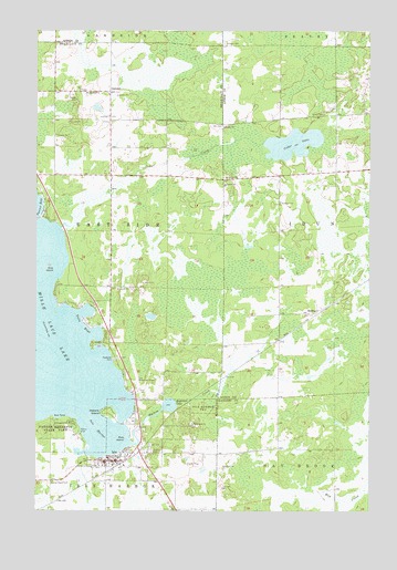
Isle, MN USGS Topographic Map
Click on map above to begin viewing in our Map Viewer.

This topographic map contains these locations and features:
Feature Name Type Latitude Longitude GNIS ID View Map
Anderson LakeLakeN46.1524°W93.4501°639342View Map
Cedar CreekStreamN46.1986°W93.4908°640994View Map
Cedar LakeLakeN46.2205°W93.4040°641016View Map
City of IsleCivilN46.1398°W93.4597°2395444View Map
Father Hennepin State ParkParkN46.1447°W93.4880°643578View Map
Holden CemeteryCemeteryN46.2465°W93.4299°645069View Map
Holden ChurchChurchN46.2250°W93.4300°645072View Map
IslePopulated PlaceN46.1380°W93.4708°645530View Map
Isle CemeteryCemeteryN46.1422°W93.4569°645531View Map
Isle HarborBayN46.1466°W93.4775°645532View Map
Isle Police DepartmentBuildingN46.1374°W93.4691°2758558View Map
Isle Private AirportAirportN46.1566°W93.4618°660230View Map
Isle Volunteer Fire DepartmentBuildingN46.1295°W93.4739°2666384View Map
Malone CreekStreamN46.1425°W93.4641°647419View Map
Malone IslandIslandN46.1502°W93.4722°647420View Map
Mille Lacs SchoolSchoolN46.1472°W93.4411°647862View Map
OpsteadPopulated PlaceN46.2338°W93.4722°648983View Map
Opstead ChurchChurchN46.2336°W93.4811°648984View Map
Pete IslandIslandN46.1436°W93.4666°649313View Map
Pine IslandIslandN46.1877°W93.4933°649464View Map
RedtopPopulated PlaceN46.1761°W93.3975°649898View Map
Redtop (historical)LocaleN46.1761°W93.3972°2070922View Map
Redtop CemeteryCemeteryN46.2049°W93.4085°649899View Map
Redtop Post Office (historical)Post OfficeN46.1761°W93.3972°2070923View Map
Sacred Heart CemeteryCemeteryN46.1324°W93.4938°650458View Map
Sunset CemeteryCemeteryN46.1411°W93.4572°652849View Map
Township of East SideCivilN46.2003°W93.4923°664034View Map
Twin BaysBayN46.1730°W93.4833°653407View Map

Note: Coordinates in the location and feature list above are referenced to NAD83 datum.


Copyright (C) 2008-2025 Ryan Niemi / Sunset Dynamics ... All Rights Reserved