TopoQuest Logo
Do you find TopoQuest useful?
Help keep TopoQuest running and adding new maps/features by donating!
Bitcoin:  19c7KJd3qBynnjoSw5npx9KScwjBe4ifkT
Litecoin:  LXs6TkuXGGXo1vDsWCkWVdjQX94eUKd6ui
Home View Maps Find Maps Find Places Resources & Links


Bald Mountain, Wyoming Topographic Map

USGS Map Title: Bald Mountain, WY
USGS Map MRC: 44107G7
DRG (GeoTIFF) Download: o44107g7.tif


Neighboring USGS Topographic Map Quads:


  Mexican Hill, WY  
44107H8
 

  Boyd Ridge, WY  
44107H7
 

  Bull Elk Park, WY  
44107H6
 

  Medicine Wheel, WY  
44107G8
 

  Bald Mountain, WY  
44107G7
 

  Ice Creek, WY  
44107G6
 

  Bear Creek Ranch, WY  
44107F8
 

  Leavitt Reservoir, WY  
44107F7
 

  Hidden Tepee Creek, WY  
44107F6


Map MRC Location:

N45°
W108°
N45°
W107°
H8 H7 H6 H5 H4 H3 H2 H1
G8 G7 G6 G5 G4 G3 G2 G1
F8 F7 F6 F5 F4 F3 F2 F1
E8 E7 E6 E5 E4 E3 E2 E1
D8 D7 D6 D5 D4 D3 D2 D1
C8 C7 C6 C5 C4 C3 C2 C1
B8 B7 B6 B5 B4 B3 B2 B1
A8 A7 A6 A5 A4 A3 A2 A1
N44°
W108°
N44°
W107°

Bald Mountain, WY USGS 1:24K Topographic Map Preview:
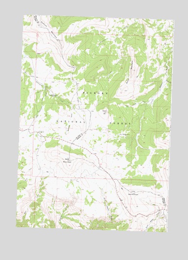
Bald Mountain, WY USGS Topographic Map
Click on map above to begin viewing in our Map Viewer.

This topographic map contains these locations and features:
Feature Name Type Latitude Longitude GNIS ID View Map
Bald MountainSummitN44.7902°W107.8318°1597888View Map
Bald Mountain CampgroundLocaleN44.8058°W107.8590°1597890View Map
Bald Mountain CityLocaleN44.8064°W107.7893°1609068View Map
Bald Mountain CreekStreamN44.8316°W107.8545°1597891View Map
Bald Mountain Placer ClaimsMineN44.8164°W107.8108°1726249View Map
Burnt MountainRidgeN44.8425°W107.7829°1598523View Map
Dayton GulchValleyN44.8400°W107.7554°1599138View Map
Duncum MountainRidgeN44.8669°W107.8537°1599417View Map
Gold CreekStreamN44.8039°W107.7965°1604640View Map
Half Ounce CreekStreamN44.8280°W107.7645°1600173View Map
Little Bald MountainSummitN44.7722°W107.7784°1600935View Map
Medicine Wheel Ranger StationLocaleN44.8280°W107.8448°1601343View Map
Porcupine CampgroundLocaleN44.8322°W107.8540°1602258View Map
Rooster HillSummitN44.8191°W107.8048°1602628View Map
Wilcox-People ProspectMineN44.8161°W107.8114°1726248View Map
Wyoming GulchValleyN44.8211°W107.8318°1604298View Map

Note: Coordinates in the location and feature list above are referenced to NAD83 datum.


Copyright (C) 2008-2024 Ryan Niemi / Sunset Dynamics ... All Rights Reserved