TopoQuest Logo
Do you find TopoQuest useful?
Help keep TopoQuest running and adding new maps/features by donating!
Bitcoin:  19c7KJd3qBynnjoSw5npx9KScwjBe4ifkT
Litecoin:  LXs6TkuXGGXo1vDsWCkWVdjQX94eUKd6ui
Home View Maps Find Maps Find Places Resources & Links


J B Hill, South Dakota Topographic Map

USGS Map Title: J B Hill, SD
USGS Map MRC: 45103D2
DRG (GeoTIFF) Download: o45103d2.tif


Neighboring USGS Topographic Map Quads:


  Sheep Pen Draw SE, SD  
45103E3
 

  Battleship Rock, SD  
45103E2
 

  Reva, SD  
45103E1
 

  Bams Butte, SD  
45103D3
 

  J B Hill, SD  
45103D2
 

  Flat Top Butte, SD  
45103D1
 

  Bams Butte SE, SD  
45103C3
 

  Irish Butte, SD  
45103C2
 

  Sheep Mountain, SD  
45103C1


Map MRC Location:

N46°
W104°
N46°
W103°
H8 H7 H6 H5 H4 H3 H2 H1
G8 G7 G6 G5 G4 G3 G2 G1
F8 F7 F6 F5 F4 F3 F2 F1
E8 E7 E6 E5 E4 E3 E2 E1
D8 D7 D6 D5 D4 D3 D2 D1
C8 C7 C6 C5 C4 C3 C2 C1
B8 B7 B6 B5 B4 B3 B2 B1
A8 A7 A6 A5 A4 A3 A2 A1
N45°
W104°
N45°
W103°

J B Hill, SD USGS 1:24K Topographic Map Preview:
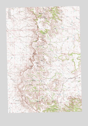
J B Hill, SD USGS Topographic Map
Click on map above to begin viewing in our Map Viewer.

This topographic map contains these locations and features:
Feature Name Type Latitude Longitude GNIS ID View Map
Andy SpringSpringN45.4027°W103.1870°1253656View Map
Beaver SpringSpringN45.4544°W103.1895°1253823View Map
Blarney Castle SpringSpringN45.4928°W103.1939°1253963View Map
Blomberg SpringSpringN45.4328°W103.1987°1253970View Map
Camp SpringSpringN45.4689°W103.1880°1254213View Map
Carrot SpringSpringN45.4764°W103.1987°1254255View Map
Colonel SpringSpringN45.4602°W103.2015°1254436View Map
Deer DrawValleyN45.3789°W103.1624°1254658View Map
Divide SpringSpringN45.4253°W103.2026°1254703View Map
Ell SpringsSpringN45.4922°W103.1589°1259320View Map
Elliott SpringSpringN45.3870°W103.1761°1254910View Map
G Wammen RanchLocaleN45.4417°W103.1713°1259319View Map
Gray SpringSpringN45.4554°W103.1797°1255349View Map
H Hotchkiss RanchLocaleN45.4125°W103.1380°1259313View Map
J B HillSummitN45.4403°W103.1401°1255797View Map
J B PassGapN45.4122°W103.2202°1265262View Map
J B SpringSpringN45.4006°W103.2036°1255798View Map
Jones CreekStreamN45.4122°W103.1349°1255874View Map
Jones Creek SpringSpringN45.4529°W103.1972°1255876View Map
Jones SpringSpringN45.4443°W103.2068°1255883View Map
Leatherburg SpringSpringN45.4742°W103.1692°1256075View Map
M Hamilton RanchLocaleN45.4208°W103.1630°1259318View Map
Meathook SpringSpringN45.4299°W103.2088°1256413View Map
Phillips RanchLocaleN45.3944°W103.1288°1257035View Map
Rabbit Creek DamDamN45.3967°W103.1638°1260574View Map
Rabbit Creek ReservoirReservoirN45.3958°W103.1613°1260910View Map
Rabbit Creek SpringSpringN45.3884°W103.2011°1257258View Map
Red ButteSummitN45.3895°W103.2369°1257298View Map
Red Tank SpringSpringN45.3915°W103.1930°1257321View Map
Road DrawValleyN45.4208°W103.1643°1257420View Map
Road Draw Spring Number OneSpringN45.4135°W103.2080°1257421View Map
Road Draw Spring Number TwoSpringN45.4081°W103.2144°1257422View Map
Rock RanchLocaleN45.3864°W103.1624°1257436View Map
Rock Ranch SchoolSchoolN45.4147°W103.1455°1257437View Map
Slash Five SpringSpringN45.4298°W103.1975°1258106View Map
Slim ButtesRangeN45.4892°W103.1902°1262433View Map
Square Top ButteSummitN45.4092°W103.1682°1258303View Map
Tepee Canyon SpringSpringN45.4868°W103.1834°1258516View Map
Tepee Number One SpringSpringN45.4882°W103.1840°1258517View Map
Thybo RanchLocaleN45.4150°W103.1357°1258548View Map
Thybo SpringSpringN45.3776°W103.1490°1258549View Map
Township of Slim ButtesCivilN45.4225°W103.1863°1268209View Map
Trail SpringSpringN45.4963°W103.1824°1258595View Map
Wammen SpringSpringN45.4368°W103.1932°1258818View Map

Note: Coordinates in the location and feature list above are referenced to NAD83 datum.


Copyright (C) 2008-2024 Ryan Niemi / Sunset Dynamics ... All Rights Reserved