TopoQuest Logo
Do you find TopoQuest useful?
Help keep TopoQuest running and adding new maps/features by donating!
Bitcoin:  19c7KJd3qBynnjoSw5npx9KScwjBe4ifkT
Litecoin:  LXs6TkuXGGXo1vDsWCkWVdjQX94eUKd6ui
Home View Maps Find Maps Find Places Resources & Links


Jackman, Maine Topographic Map

USGS Map Title: Jackman, ME
USGS Map MRC: 45070F3
DRG (GeoTIFF) Download: o45070f3.tif


Neighboring USGS Topographic Map Quads:


  Sandy Bay Mountain, ME  
45070G4
 

  Campbell Brook, ME  
45070G3
 

  Boundary Bald Mountain, ME  
45070G2
 

  Stony Brook, ME  
45070F4
 

  Jackman, ME  
45070F3
 

  Heald Pond, ME  
45070F2
 

  Holeb, ME  
45070E4
 

  Attean Pond, ME  
45070E3
 

  Catheart Mountain, ME  
45070E2


Map MRC Location:

N46°
W71°
N46°
W70°
H8 H7 H6 H5 H4 H3 H2 H1
G8 G7 G6 G5 G4 G3 G2 G1
F8 F7 F6 F5 F4 F3 F2 F1
E8 E7 E6 E5 E4 E3 E2 E1
D8 D7 D6 D5 D4 D3 D2 D1
C8 C7 C6 C5 C4 C3 C2 C1
B8 B7 B6 B5 B4 B3 B2 B1
A8 A7 A6 A5 A4 A3 A2 A1
N45°
W71°
N45°
W70°

Jackman, ME USGS 1:24K Topographic Map Preview:
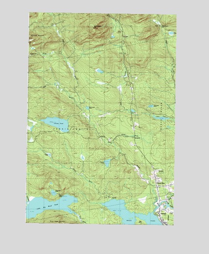
Jackman, ME USGS Topographic Map
Click on map above to begin viewing in our Map Viewer.

This topographic map contains these locations and features:
Feature Name Type Latitude Longitude GNIS ID View Map
Alder BrookStreamN45.6950°W70.3340°561140View Map
Brandy BrookStreamN45.6739°W70.3028°562897View Map
Burnt Land PondLakeN45.6938°W70.3241°563255View Map
Coburn PondLakeN45.6885°W70.2616°564137View Map
Crocker PondReservoirN45.6875°W70.3398°1773754View Map
Crocker PondLakeN45.6844°W70.3491°564528View Map
Crocker Pond DamDamN45.6875°W70.3398°1773753View Map
Daymond PondLakeN45.6955°W70.2703°564841View Map
DennistownPopulated PlaceN45.6770°W70.2831°578876View Map
DyervillePopulated PlaceN45.6414°W70.3065°579264View Map
East Branch Sandy StreamStreamN45.6875°W70.3262°565574View Map
Forest Hills Consolidated SchoolSchoolN45.6378°W70.2636°1908550View Map
Foxs CampLocaleN45.6431°W70.3528°566527View Map
Gander BrookStreamN45.6387°W70.3076°566675View Map
Gander PondLakeN45.6657°W70.3554°566677View Map
Heald StreamStreamN45.6367°W70.2545°567864View Map
Heald Stream FallsFallsN45.7434°W70.2634°578874View Map
Hog IslandIslandN45.6270°W70.2787°568168View Map
Jackman Moose River Fire DepartmentBuildingN45.6385°W70.2624°2553059View Map
Jackman Post OfficePost OfficeN45.6316°W70.2621°2768904View Map
Jackman Public LibraryBuildingN45.6379°W70.2627°2738429View Map
Little Big Wood PondLakeN45.6355°W70.3556°569682View Map
Moose RiverPopulated PlaceN45.6528°W70.2662°571635View Map
Moose River Seaplane BaseAirportN45.6334°W70.2656°582165View Map
Mud PondLakeN45.7389°W70.2541°571928View Map
Newton FieldAirportN45.6330°W70.2536°582164View Map
Plantation of DennistownCivilN45.6761°W70.3450°582439View Map
Rancourt PondLakeN45.6616°W70.3066°574018View Map
Sandy Stream MountainSummitN45.7416°W70.3203°574898View Map
Sky Lodge Landing Strip (historical)AirportN45.6575°W70.2626°1908694View Map
Slidedown ValleyValleyN45.7262°W70.3473°575551View Map
Stetson SchoolSchoolN45.6814°W70.2856°576310View Map
Sugar Berth PondLakeN45.6432°W70.3516°576491View Map
The FallsFallsN45.7328°W70.2953°578875View Map
West Branch Sandy StreamStreamN45.6875°W70.3262°578088View Map

Note: Coordinates in the location and feature list above are referenced to NAD83 datum.


Copyright (C) 2008-2025 Ryan Niemi / Sunset Dynamics ... All Rights Reserved