TopoQuest Logo
Do you find TopoQuest useful?
Help keep TopoQuest running and adding new maps/features by donating!
Bitcoin:  19c7KJd3qBynnjoSw5npx9KScwjBe4ifkT
Litecoin:  LXs6TkuXGGXo1vDsWCkWVdjQX94eUKd6ui
Home View Maps Find Maps Find Places Resources & Links


Jackson, Montana Topographic Map

USGS Map Title: Jackson, MT
USGS Map MRC: 45113C4
DRG (GeoTIFF) Download: o45113c4.tif


Neighboring USGS Topographic Map Quads:


  Ajax Ranch, MT  
45113D5
 

  Fox Gulch, MT  
45113D4
 

  Jackson Hill, MT  
45113D3
 

  Lower Miner Lakes, MT  
45113C5
 

  Jackson, MT  
45113C4
 

  Butch Hill, MT  
45113C3
 

  Goldstone Pass, MT  
45113B5
 

  Selway Mountain, MT  
45113B4
 

  Peterson Lake, MT  
45113B3


Map MRC Location:

N46°
W114°
N46°
W113°
H8 H7 H6 H5 H4 H3 H2 H1
G8 G7 G6 G5 G4 G3 G2 G1
F8 F7 F6 F5 F4 F3 F2 F1
E8 E7 E6 E5 E4 E3 E2 E1
D8 D7 D6 D5 D4 D3 D2 D1
C8 C7 C6 C5 C4 C3 C2 C1
B8 B7 B6 B5 B4 B3 B2 B1
A8 A7 A6 A5 A4 A3 A2 A1
N45°
W114°
N45°
W113°

Jackson, MT USGS 1:24K Topographic Map Preview:
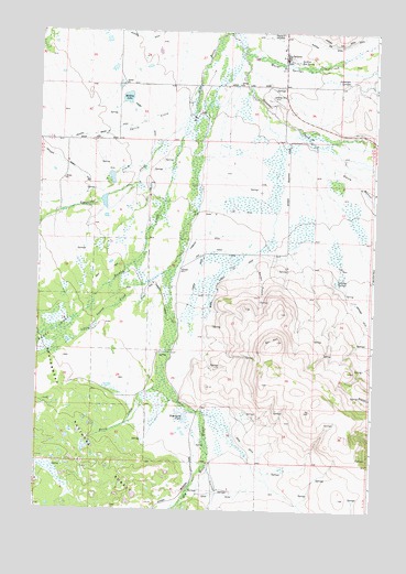
Jackson, MT USGS Topographic Map
Click on map above to begin viewing in our Map Viewer.

This topographic map contains these locations and features:
Feature Name Type Latitude Longitude GNIS ID View Map
05S14W31BCAC01 WellWellN45.3577°W113.3859°809075View Map
05S14W31BCBB01 WellWellN45.3596°W113.3873°809085View Map
05S15W25BCCB01 WellWellN45.3699°W113.4089°809141View Map
05S15W25CBAA01 SpringSpringN45.3677°W113.4039°809128View Map
05S15W26ADAD01 WellWellN45.3708°W113.4098°809147View Map
05S15W29ADAD01 WellWellN45.3705°W113.4712°809145View Map
05S15W36CABD01 WellWellN45.3524°W113.4023°809055View Map
06S15W02ADAD01 WellWellN45.3449°W113.3973°809025View Map
06S15W09AADA01 WellWellN45.3335°W113.4395°808974View Map
06S15W28BBAB01 WellWellN45.2910°W113.4559°808755View Map
06S15W30DBBC01 WellWellN45.2827°W113.4726°808715View Map
06S15W33CDDA01 WellWellN45.2641°W113.4501°808638View Map
Alamo Post Office (historical)Post OfficeN45.3746°W113.4098°1797226View Map
Bailey GulchValleyN45.3138°W113.4198°779256View Map
Berry CreekStreamN45.2838°W113.4523°779726View Map
Blanchard PondLakeN45.2744°W113.4450°780094View Map
Blanchard Pond DamDamN45.2749°W113.4442°798466View Map
Burton DitchCanalN45.3727°W113.4009°780664View Map
Company DitchCanalN45.3219°W113.4395°781551View Map
Davis DitchCanalN45.2566°W113.4134°782113View Map
Davis Woody DitchCanalN45.3119°W113.4295°782121View Map
Englejard CreekStreamN45.3535°W113.4434°783208View Map
Governor CreekStreamN45.3746°W113.4298°784140View Map
Hamby CreekStreamN45.3496°W113.4473°784492View Map
Hamby DitchCanalN45.3508°W113.4603°784493View Map
Hamby SwampSwampN45.2963°W113.4939°784495View Map
Humperdinck Number 1 DamDamN45.3299°W113.4759°798734View Map
Humperdinck Number 2 DamDamN45.3283°W113.4759°798735View Map
JacksonPopulated PlaceN45.3680°W113.4089°785383View Map
Jackson DitchCanalN45.3721°W113.4623°785392View Map
Jackson Fire DepartmentBuildingN45.3684°W113.4116°1797067View Map
Jackson Hot SpringsSpringN45.3674°W113.4042°785424View Map
Jackson Hot Springs LodgeLocaleN45.3680°W113.4089°1797181View Map
Jackson Miner DitchCanalN45.3477°W113.4809°785398View Map
Jackson Post OfficePost OfficeN45.3684°W113.4091°1797264View Map
Jackson SchoolSchoolN45.3705°W113.4101°1797121View Map
Jackson Work CenterLocaleN45.3588°W113.3876°794531View Map
JohnsonLocaleN45.3460°W113.4812°794530View Map
Johnson Miner DitchCanalN45.3349°W113.4814°785542View Map
Kirk DitchCanalN45.3174°W113.4378°785771View Map
Laphan DitchCanalN45.3119°W113.4403°785956View Map
Laphan MountainSummitN45.2758°W113.3976°794532View Map
Little Swamp CreekStreamN45.3124°W113.4514°786372View Map
Mulkey LakeLakeN45.3575°W113.4677°787846View Map
Patterson SpringsSpringN45.3624°W113.3859°788702View Map
Saginaw CreekStreamN45.2616°W113.4359°789922View Map
Sawmill DitchCanalN45.3008°W113.4528°790062View Map
Ski HillSummitN45.2941°W113.4109°790584View Map
Spencer SpringsSpringN45.3096°W113.3889°791147View Map
Spring CreekStreamN45.3616°W113.4414°791200View Map

Note: Coordinates in the location and feature list above are referenced to NAD83 datum.


Copyright (C) 2008-2025 Ryan Niemi / Sunset Dynamics ... All Rights Reserved