TopoQuest Logo
Do you find TopoQuest useful?
Help keep TopoQuest running and adding new maps/features by donating!
Bitcoin:  19c7KJd3qBynnjoSw5npx9KScwjBe4ifkT
Litecoin:  LXs6TkuXGGXo1vDsWCkWVdjQX94eUKd6ui
Home View Maps Find Maps Find Places Resources & Links


Jackson Mountain, Colorado Topographic Map

USGS Map Title: Jackson Mountain, CO
USGS Map MRC: 37106C8
DRG (GeoTIFF) Download: o37106c8.tif


Neighboring USGS Topographic Map Quads:


  Pagosa Peak, CO  
37107D1
 

  Saddle Mountain, CO  
37106D8
 

  Wolf Creek Pass, CO  
37106D7
 

  Pagosa Springs, CO  
37107C1
 

  Jackson Mountain, CO  
37106C8
 

  Blackhead Peak, CO  
37106C7
 

  Oakbrush Hill, CO  
37107B1
 

  Serviceberry Mountain, CO  
37106B8
 

  Harris Lake, CO  
37106B7


Map MRC Location:

N38°
W107°
N38°
W106°
H8 H7 H6 H5 H4 H3 H2 H1
G8 G7 G6 G5 G4 G3 G2 G1
F8 F7 F6 F5 F4 F3 F2 F1
E8 E7 E6 E5 E4 E3 E2 E1
D8 D7 D6 D5 D4 D3 D2 D1
C8 C7 C6 C5 C4 C3 C2 C1
B8 B7 B6 B5 B4 B3 B2 B1
A8 A7 A6 A5 A4 A3 A2 A1
N37°
W107°
N37°
W106°

Jackson Mountain, CO USGS 1:24K Topographic Map Preview:
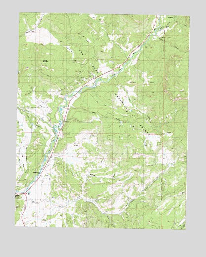
Jackson Mountain, CO USGS Topographic Map
Click on map above to begin viewing in our Map Viewer.

This topographic map contains these locations and features:
Feature Name Type Latitude Longitude GNIS ID View Map
Coal CreekStreamN37.3378°W106.9312°190943View Map
Cox MineMineN37.3133°W106.9923°1735061View Map
Deer CreekStreamN37.3722°W106.8867°196891View Map
Dowell MineMineN37.3133°W106.9923°1735060View Map
Dry GulchValleyN37.2912°W106.9728°1945989View Map
East Fork San Juan RiverStreamN37.3653°W106.9006°190932View Map
Eoff Ranch CemeteryCemeteryN37.2957°W106.9995°2736060View Map
Fawn GulchValleyN37.3207°W106.9611°190942View Map
Fourmile CreekStreamN37.3078°W106.9728°184129View Map
Highline DitchCanalN37.3197°W106.9795°1947432View Map
Horse GulchValleyN37.2745°W106.9990°196890View Map
Hott RanchLocaleN37.2886°W106.8825°190945View Map
Jackson CreekStreamN37.3092°W106.9753°1952470View Map
Jackson MountainSummitN37.3439°W106.9806°190950View Map
Johnny CreekStreamN37.3608°W106.9048°196886View Map
Kleckner MineMineN37.3122°W106.9020°1735062View Map
Laughlin ParkFlatN37.3539°W106.9634°1945961View Map
Laughlin ParkFlatN37.3528°W106.9617°190951View Map
Mesa DitchCanalN37.2795°W106.9964°1947437View Map
Pagosa DamDamN37.3100°W106.9889°201414View Map
Pagosa Fire Protection District Station 4 Highway 160 EastBuildingN37.2737°W106.9876°2667176View Map
Pagosa ReservoirReservoirN37.3100°W106.9892°201415View Map
Park DitchCanalN37.2778°W106.9756°190946View Map
Red Ryder Rodeo GroundsLocaleN37.2647°W106.9887°190935View Map
Saddleback RanchLocaleN37.3633°W106.8987°190955View Map
Spruce CanyonValleyN37.2586°W106.9342°196889View Map
Three Meadows RanchLocaleN37.3306°W106.9195°190949View Map
Three Quarter Circles RanchLocaleN37.3133°W106.9820°190948View Map
TreasurePopulated PlaceN37.3125°W106.9656°197190View Map
Treasure Guard StationLocaleN37.3122°W106.9659°190947View Map
West Fork San Juan RiverStreamN37.3653°W106.9006°190927View Map
Willow DrawValleyN37.2681°W106.9515°190941View Map

Note: Coordinates in the location and feature list above are referenced to NAD83 datum.


Copyright (C) 2008-2024 Ryan Niemi / Sunset Dynamics ... All Rights Reserved