TopoQuest Logo
Do you find TopoQuest useful?
Help keep TopoQuest running and adding new maps/features by donating!
Bitcoin:  19c7KJd3qBynnjoSw5npx9KScwjBe4ifkT
Litecoin:  LXs6TkuXGGXo1vDsWCkWVdjQX94eUKd6ui
Home View Maps Find Maps Find Places Resources & Links


Jal, New Mexico Topographic Map

USGS Map Title: Jal, NM
USGS Map MRC: 32103A2
DRG (GeoTIFF) Download: o32103a2.tif


Neighboring USGS Topographic Map Quads:


  Custer Mountain, NM  
32103B3
 

  Jal NW, NM  
32103B2
 

  Jal NE, TX  
32103B1
 

  Javelina Basin, NM  
32103A3
 

  Jal, NM  
32103A2
 

  Jal SE, TX  
32103A1
 

  Cheyenne Draw, TX  
31103H3
 

  Kermit NW, TX  
31103H2
 

  Vesrue, TX  
31103H1


Map MRC Location:

N33°
W104°
N33°
W103°
H8 H7 H6 H5 H4 H3 H2 H1
G8 G7 G6 G5 G4 G3 G2 G1
F8 F7 F6 F5 F4 F3 F2 F1
E8 E7 E6 E5 E4 E3 E2 E1
D8 D7 D6 D5 D4 D3 D2 D1
C8 C7 C6 C5 C4 C3 C2 C1
B8 B7 B6 B5 B4 B3 B2 B1
A8 A7 A6 A5 A4 A3 A2 A1
N32°
W104°
N32°
W103°

Jal, NM USGS 1:24K Topographic Map Preview:
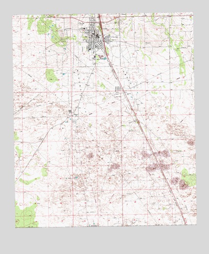
Jal, NM USGS Topographic Map
Click on map above to begin viewing in our Map Viewer.

This topographic map contains these locations and features:
Feature Name Type Latitude Longitude GNIS ID View Map
BennettPopulated PlaceN32.0679°W103.2110°923559View Map
Bennett Post Office (historical)Post OfficeN32.0679°W103.2110°938019View Map
Burke Junior High SchoolSchoolN32.1165°W103.2005°886924View Map
Calvary Baptist ChurchChurchN32.1132°W103.1935°921230View Map
Church of ChristChurchN32.1132°W103.1935°920255View Map
Church of GodChurchN32.1132°W103.1935°920280View Map
City of JalCivilN32.1155°W103.1892°2410131View Map
Fifth Street Baptist ChurchChurchN32.1132°W103.1935°920988View Map
First Assembly of God ChurchChurchN32.1132°W103.1935°921166View Map
First Baptist ChurchChurchN32.1132°W103.1935°921229View Map
JalPopulated PlaceN32.1132°W103.1935°899684View Map
Jal ClinicHospitalN32.1132°W103.1935°901292View Map
Jal Elementary SchoolSchoolN32.1132°W103.1935°901359View Map
Jal Emergency Medical ServicesBuildingN32.1111°W103.1949°2657680View Map
Jal High SchoolSchoolN32.1132°W103.1935°934209View Map
Jal Junior / Senior High SchoolSchoolN32.1117°W103.1924°934210View Map
Jal Post OfficePost OfficeN32.1155°W103.1949°937502View Map
Jal Spanish Baptist ChurchChurchN32.1132°W103.1935°920989View Map
Jal Volunteer Fire DepartmentBuildingN32.1107°W103.1948°2657685View Map
Jal Weather StationLocaleN32.1132°W103.1935°931878View Map
KPEQ-FM (Jal)TowerN32.1235°W103.2110°938667View Map
Lea County Road Department PitMineN32.1207°W103.2249°916198View Map
Toboso FlatsFlatN32.0765°W103.1649°895710View Map

Note: Coordinates in the location and feature list above are referenced to NAD83 datum.


Copyright (C) 2008-2025 Ryan Niemi / Sunset Dynamics ... All Rights Reserved