TopoQuest Logo
Do you find TopoQuest useful?
Help keep TopoQuest running and adding new maps/features by donating!
Bitcoin:  19c7KJd3qBynnjoSw5npx9KScwjBe4ifkT
Litecoin:  LXs6TkuXGGXo1vDsWCkWVdjQX94eUKd6ui
Home View Maps Find Maps Find Places Resources & Links


Jasper East, Texas Topographic Map

USGS Map Title: Jasper East, TX
USGS Map MRC: 30093H8
DRG (GeoTIFF) Download: o30093h8.tif


Neighboring USGS Topographic Map Quads:


  McGee Bend, TX  
31094A1
 

  Harrisburg, TX  
31093A8
 

  Weeks Settlement, TX  
31093A7
 

  Jasper West, TX  
30094H1
 

  Jasper East, TX  
30093H8
 

  Jamestown, TX  
30093H7
 

  Beech Grove, TX  
30094G1
 

  Roganville, TX  
30093G8
 

  Newton West, TX  
30093G7


Map MRC Location:

N31°
W94°
N31°
W93°
H8 H7 H6 H5 H4 H3 H2 H1
G8 G7 G6 G5 G4 G3 G2 G1
F8 F7 F6 F5 F4 F3 F2 F1
E8 E7 E6 E5 E4 E3 E2 E1
D8 D7 D6 D5 D4 D3 D2 D1
C8 C7 C6 C5 C4 C3 C2 C1
B8 B7 B6 B5 B4 B3 B2 B1
A8 A7 A6 A5 A4 A3 A2 A1
N30°
W94°
N30°
W93°

Jasper East, TX USGS 1:24K Topographic Map Preview:
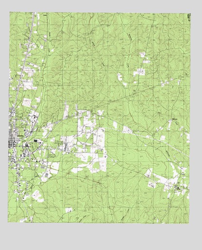
Jasper East, TX USGS Topographic Map
Click on map above to begin viewing in our Map Viewer.

This topographic map contains these locations and features:
Feature Name Type Latitude Longitude GNIS ID View Map
Aubrey E Cole Law Enforcement CenterBuildingN30.9259°W93.9894°2738693View Map
Bishop ChapelChurchN30.9460°W93.9305°1352247View Map
Bishop CreekStreamN30.9496°W93.9174°1352248View Map
Blake-Beaty-Orton HouseBuildingN30.9191°W93.9996°2031479View Map
BloxPopulated PlaceN30.9741°W93.9752°1379433View Map
Buck SpringSpringN30.9913°W93.9891°1998662View Map
Carridine ParkParkN30.9355°W93.9988°2028664View Map
Church of ChristChurchN30.9230°W93.9974°2020769View Map
City of JasperCivilN30.9221°W93.9947°2410134View Map
Cole Springs CemeteryCemeteryN30.9146°W93.9730°1354767View Map
Cornerstone Missionary Baptist ChurchChurchN30.9291°W93.9944°2020764View Map
East End Fire DepartmentBuildingN30.9655°W93.9103°2655241View Map
Fourmile CreekStreamN30.9705°W93.9741°1381891View Map
Greater New Bethel Baptist ChurchChurchN30.9349°W93.9880°2020766View Map
Holly SpringsPopulated PlaceN30.8971°W93.8841°1359448View Map
Huff CreekPopulated PlaceN30.9371°W93.8877°1379972View Map
JasperPopulated PlaceN30.9202°W93.9966°1360162View Map
Jasper County Constable's Office Precinct 1BuildingN30.9213°W93.9999°2751395View Map
Jasper County Sheriff's OfficeBuildingN30.9243°W93.9893°2375912View Map
Jasper County Sheriff's OfficeBuildingN30.9258°W93.9894°2751149View Map
Jasper Volunteer Fire Department Station 1BuildingN30.9195°W93.9991°2655214View Map
Kiwanis ParkParkN30.9191°W93.9994°2029056View Map
KTXJ-AM (Jasper)TowerN30.9199°W93.9705°1387856View Map
KWYX-FM (Jasper)TowerN30.9199°W93.9705°1388006View Map
Little Sandy CreekStreamN30.9260°W93.9821°1361464View Map
New BloxPopulated PlaceN30.9821°W93.9866°1380243View Map
Peaceful Restaurant Baptist ChurchChurchN30.9363°W93.9969°2020767View Map
Priority One Emergency Medical ServicesBuildingN30.9127°W93.9911°2721007View Map
Rosebloom ChurchChurchN30.9296°W93.8766°1366866View Map
Sand Hill ChurchChurchN30.9438°W93.9963°1367604View Map
Steers StadiumParkN30.9191°W93.9466°1384686View Map
Tanglewood Baptist ChurchChurchN30.9266°W93.9885°2020768View Map
Texas Department of Criminal Justice Glen Ray Goodman Transfer FacilityBuildingN30.9146°W93.9460°2738554View Map
Texas Forest Service Jasper OfficeBuildingN30.9155°W93.9963°2655579View Map
Wings of An Eagle Bible Fellowship ChurchChurchN30.9208°W93.9974°2020777View Map

Note: Coordinates in the location and feature list above are referenced to NAD83 datum.


Copyright (C) 2008-2024 Ryan Niemi / Sunset Dynamics ... All Rights Reserved