TopoQuest Logo
Do you find TopoQuest useful?
Help keep TopoQuest running and adding new maps/features by donating!
Bitcoin:  19c7KJd3qBynnjoSw5npx9KScwjBe4ifkT
Litecoin:  LXs6TkuXGGXo1vDsWCkWVdjQX94eUKd6ui
Home View Maps Find Maps Find Places Resources & Links


Jellico East, Tennessee Topographic Map

USGS Map Title: Jellico East, TN
USGS Map MRC: 36084E1
DRG (GeoTIFF) Download: o36084e1.tif


Neighboring USGS Topographic Map Quads:


  Williamsburg, KY  
36084F2
 

  Saxton, KY  
36084F1
 

  Frakes, KY  
36083F8
 

  Jellico West, TN  
36084E2
 

  Jellico East, TN  
36084E1
 

  Eagan, TN  
36083E8
 

  Ivydell, TN  
36084D2
 

  La Follette, TN  
36084D1
 

  Well Spring, TN  
36083D8


Map MRC Location:

N37°
W85°
N37°
W84°
H8 H7 H6 H5 H4 H3 H2 H1
G8 G7 G6 G5 G4 G3 G2 G1
F8 F7 F6 F5 F4 F3 F2 F1
E8 E7 E6 E5 E4 E3 E2 E1
D8 D7 D6 D5 D4 D3 D2 D1
C8 C7 C6 C5 C4 C3 C2 C1
B8 B7 B6 B5 B4 B3 B2 B1
A8 A7 A6 A5 A4 A3 A2 A1
N36°
W85°
N36°
W84°

Jellico East, TN USGS 1:24K Topographic Map Preview:
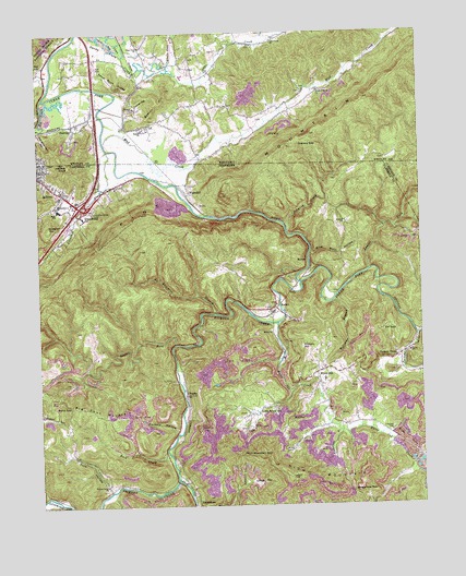
Jellico East, TN USGS Topographic Map
Click on map above to begin viewing in our Map Viewer.

This topographic map contains these locations and features:
Feature Name Type Latitude Longitude GNIS ID View Map
Big Four MountainSummitN36.5223°W84.1048°1277298View Map
Blue Rose MineMineN36.5354°W84.0452°1651077View Map
Boston ChurchChurchN36.5995°W84.0899°510857View Map
Boston HillSummitN36.6070°W84.0844°510858View Map
Boston SchoolSchoolN36.6056°W84.0922°510859View Map
Bowlin CemeteryCemeteryN36.5842°W84.0955°1953678View Map
Brooks Graham MineMineN36.5079°W84.0188°1651080View Map
Burke Hollow Railroad Station (historical)LocaleN36.5999°W84.1132°2710062View Map
Camp HollowValleyN36.5054°W84.0585°1279396View Map
Cane Creek ChurchChurchN36.6226°W84.0469°511191View Map
Car GapGapN36.5459°W84.0127°1279643View Map
Carl Duncan MineMineN36.5217°W84.0510°1651082View Map
Chadwell CemeteryCemeteryN36.5195°W84.0099°1280186View Map
ChaskaPopulated PlaceN36.5290°W84.0774°1280289View Map
Clear Fork ChurchChurchN36.6215°W84.0894°511401View Map
Cooper HollowValleyN36.6037°W84.0956°511522View Map
Crouches CreekStreamN36.5940°W84.1019°1281734View Map
Crouches Creek Baptist ChurchChurchN36.5798°W84.1133°1953691View Map
Elk CreekStreamN36.6079°W84.1224°512037View Map
Ewing SchoolSchoolN36.5401°W84.0038°1283945View Map
FairviewPopulated PlaceN36.6001°W84.1116°512108View Map
Gibson CemeteryCemeteryN36.5842°W84.1058°1953680View Map
Gravely GapGapN36.5959°W84.0388°512402View Map
Habersham Division (historical)CensusN36.5006°W84.0733°1648622View Map
Heckler KnobSummitN36.5904°W84.1149°1287320View Map
Hickory CreekStreamN36.5587°W84.0394°1287570View Map
Hickory HillSummitN36.5417°W84.0391°1287602View Map
High Cliff Missionary Baptist ChurchChurchN36.5851°W84.0760°1953701View Map
HighcliffPopulated PlaceN36.5823°W84.0760°1287727View Map
HoltonPopulated PlaceN36.5651°W84.0371°1315252View Map
Huddleston CemeteryCemeteryN36.5779°W84.1072°1281735View Map
Interchange 160CrossingN36.5790°W84.1110°1311309View Map
Jellico High SchoolSchoolN36.5784°W84.1180°1318874View Map
Keswick Railroad Station (historical)LocaleN36.6017°W84.1120°2710193View Map
Laurel ForkStreamN36.5429°W84.0808°1290746View Map
Laurel ForkStreamN36.5623°W84.0169°496040View Map
Lick CreekStreamN36.5073°W84.0808°1269727View Map
Little Cane CreekStreamN36.6151°W84.0808°513461View Map
Little White OakPopulated PlaceN36.5242°W84.0535°1291710View Map
Little White Oak Independent Missionary Baptist ChurchChurchN36.5240°W84.0558°1953709View Map
LotPopulated PlaceN36.6009°W84.0877°513645View Map
MorleyPopulated PlaceN36.5512°W84.0483°1294387View Map
Morley Baptist ChurchChurchN36.5456°W84.0488°1294390View Map
Morley Post OfficePost OfficeN36.5523°W84.0474°1651109View Map
Mud CreekStreamN36.5962°W84.1033°514128View Map
No Business BranchStreamN36.5509°W84.0674°1295779View Map
Perkins CemeteryCemeteryN36.5887°W84.0910°1953683View Map
Perkins HollowValleyN36.5200°W84.0804°1297193View Map
Pigeon Roost CreekStreamN36.6122°W84.1203°2091996View Map
Pink Root HollowValleyN36.5663°W84.0362°1297670View Map
Primroy ChurchChurchN36.5751°W84.0241°1298535View Map
Primroy CreekStreamN36.5737°W84.0438°1298536View Map
Queener HillSummitN36.5740°W84.1216°1298756View Map
Red AshPopulated PlaceN36.6165°W84.1219°514859View Map
Rich MountainSummitN36.5081°W84.0394°1299321View Map
Rich Mountain GapGapN36.5134°W84.0591°1299323View Map
Rock CreekStreamN36.5134°W84.0830°1299747View Map
Sand GapGapN36.5262°W84.1155°1300663View Map
Sand Rock RidgeRidgeN36.6123°W84.0974°515228View Map
Sandy FlatsFlatN36.6204°W84.1013°515239View Map
Sawmill HollowValleyN36.5059°W84.0583°1300844View Map
Slaughter Pen HollowValleyN36.5993°W84.1243°515479View Map
South Whitley Volunteer Fire DepartmentBuildingN36.6040°W84.0945°2636629View Map
Stateline Railroad Station (historical)LocaleN36.5911°W84.0863°2710246View Map
Sugartree BranchStreamN36.5195°W84.0274°1271729View Map
Sugartree GapGapN36.5037°W84.0227°1271732View Map
Sulphur Spring ChurchChurchN36.6098°W84.0324°515810View Map
Tackett CreekStreamN36.5448°W84.0010°1303987View Map
Tackett CreekPopulated PlaceN36.5390°W84.0080°1272035View Map
Walnut Grove ChurchChurchN36.5051°W84.1038°1273727View Map
Wesleyan ChurchChurchN36.5798°W84.1188°1274127View Map
White OakPopulated PlaceN36.5348°W84.0346°1274385View Map
White Oak Church of ChristChurchN36.5209°W84.0258°1953716View Map
White Oak CreekStreamN36.5481°W84.0469°1274391View Map
White Oak Elementary SchoolSchoolN36.5331°W84.0319°1318942View Map
White Oak Missionary Baptist ChurchChurchN36.5317°W84.0327°1953717View Map
White Oak Volunteer Fire DepartmentBuildingN36.5348°W84.0342°2654490View Map
Williams BranchStreamN36.5540°W84.0285°1274632View Map
York HollowValleyN36.5038°W84.1025°1275312View Map

Note: Coordinates in the location and feature list above are referenced to NAD83 datum.


Copyright (C) 2008-2024 Ryan Niemi / Sunset Dynamics ... All Rights Reserved