TopoQuest Logo
Do you find TopoQuest useful?
Help keep TopoQuest running and adding new maps/features by donating!
Bitcoin:  19c7KJd3qBynnjoSw5npx9KScwjBe4ifkT
Litecoin:  LXs6TkuXGGXo1vDsWCkWVdjQX94eUKd6ui
Home View Maps Find Maps Find Places Resources & Links


Johnson West, Kansas Topographic Map

USGS Map Title: Johnson West, KS
USGS Map MRC: 37101E7
DRG (GeoTIFF) Download: o37101e7.tif


Neighboring USGS Topographic Map Quads:


  Johnson NW, KS  
37101F8
 

  Johnson NE, KS  
37101F7
 

  Big Bow NW, KS  
37101F6
 

  Manter, KS  
37101E8
 

  Johnson West, KS  
37101E7
 

  Johnson East, KS  
37101E6
 

  Richfield NW, KS  
37101D8
 

  Richfield NE, KS  
37101D7
 

  Shore Airport, KS  
37101D6


Map MRC Location:

N38°
W102°
N38°
W101°
H8 H7 H6 H5 H4 H3 H2 H1
G8 G7 G6 G5 G4 G3 G2 G1
F8 F7 F6 F5 F4 F3 F2 F1
E8 E7 E6 E5 E4 E3 E2 E1
D8 D7 D6 D5 D4 D3 D2 D1
C8 C7 C6 C5 C4 C3 C2 C1
B8 B7 B6 B5 B4 B3 B2 B1
A8 A7 A6 A5 A4 A3 A2 A1
N37°
W102°
N37°
W101°

Johnson West, KS USGS 1:24K Topographic Map Preview:
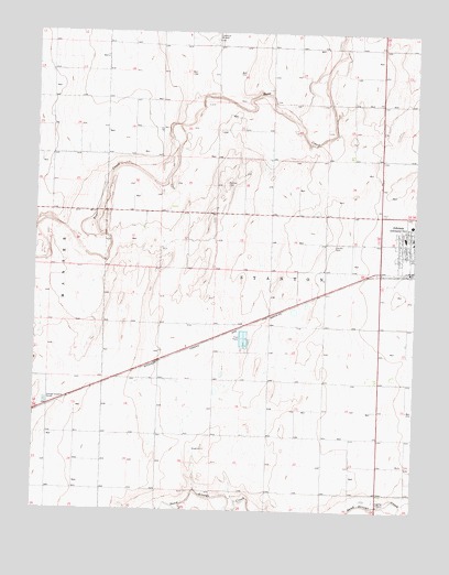
Johnson West, KS USGS Topographic Map
Click on map above to begin viewing in our Map Viewer.

This topographic map contains these locations and features:
Feature Name Type Latitude Longitude GNIS ID View Map
Cockrum Airport (historical)AirportN37.6233°W101.8166°471677View Map
Faith Baptist ChurchChurchN37.5736°W101.7529°2688921View Map
First Baptist ChurchChurchN37.5673°W101.7536°2688947View Map
First United Methodist ChurchChurchN37.5688°W101.7522°2690009View Map
JohnsonPopulated PlaceN37.5706°W101.7510°471702View Map
Johnson City HallBuildingN37.5688°W101.7511°2693355View Map
Johnson City Municipal Power PlantLocaleN37.5669°W101.7509°2692437View Map
Johnson Post OfficePost OfficeN37.5694°W101.7505°2693797View Map
Manter Wastewater PlantLocaleN37.5282°W101.8718°2693511View Map
Stanton CountyCivilN37.5631°W101.7842°485055View Map
Stanton County CemeteryCemeteryN37.5700°W101.7778°2739714View Map
Stanton County CourthouseBuildingN37.5719°W101.7500°2625146View Map
Stanton County Elementary SchoolSchoolN37.5720°W101.7538°2427236View Map
Stanton County Emergency Medical ServicesBuildingN37.5700°W101.7613°2696483View Map
Stanton County Fire and Rescue Main StationBuildingN37.5673°W101.7517°2111905View Map
Stanton County Health DepartmentBuildingN37.5719°W101.7500°2695066View Map
Stanton County Junior / Senior High SchoolSchoolN37.5756°W101.7546°481036View Map
Stanton County Middle SchoolSchoolN37.5648°W101.7515°481037View Map
Stanton County Road DepartmentBuildingN37.5736°W101.7612°2693290View Map
Township of StantonCivilN37.5627°W101.7713°485075View Map

Note: Coordinates in the location and feature list above are referenced to NAD83 datum.


Copyright (C) 2008-2025 Ryan Niemi / Sunset Dynamics ... All Rights Reserved