TopoQuest Logo
Do you find TopoQuest useful?
Help keep TopoQuest running and adding new maps/features by donating!
Bitcoin:  19c7KJd3qBynnjoSw5npx9KScwjBe4ifkT
Litecoin:  LXs6TkuXGGXo1vDsWCkWVdjQX94eUKd6ui
Home View Maps Find Maps Find Places Resources & Links


Jordan, Montana Topographic Map

USGS Map Title: Jordan, MT
USGS Map MRC: 47106C8
DRG (GeoTIFF) Download: o47106c8.tif


Neighboring USGS Topographic Map Quads:


  Biscuit Butte, MT  
47107D1
 

  Jordan NW, MT  
47106D8
 

  Jordan NE, MT  
47106D7
 

  Smoky Butte, MT  
47107C1
 

  Jordan, MT  
47106C8
 

  Jordan SE, MT  
47106C7
 

  Ziegele Coulee, MT  
47107B1
 

  Darby Buttes, MT  
47106B8
 

  Kirby Ranch, MT  
47106B7


Map MRC Location:

N48°
W107°
N48°
W106°
H8 H7 H6 H5 H4 H3 H2 H1
G8 G7 G6 G5 G4 G3 G2 G1
F8 F7 F6 F5 F4 F3 F2 F1
E8 E7 E6 E5 E4 E3 E2 E1
D8 D7 D6 D5 D4 D3 D2 D1
C8 C7 C6 C5 C4 C3 C2 C1
B8 B7 B6 B5 B4 B3 B2 B1
A8 A7 A6 A5 A4 A3 A2 A1
N47°
W107°
N47°
W106°

Jordan, MT USGS 1:24K Topographic Map Preview:
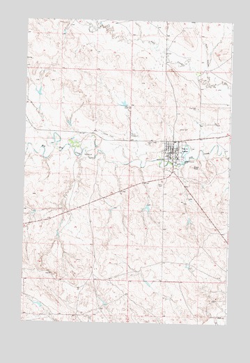
Jordan, MT USGS Topographic Map
Click on map above to begin viewing in our Map Viewer.

This topographic map contains these locations and features:
Feature Name Type Latitude Longitude GNIS ID View Map
18N38E17B___01 WellWellN47.3239°W106.9120°822209View Map
18N38E17B___02 WellWellN47.3211°W106.9120°822195View Map
18N38E18AACC01 WellWellN47.3225°W106.9203°822202View Map
18N38E20BBAB01 WellWellN47.3103°W106.9117°822118View Map
19N38E31A___01 WellWellN47.3639°W106.9181°822454View Map
Assembly of God ChurchChurchN47.3203°W106.9115°1716033View Map
Coleman Number 1 DamDamN47.2983°W106.9256°797471View Map
Community Presbyterian ChurchChurchN47.3231°W106.9117°1716036View Map
Garfield CountyCivilN47.2776°W106.9929°1716058View Map
Garfield County AmbulanceBuildingN47.3187°W106.9116°2637868View Map
Garfield County CourthouseBuildingN47.3189°W106.9117°1716030View Map
Garfield County FairgroundLocaleN47.3278°W106.9370°1716024View Map
Garfield County Health CenterHospitalN47.3189°W106.9113°1715943View Map
Garfield County High SchoolSchoolN47.3187°W106.9072°1715880View Map
Garfield County LibraryBuildingN47.3208°W106.9067°1716028View Map
Garfield County MuseumBuildingN47.3250°W106.9084°1715945View Map
Garfield County Sheriff's OfficeBuildingN47.3189°W106.9117°1716029View Map
Greenridge CemeteryCemeteryN47.3389°W106.8953°771980View Map
Happy Jack Number 1 DamDamN47.2567°W106.9890°797749View Map
Huff CouleeValleyN47.3550°W106.8906°772602View Map
Indian Country Historical MarkerParkN47.3078°W106.9028°1715946View Map
John Boy Number 2 DamDamN47.3450°W106.9923°797239View Map
JordanPopulated PlaceN47.3208°W106.9101°772903View Map
Jordan AirportAirportN47.3261°W106.9480°2650697View Map
Jordan Elementary SchoolSchoolN47.3193°W106.9070°1715898View Map
Jordan Mobile Home ParkLocaleN47.3253°W106.9062°1716025View Map
Jordan Post OfficePost OfficeN47.3208°W106.9127°1715983View Map
Jordan Seventh Day Adventist ChurchChurchN47.3233°W106.9117°1716035View Map
Jordan Volunteer Fire DepartmentBuildingN47.3215°W106.9096°1716027View Map
Kamp KatieLocaleN47.3153°W106.9106°1716026View Map
Kariotis ParkParkN47.3186°W106.9115°1716031View Map
Mister PP DamDamN47.3400°W106.9406°798330View Map
Panwitz ParkParkN47.3225°W106.9056°775071View Map
Pikes PeakSummitN47.3147°W106.8978°775223View Map
Pioneer CemeteryCemeteryN47.3245°W106.9235°775257View Map
Saint John the Baptist ChurchChurchN47.3197°W106.9109°1716034View Map
Saint Johns Evangelical Lutheran ChurchChurchN47.3225°W106.9095°1716037View Map
The Church of Jesus Christ of Latter Day SaintsChurchN47.3181°W106.9040°1716038View Map
Town of JordanCivilN47.3211°W106.9099°2412810View Map
Willems ParkParkN47.3194°W106.9076°1716032View Map
Woodland ParkParkN47.3178°W106.9153°778674View Map

Note: Coordinates in the location and feature list above are referenced to NAD83 datum.


Copyright (C) 2008-2025 Ryan Niemi / Sunset Dynamics ... All Rights Reserved