TopoQuest Logo
Do you find TopoQuest useful?
Help keep TopoQuest running and adding new maps/features by donating!
Bitcoin:  19c7KJd3qBynnjoSw5npx9KScwjBe4ifkT
Litecoin:  LXs6TkuXGGXo1vDsWCkWVdjQX94eUKd6ui
Home View Maps Find Maps Find Places Resources & Links


Jordan, Oregon Topographic Map

USGS Map Title: Jordan, OR
USGS Map MRC: 44122F6
DRG (GeoTIFF) Download: o44122f6.tif


Neighboring USGS Topographic Map Quads:


  Stayton, OR  
44122G7
 

  Stout Mountain, OR  
44122G6
 

  Lyons, OR  
44122G5
 

  Scio, OR  
44122F7
 

  Jordan, OR  
44122F6
 

  Snow Peak, OR  
44122F5
 

  Onehorse Slough, OR  
44122E7
 

  Lacomb, OR  
44122E6
 

  Keel Mountain, OR  
44122E5


Map MRC Location:

N45°
W123°
N45°
W122°
H8 H7 H6 H5 H4 H3 H2 H1
G8 G7 G6 G5 G4 G3 G2 G1
F8 F7 F6 F5 F4 F3 F2 F1
E8 E7 E6 E5 E4 E3 E2 E1
D8 D7 D6 D5 D4 D3 D2 D1
C8 C7 C6 C5 C4 C3 C2 C1
B8 B7 B6 B5 B4 B3 B2 B1
A8 A7 A6 A5 A4 A3 A2 A1
N44°
W123°
N44°
W122°

Jordan, OR USGS 1:24K Topographic Map Preview:
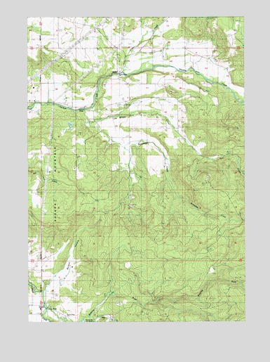
Jordan, OR USGS Topographic Map
Click on map above to begin viewing in our Map Viewer.

This topographic map contains these locations and features:
Feature Name Type Latitude Longitude GNIS ID View Map
Bear CreekStreamN44.7137°W122.6262°1131035View Map
Bentz PondsReservoirN44.7056°W122.7264°1134070View Map
Bilyeu CemeteryCemeteryN44.7123°W122.7040°1158702View Map
Bilyeu CreekStreamN44.7118°W122.7195°1124614View Map
Blue CreekStreamN44.7082°W122.6956°1131031View Map
Burgen CreekStreamN44.6360°W122.7373°1131028View Map
Burgen HollowValleyN44.6376°W122.7429°1134081View Map
Burmester CreekStreamN44.6965°W122.6962°1118333View Map
Camp MorrisonLocaleN44.6846°W122.6276°1162295View Map
Craft CreekStreamN44.6415°W122.7373°1131051View Map
Gillette FieldAirportN44.7196°W122.6960°2645984View Map
Hafco ReservoirReservoirN44.7253°W122.7448°1134074View Map
Hannah BridgeBridgeN44.7121°W122.7184°1134078View Map
Humphrey CemeteryCemeteryN44.7290°W122.7067°1131032View Map
John Shelton CemeteryCemeteryN44.7387°W122.6651°1131033View Map
JordanPopulated PlaceN44.7271°W122.6998°1122517View Map
Jordan BridgeBridgeN44.7268°W122.6987°1134077View Map
Jordan Catholic CemeteryCemeteryN44.7168°W122.6909°1135200View Map
Jordan CreekStreamN44.7265°W122.6973°1122527View Map
Jordan Guard StationLocaleN44.7362°W122.7334°1122531View Map
Jordan Post Office (historical)Post OfficeN44.7271°W122.6998°1165458View Map
Jordan ValleyValleyN44.7262°W122.6984°1131030View Map
Larson PondsReservoirN44.6257°W122.7012°1134076View Map
Larwaood Wayside County ParkParkN44.6401°W122.7429°1162301View Map
Larwood BridgeBridgeN44.6307°W122.7409°1134080View Map
Larwood Post Office (historical)Post OfficeN44.6304°W122.7401°1165517View Map
Lourdes SchoolSchoolN44.7167°W122.6919°1126459View Map
Lyons Rural Fire Protection District Station 2BuildingN44.7172°W122.6921°2577125View Map
Our Lady of Lourdes Catholic CemeteryCemeteryN44.7151°W122.6706°1131034View Map
Roaring RiverStreamN44.6301°W122.7401°1126099View Map
Roaring River County ParkParkN44.6262°W122.7304°1966243View Map
Roaring River State Fish HatcheryLocaleN44.6251°W122.7215°1126100View Map
Rogers MountainSummitN44.6682°W122.7311°1136703View Map
Rogers Mountain Ranch ReservoirReservoirN44.6932°W122.7464°1134071View Map
Scio Rural Fire Protection District Station 93BuildingN44.6986°W122.6923°2576482View Map
South Fork Neal CreekStreamN44.7071°W122.7162°1127306View Map
South Roaring RiverStreamN44.6332°W122.6790°1131048View Map
Wildwood CreekStreamN44.6873°W122.6929°1131029View Map
Wilkes ReservoirReservoirN44.7439°W122.6306°1134075View Map
Ziebart ReservoirReservoirN44.7454°W122.7470°1134073View Map
Zurfluhs PondsReservoirN44.6901°W122.7220°1134072View Map

Note: Coordinates in the location and feature list above are referenced to NAD83 datum.


Copyright (C) 2008-2025 Ryan Niemi / Sunset Dynamics ... All Rights Reserved