TopoQuest Logo
Do you find TopoQuest useful?
Help keep TopoQuest running and adding new maps/features by donating!
Bitcoin:  19c7KJd3qBynnjoSw5npx9KScwjBe4ifkT
Litecoin:  LXs6TkuXGGXo1vDsWCkWVdjQX94eUKd6ui
Home View Maps Find Maps Find Places Resources & Links


Joyce, Washington Topographic Map

USGS Map Title: Joyce, WA
USGS Map MRC: 48123B6
DRG (GeoTIFF) Download: o48123b6.tif


Neighboring USGS Topographic Map Quads:


  Disque, WA  
48123B7
 

  Joyce, WA  
48123B6
 

  Angeles Point, WA  
48123B5
 

  Lake Crescent, WA  
48123A7
 

  Lake Sutherland, WA  
48123A6
 

  Elwha, WA  
48123A5


Map MRC Location:

N49°
W124°
N49°
W123°
H8 H7 H6 H5 H4 H3 H2 H1
G8 G7 G6 G5 G4 G3 G2 G1
F8 F7 F6 F5 F4 F3 F2 F1
E8 E7 E6 E5 E4 E3 E2 E1
D8 D7 D6 D5 D4 D3 D2 D1
C8 C7 C6 C5 C4 C3 C2 C1
B8 B7 B6 B5 B4 B3 B2 B1
A8 A7 A6 A5 A4 A3 A2 A1
N48°
W124°
N48°
W123°

Joyce, WA USGS 1:24K Topographic Map Preview:
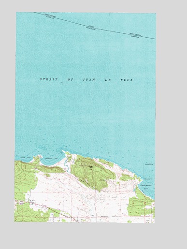
Joyce, WA USGS Topographic Map
Click on map above to begin viewing in our Map Viewer.

This topographic map contains these locations and features:
Feature Name Type Latitude Longitude GNIS ID View Map
Agate BayBayN48.1623°W123.7413°1515748View Map
Clallam County Fire District 4 Station 1BuildingN48.1346°W123.7288°2643826View Map
CovillePopulated PlaceN48.1268°W123.6294°1518208View Map
Crescent BayBayN48.1615°W123.7188°1518308View Map
Crescent RockPillarN48.1693°W123.7280°1528809View Map
Crescent SchoolSchoolN48.1362°W123.7465°1530851View Map
Freshwater Bay Boat Launch RampLocaleN48.1398°W123.6302°1529618View Map
JoycePopulated PlaceN48.1365°W123.7341°1521482View Map
Joyce Bible ChurchChurchN48.1366°W123.7428°2609771View Map
Joyce Post OfficePost OfficeN48.1365°W123.7347°2606961View Map
Observatory PointCapeN48.1498°W123.6371°1523966View Map
Port CrescentPopulated PlaceN48.1620°W123.7327°1530214View Map
Port CrescentLocaleN48.1637°W123.7033°1530532View Map
Salt CreekStreamN48.1634°W123.7060°1525396View Map
Salt Creek CampgroundLocaleN48.1648°W123.6983°1529619View Map
Salt Creek Recreation AreaParkN48.1590°W123.6883°1529430View Map
Striped PeakSummitN48.1565°W123.6846°1526633View Map
Striped Peak Lookout TowerTowerN48.1504°W123.6702°1533231View Map
Tongue PointCapeN48.1662°W123.7052°1528808View Map

Note: Coordinates in the location and feature list above are referenced to NAD83 datum.


Copyright (C) 2008-2024 Ryan Niemi / Sunset Dynamics ... All Rights Reserved