TopoQuest Logo
Do you find TopoQuest useful?
Help keep TopoQuest running and adding new maps/features by donating!
Bitcoin:  19c7KJd3qBynnjoSw5npx9KScwjBe4ifkT
Litecoin:  LXs6TkuXGGXo1vDsWCkWVdjQX94eUKd6ui
Home View Maps Find Maps Find Places Resources & Links


Judson, Minnesota Topographic Map

USGS Map Title: Judson, MN
USGS Map MRC: 44094B2
DRG (GeoTIFF) Download: o44094b2.tif


Neighboring USGS Topographic Map Quads:


  Courtland, MN  
44094C3
 

  Nicollet, MN  
44094C2
 

  North Star, MN  
44094C1
 

  Cambria, MN  
44094B3
 

  Judson, MN  
44094B2
 

  Mankato West, MN  
44094B1
 

  Perth, MN  
44094A3
 

  Lake Crystal, MN  
44094A2
 

  Good Thunder, MN  
44094A1


Map MRC Location:

N45°
W95°
N45°
W94°
H8 H7 H6 H5 H4 H3 H2 H1
G8 G7 G6 G5 G4 G3 G2 G1
F8 F7 F6 F5 F4 F3 F2 F1
E8 E7 E6 E5 E4 E3 E2 E1
D8 D7 D6 D5 D4 D3 D2 D1
C8 C7 C6 C5 C4 C3 C2 C1
B8 B7 B6 B5 B4 B3 B2 B1
A8 A7 A6 A5 A4 A3 A2 A1
N44°
W95°
N44°
W94°

Judson, MN USGS 1:24K Topographic Map Preview:
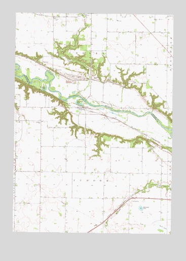
Judson, MN USGS Topographic Map
Click on map above to begin viewing in our Map Viewer.

This topographic map contains these locations and features:
Feature Name Type Latitude Longitude GNIS ID View Map
Hebron CemeteryCemeteryN44.2116°W94.1741°644822View Map
Horseshoe LakeLakeN44.2077°W94.2273°645203View Map
Jerusalem CemeteryCemeteryN44.1888°W94.2294°2051625View Map
JudsonPopulated PlaceN44.1964°W94.1952°654772View Map
Judson (historical)LocaleN44.1961°W94.1975°2051680View Map
Judson Post Office (historical)Post OfficeN44.1964°W94.1952°2051681View Map
KXLP-FM (New Ulm)TowerN44.1289°W94.1877°663310View Map
McGibneys LakeLakeN44.1983°W94.1993°647677View Map
Mennenga LakeLakeN44.1394°W94.1491°647765View Map
Rush LakeSwampN44.1286°W94.1311°650407View Map
Swan Lake OutletStreamN44.2030°W94.2014°652907View Map
Township of JudsonCivilN44.1556°W94.1917°664590View Map
Township of NicolletCivilN44.2405°W94.1871°665121View Map
Trinity CemeteryCemeteryN44.2463°W94.2197°653286View Map
Welsh Heritage FarmsLocaleN44.1503°W94.1536°2647731View Map
Williams CemeteryCemeteryN44.2194°W94.2111°2063902View Map
Zion CemeteryCemeteryN44.2497°W94.1953°2063903View Map

Note: Coordinates in the location and feature list above are referenced to NAD83 datum.


Copyright (C) 2008-2025 Ryan Niemi / Sunset Dynamics ... All Rights Reserved