TopoQuest Logo
Do you find TopoQuest useful?
Help keep TopoQuest running and adding new maps/features by donating!
Bitcoin:  19c7KJd3qBynnjoSw5npx9KScwjBe4ifkT
Litecoin:  LXs6TkuXGGXo1vDsWCkWVdjQX94eUKd6ui
Home View Maps Find Maps Find Places Resources & Links


Justiceburg NW, Texas Topographic Map

USGS Map Title: Justiceburg NW, TX
USGS Map MRC: 33101B2
DRG (GeoTIFF) Download: o33101b2.tif


Neighboring USGS Topographic Map Quads:


  Cap Rock SE, TX  
33101C3
 

  Verbena, TX  
33101C2
 

  Twomile Creek, TX  
33101C1
 

  Post East, TX  
33101B3
 

  Justiceburg NW, TX  
33101B2
 

  Cottonwood Creek, TX  
33101B1
 

  Cooper Creek, TX  
33101A3
 

  Justiceburg, TX  
33101A2
 

  Justiceburg SE, TX  
33101A1


Map MRC Location:

N34°
W102°
N34°
W101°
H8 H7 H6 H5 H4 H3 H2 H1
G8 G7 G6 G5 G4 G3 G2 G1
F8 F7 F6 F5 F4 F3 F2 F1
E8 E7 E6 E5 E4 E3 E2 E1
D8 D7 D6 D5 D4 D3 D2 D1
C8 C7 C6 C5 C4 C3 C2 C1
B8 B7 B6 B5 B4 B3 B2 B1
A8 A7 A6 A5 A4 A3 A2 A1
N33°
W102°
N33°
W101°

Justiceburg NW, TX USGS 1:24K Topographic Map Preview:
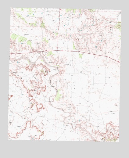
Justiceburg NW, TX USGS Topographic Map
Click on map above to begin viewing in our Map Viewer.

This topographic map contains these locations and features:
Feature Name Type Latitude Longitude GNIS ID View Map
Beach Ranch AirportAirportN33.2279°W101.1351°2675795View Map
Buffalo TankReservoirN33.1722°W101.2195°1353211View Map
Center TankReservoirN33.2164°W101.2371°1354206View Map
Center WindmillLocaleN33.1476°W101.2343°1354212View Map
Cottonwood WindmillLocaleN33.1759°W101.2032°1355142View Map
Dick Woods WindmillLocaleN33.1409°W101.2490°1356007View Map
Dutchman WindmillLocaleN33.1473°W101.2093°1356501View Map
East TankReservoirN33.2167°W101.2192°1356720View Map
Farm TankReservoirN33.1296°W101.2197°1357237View Map
George WindmillLocaleN33.1990°W101.2060°1357957View Map
Giles TankReservoirN33.1834°W101.2376°1358014View Map
Gussie TankReservoirN33.1988°W101.2411°1358532View Map
Horseshoe TankReservoirN33.1895°W101.2057°1359671View Map
Horseshoe WindmillLocaleN33.1918°W101.1965°1359678View Map
Kelly TankReservoirN33.1285°W101.2259°1360550View Map
Lisbeck TankReservoirN33.1377°W101.2369°1361261View Map
McCrary RanchLocaleN33.1395°W101.1846°1362400View Map
Nell TankReservoirN33.1678°W101.2356°1363664View Map
Post East DivisionCivilN33.1539°W101.2043°1939104View Map
Red Tower WindmillLocaleN33.1618°W101.2051°1366246View Map
Robbie TankReservoirN33.2245°W101.2332°1366568View Map
Sand CreekStreamN33.1434°W101.1885°1367584View Map
Skull TankReservoirN33.1602°W101.2259°1368390View Map
Twin Sisters TanksReservoirN33.1821°W101.2182°1370363View Map

Note: Coordinates in the location and feature list above are referenced to NAD83 datum.


Copyright (C) 2008-2025 Ryan Niemi / Sunset Dynamics ... All Rights Reserved