TopoQuest Logo
Do you find TopoQuest useful?
Help keep TopoQuest running and adding new maps/features by donating!
Bitcoin:  19c7KJd3qBynnjoSw5npx9KScwjBe4ifkT
Litecoin:  LXs6TkuXGGXo1vDsWCkWVdjQX94eUKd6ui
Home View Maps Find Maps Find Places Resources & Links


K C Lake, Nebraska Topographic Map

USGS Map Title: K C Lake, NE
USGS Map MRC: 41101F6
DRG (GeoTIFF) Download: o41101f6.tif


Neighboring USGS Topographic Map Quads:


  George Lake SE, NE  
41101G7
 

  Spring Valley, NE  
41101G6
 

  Middle Valley, NE  
41101G5
 

  Jensen Lake, NE  
41101F7
 

  K C Lake, NE  
41101F6
 

  Bean Soup Lake, NE  
41101F5
 

  Hulbert Lake, NE  
41101E7
 

  Arthur, NE  
41101E6
 

  Lightning Valley, NE  
41101E5


Map MRC Location:

N42°
W102°
N42°
W101°
H8 H7 H6 H5 H4 H3 H2 H1
G8 G7 G6 G5 G4 G3 G2 G1
F8 F7 F6 F5 F4 F3 F2 F1
E8 E7 E6 E5 E4 E3 E2 E1
D8 D7 D6 D5 D4 D3 D2 D1
C8 C7 C6 C5 C4 C3 C2 C1
B8 B7 B6 B5 B4 B3 B2 B1
A8 A7 A6 A5 A4 A3 A2 A1
N41°
W102°
N41°
W101°

K C Lake, NE USGS 1:24K Topographic Map Preview:
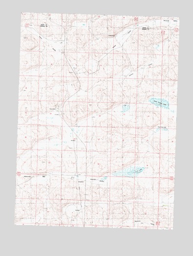
K C Lake, NE USGS Topographic Map
Click on map above to begin viewing in our Map Viewer.

This topographic map contains these locations and features:
Feature Name Type Latitude Longitude GNIS ID View Map
Collins ValleyBasinN41.7133°W101.6613°828273View Map
Dancer RanchLocaleN41.6980°W101.6657°828567View Map
Deans ValleyBasinN41.7425°W101.6605°828626View Map
Frye RanchLocaleN41.6342°W101.6999°1794585View Map
Hartman RanchLocaleN41.6530°W101.6868°1794586View Map
Hobin ValleyBasinN41.7305°W101.7257°830039View Map
J Walz RanchLocaleN41.6767°W101.7041°830323View Map
K C LakeLakeN41.6589°W101.6555°830430View Map
K C ValleyBasinN41.6517°W101.6882°830431View Map
McElhinney RanchLocaleN41.6536°W101.7368°1794589View Map
Meadow View SchoolSchoolN41.6558°W101.7043°831178View Map
N Kramer RanchLocaleN41.7375°W101.6755°1794591View Map
Neilson LakeLakeN41.6880°W101.7213°831580View Map
Nostrum ValleyBasinN41.6286°W101.6518°831772View Map
Sand Puddin LakeLakeN41.6994°W101.6391°833195View Map
Staples RanchLocaleN41.6542°W101.7271°1794588View Map
Swanson RanchLocaleN41.6933°W101.7199°1794590View Map
Three Tanks LakesSwampN41.6835°W101.6399°834102View Map
Trenary RanchLocaleN41.6522°W101.6968°1794587View Map

Note: Coordinates in the location and feature list above are referenced to NAD83 datum.


Copyright (C) 2008-2025 Ryan Niemi / Sunset Dynamics ... All Rights Reserved