TopoQuest Logo
Do you find TopoQuest useful?
Help keep TopoQuest running and adding new maps/features by donating!
Bitcoin:  19c7KJd3qBynnjoSw5npx9KScwjBe4ifkT
Litecoin:  LXs6TkuXGGXo1vDsWCkWVdjQX94eUKd6ui
Home View Maps Find Maps Find Places Resources & Links


Kaminski Hill, Montana Topographic Map

USGS Map Title: Kaminski Hill, MT
USGS Map MRC: 48106H2
DRG (GeoTIFF) Download: o48106h2.tif


Neighboring USGS Topographic Map Quads:


  Glass Hill, MT  
48106H3
 

  Kaminski Hill, MT  
48106H2
 

  Brockway Spring, MT  
48106H1
 

  Glentana West, MT  
48106G3
 

  Glentana East, MT  
48106G2
 

  Richland, MT  
48106G1


Map MRC Location:

N49°
W107°
N49°
W106°
H8 H7 H6 H5 H4 H3 H2 H1
G8 G7 G6 G5 G4 G3 G2 G1
F8 F7 F6 F5 F4 F3 F2 F1
E8 E7 E6 E5 E4 E3 E2 E1
D8 D7 D6 D5 D4 D3 D2 D1
C8 C7 C6 C5 C4 C3 C2 C1
B8 B7 B6 B5 B4 B3 B2 B1
A8 A7 A6 A5 A4 A3 A2 A1
N48°
W107°
N48°
W106°

Kaminski Hill, MT USGS 1:24K Topographic Map Preview:
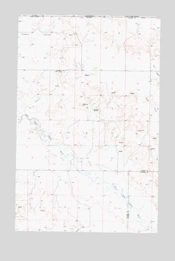
Kaminski Hill, MT USGS Topographic Map
Click on map above to begin viewing in our Map Viewer.

This topographic map contains these locations and features:
Feature Name Type Latitude Longitude GNIS ID View Map
36N43E06ADAD01 WellWellN48.9053°W106.1317°1636992View Map
37N42E02CBCD02 WellWellN48.9870°W106.1534°1637307View Map
37N42E05DAAD01 WellWellN48.9884°W106.2006°1637318View Map
37N42E05DADA01 WellWellN48.9889°W106.2009°1637320View Map
37N42E09DDCC01 WellWellN48.9692°W106.1825°1637233View Map
37N42E09DDCD01 WellWellN48.9692°W106.1814°1637232View Map
37N42E12CBBA01 WellWellN48.9756°W106.1311°1637254View Map
37N42E12CBBA02 WellWellN48.9759°W106.1311°1637257View Map
37N42E12CBBA03 WellWellN48.9759°W106.1311°1637258View Map
37N42E13BCCB01 WellWellN48.9628°W106.1328°1637211View Map
37N42E16AABB01 WellWellN48.9678°W106.1828°1637225View Map
37N42E17BAAA01 WellWellN48.9678°W106.2111°1637226View Map
37N42E29ABCC01 WellWellN48.9364°W106.2100°1637103View Map
37N42E29CACA01 WellWellN48.9297°W106.2136°1637077View Map
37N42E34ADBB01 WellWellN48.9214°W106.1611°1637055View Map
37N45E02CBCD01 WellWellN48.9872°W106.1545°1637308View Map
Ghost Number 1 DamDamN48.9500°W106.2322°797697View Map
Hopper School (historical)SchoolN48.8836°W106.1964°1677252View Map
Kaminski HillSummitN48.9484°W106.1939°772934View Map
Kaminski SpringSpringN48.9456°W106.1831°772935View Map
Kirk School (historical)SchoolN48.9422°W106.2370°1677264View Map
North Bench Community HallLocaleN48.9678°W106.2114°774675View Map
North Bench School (historical)SchoolN48.9675°W106.1939°1677265View Map
Richland Bench School (historical)SchoolN48.9553°W106.1359°1677263View Map
Roanwood CreekStreamN48.9334°W106.2314°775816View Map

Note: Coordinates in the location and feature list above are referenced to NAD83 datum.


Copyright (C) 2008-2025 Ryan Niemi / Sunset Dynamics ... All Rights Reserved