TopoQuest Logo
Do you find TopoQuest useful?
Help keep TopoQuest running and adding new maps/features by donating!
Bitcoin:  19c7KJd3qBynnjoSw5npx9KScwjBe4ifkT
Litecoin:  LXs6TkuXGGXo1vDsWCkWVdjQX94eUKd6ui
Home View Maps Find Maps Find Places Resources & Links


Kanosh, Utah Topographic Map

USGS Map Title: Kanosh, UT
USGS Map MRC: 38112G4
DRG (GeoTIFF) Download: o38112g4.tif


Neighboring USGS Topographic Map Quads:


  Tabernacle Hill, UT  
38112H5
 

  Meadow, UT  
38112H4
 

  Fillmore, UT  
38112H3
 

  Sixmile Point, UT  
38112G5
 

  Kanosh, UT  
38112G4
 

  Sunset Peak, UT  
38112G3
 

  Dog Valley Peak, UT  
38112F5
 

  Red Ridge, UT  
38112F4
 

  Joseph Peak, UT  
38112F3


Map MRC Location:

N39°
W113°
N39°
W112°
H8 H7 H6 H5 H4 H3 H2 H1
G8 G7 G6 G5 G4 G3 G2 G1
F8 F7 F6 F5 F4 F3 F2 F1
E8 E7 E6 E5 E4 E3 E2 E1
D8 D7 D6 D5 D4 D3 D2 D1
C8 C7 C6 C5 C4 C3 C2 C1
B8 B7 B6 B5 B4 B3 B2 B1
A8 A7 A6 A5 A4 A3 A2 A1
N38°
W113°
N38°
W112°

Kanosh, UT USGS 1:24K Topographic Map Preview:
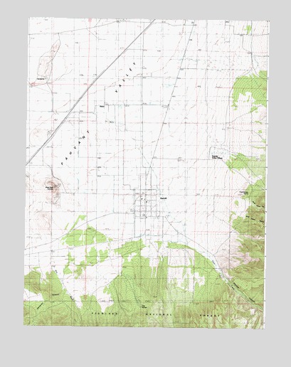
Kanosh, UT USGS Topographic Map
Click on map above to begin viewing in our Map Viewer.

This topographic map contains these locations and features:
Feature Name Type Latitude Longitude GNIS ID View Map
Black Rock VolcanoSummitN38.8064°W112.4844°1438877View Map
Brush Hollow CanyonValleyN38.8011°W112.3844°1439196View Map
Corn CreekStreamN38.8205°W112.4397°1439954View Map
Corn Creek Bench SpringSpringN38.7734°W112.4072°1449946View Map
Corn Creek Wildlife Management AreaParkN38.7714°W112.4208°1448301View Map
Dameron CanyonValleyN38.7680°W112.4805°1440244View Map
Dual SpringsSpringN38.7583°W112.4391°1440699View Map
Frank Barney SpringSpringN38.8050°W112.3836°1441210View Map
HattonPopulated PlaceN38.8389°W112.4566°1441631View Map
Hockman CemeteryCemeteryN38.8025°W112.4367°2769296View Map
Hot SpringSpringN38.8494°W112.4908°1441919View Map
John Watts SpringSpringN38.7519°W112.4222°1449947View Map
KanoshPopulated PlaceN38.8014°W112.4374°1442277View Map
Kanosh CanyonValleyN38.7700°W112.3930°1442278View Map
Kanosh CemeteryCemeteryN38.7852°W112.4377°1442279View Map
Kanosh Indian Reservation (historical)CivilN38.8214°W112.3877°1448539View Map
Kanosh Indian VillageCemeteryN38.8208°W112.4031°2769294View Map
Kanosh Indian VillagePopulated PlaceN38.8200°W112.4038°1442280View Map
Kanosh Post OfficePost OfficeN38.8003°W112.4381°2769101View Map
Kanosh Volunteer Fire DepartmentBuildingN38.8016°W112.4387°2627157View Map
Kanosh Wildlife Management AreaParkN38.8291°W112.3772°1448540View Map
Limekiln CanyonValleyN38.7541°W112.4933°1442609View Map
Rock Corral QuarryMineN38.8555°W112.4897°1445056View Map
The Church of Jesus Christ of Latter Day SaintsChurchN38.8008°W112.4372°1449497View Map
Town of KanoshCivilN38.8024°W112.4378°2412815View Map
Wine Hollow CanyonValleyN38.7950°W112.3844°1447479View Map

Note: Coordinates in the location and feature list above are referenced to NAD83 datum.


Copyright (C) 2008-2024 Ryan Niemi / Sunset Dynamics ... All Rights Reserved