TopoQuest Logo
Do you find TopoQuest useful?
Help keep TopoQuest running and adding new maps/features by donating!
Bitcoin:  19c7KJd3qBynnjoSw5npx9KScwjBe4ifkT
Litecoin:  LXs6TkuXGGXo1vDsWCkWVdjQX94eUKd6ui
Home View Maps Find Maps Find Places Resources & Links


Kaskela, Oregon Topographic Map

USGS Map Title: Kaskela, OR
USGS Map MRC: 44121H1
DRG (GeoTIFF) Download: o44121h1.tif


Neighboring USGS Topographic Map Quads:


  Maupin SW, OR  
45121A2
 

  Dant, OR  
45121A1
 

  Criterion, OR  
45120A8
 

  Mutton Mountain, OR  
44121H2
 

  Kaskela, OR  
44121H1
 

  Shaniko Junction, OR  
44120H8
 

  Eagle Butte, OR  
44121G2
 

  Gateway, OR  
44121G1
 

  Willowdale, OR  
44120G8


Map MRC Location:

N45°
W122°
N45°
W121°
H8 H7 H6 H5 H4 H3 H2 H1
G8 G7 G6 G5 G4 G3 G2 G1
F8 F7 F6 F5 F4 F3 F2 F1
E8 E7 E6 E5 E4 E3 E2 E1
D8 D7 D6 D5 D4 D3 D2 D1
C8 C7 C6 C5 C4 C3 C2 C1
B8 B7 B6 B5 B4 B3 B2 B1
A8 A7 A6 A5 A4 A3 A2 A1
N44°
W122°
N44°
W121°

Kaskela, OR USGS 1:24K Topographic Map Preview:
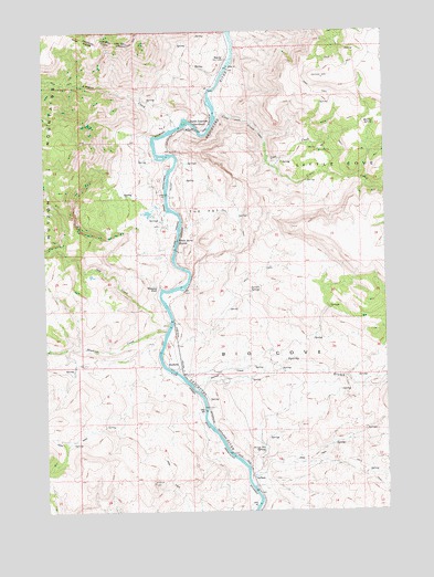
Kaskela, OR USGS Topographic Map
Click on map above to begin viewing in our Map Viewer.

This topographic map contains these locations and features:
Feature Name Type Latitude Longitude GNIS ID View Map
Antoken CreekStreamN44.9748°W121.0767°1117012View Map
Axford (historical)LocaleN44.8832°W121.0500°1135984View Map
Big CoveBasinN44.8993°W121.0003°1117596View Map
Boiling SpringSpringN44.9752°W121.0043°1117916View Map
Cove CampLocaleN44.9687°W121.0248°1119404View Map
Cove CreekStreamN44.9790°W121.0626°1119411View Map
Cove Creek (historical)LocaleN44.9790°W121.0620°1167757View Map
HardyLocaleN44.9926°W121.0581°1637829View Map
Hardy RanchLocaleN44.9929°W121.0587°1638140View Map
Jersey School SpringSpringN44.8910°W121.0461°1122414View Map
KaskelaLocaleN44.9121°W121.0770°1136432View Map
Kaskela Post Office (historical)Post OfficeN44.9121°W121.0770°1165468View Map
Larson SpringSpringN44.9321°W121.0507°1122966View Map
North JunctionLocaleN44.9746°W121.0728°1637856View Map
North Junction Post Office (historical)Post OfficeN44.9746°W121.0728°1165712View Map
Oak CreekStreamN44.9232°W121.0803°1124902View Map
Skookum CreekStreamN44.9218°W121.0814°1127034View Map
Spring BranchStreamN44.9065°W121.0712°1127408View Map
Swamp CreekStreamN44.9082°W121.0670°1127792View Map
The PotBasinN44.9507°W121.0673°1127994View Map
Vidler CreekStreamN44.9671°W121.0437°1128537View Map
Whiskey DickLocaleN44.9332°W121.0831°1136898View Map
Whiskey Dick RanchLocaleN44.9332°W121.0837°1638141View Map
White Horse RapidsRapidsN44.9454°W121.0773°1128981View Map

Note: Coordinates in the location and feature list above are referenced to NAD83 datum.


Copyright (C) 2008-2025 Ryan Niemi / Sunset Dynamics ... All Rights Reserved