TopoQuest Logo
Do you find TopoQuest useful?
Help keep TopoQuest running and adding new maps/features by donating!
Bitcoin:  19c7KJd3qBynnjoSw5npx9KScwjBe4ifkT
Litecoin:  LXs6TkuXGGXo1vDsWCkWVdjQX94eUKd6ui
Home View Maps Find Maps Find Places Resources & Links


Kayenta West, Arizona Topographic Map

USGS Map Title: Kayenta West, AZ
USGS Map MRC: 36110F3
DRG (GeoTIFF) Download: o36110f3.tif


Neighboring USGS Topographic Map Quads:


  Keet Seel Ruin, AZ  
36110G4
 

  Segihatsosi Canyon, AZ  
36110G3
 

  Agathla Peak, AZ  
36110G2
 

  Marsh Pass, AZ  
36110F4
 

  Kayenta West, AZ  
36110F3
 

  Kayenta East, AZ  
36110F2
 

  Long House Valley, AZ  
36110E4
 

  Marsh Pass SE, AZ  
36110E3
 

  Owl Spring, AZ  
36110E2


Map MRC Location:

N37°
W111°
N37°
W110°
H8 H7 H6 H5 H4 H3 H2 H1
G8 G7 G6 G5 G4 G3 G2 G1
F8 F7 F6 F5 F4 F3 F2 F1
E8 E7 E6 E5 E4 E3 E2 E1
D8 D7 D6 D5 D4 D3 D2 D1
C8 C7 C6 C5 C4 C3 C2 C1
B8 B7 B6 B5 B4 B3 B2 B1
A8 A7 A6 A5 A4 A3 A2 A1
N36°
W111°
N36°
W110°

Kayenta West, AZ USGS 1:24K Topographic Map Preview:
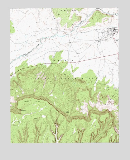
Kayenta West, AZ USGS Topographic Map
Click on map above to begin viewing in our Map Viewer.

This topographic map contains these locations and features:
Feature Name Type Latitude Longitude GNIS ID View Map
Black Mesa Police DepartmentBuildingN36.7274°W110.2549°2751642View Map
Fir SpringSpringN36.6479°W110.3440°4605View Map
KayentaPopulated PlaceN36.7278°W110.2546°6627View Map
Kayenta Boarding SchoolSchoolN36.7281°W110.2535°23387View Map
Kayenta Census Designated PlaceCensusN36.7143°W110.2590°2408461View Map
Kayenta ChapterCivilN36.6889°W110.3040°2418983View Map
Kayenta Post OfficePost OfficeN36.7242°W110.2559°44964View Map
Kayenta PreschoolSchoolN36.7247°W110.2549°23389View Map
Kayenta Primary SchoolSchoolN36.7306°W110.2579°23388View Map
Little Shonot SpringSpringN36.6560°W110.3632°7187View Map
Little Shonto SpringSpringN36.6560°W110.3633°2676185View Map
Lolamai PointCliffN36.6639°W110.3496°7284View Map
Lolomai PointCapeN36.6639°W110.3489°2676187View Map
Parrish CreekStreamN36.7242°W110.3135°9231View Map
Rock SpringSpringN36.6420°W110.3741°10421View Map
Tees Spa SpringSpringN36.6533°W110.3079°12222View Map
Tohdenasshai Trading PostLocaleN36.7244°W110.2574°23442View Map
Wagon Wheel Rest AreaParkN36.7006°W110.2968°23447View Map

Note: Coordinates in the location and feature list above are referenced to NAD83 datum.


Copyright (C) 2008-2025 Ryan Niemi / Sunset Dynamics ... All Rights Reserved