TopoQuest Logo
Do you find TopoQuest useful?
Help keep TopoQuest running and adding new maps/features by donating!
Bitcoin:  19c7KJd3qBynnjoSw5npx9KScwjBe4ifkT
Litecoin:  LXs6TkuXGGXo1vDsWCkWVdjQX94eUKd6ui
Home View Maps Find Maps Find Places Resources & Links


Kemmerer, Wyoming Topographic Map

USGS Map Title: Kemmerer, WY
USGS Map MRC: 41110G5
DRG (GeoTIFF) Download: o41110g5.tif


Neighboring USGS Topographic Map Quads:


  Kemmerer Reservoir, WY  
41110H6
 

  Sublet, WY  
41110H5
 

  Round Mountain, WY  
41110H4
 

  Fossil, WY  
41110G6
 

  Kemmerer, WY  
41110G5
 

  Willow Springs, WY  
41110G4
 

  Warfield Creek, WY  
41110F6
 

  Elkol, WY  
41110F5
 

  Little Round Mountain, WY  
41110F4


Map MRC Location:

N42°
W111°
N42°
W110°
H8 H7 H6 H5 H4 H3 H2 H1
G8 G7 G6 G5 G4 G3 G2 G1
F8 F7 F6 F5 F4 F3 F2 F1
E8 E7 E6 E5 E4 E3 E2 E1
D8 D7 D6 D5 D4 D3 D2 D1
C8 C7 C6 C5 C4 C3 C2 C1
B8 B7 B6 B5 B4 B3 B2 B1
A8 A7 A6 A5 A4 A3 A2 A1
N41°
W111°
N41°
W110°

Kemmerer, WY USGS 1:24K Topographic Map Preview:
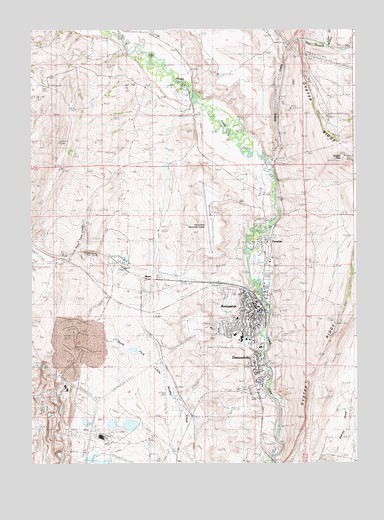
Kemmerer, WY USGS Topographic Map
Click on map above to begin viewing in our Map Viewer.

This topographic map contains these locations and features:
Feature Name Type Latitude Longitude GNIS ID View Map
Adaville MineMineN41.7833°W110.6091°1746983View Map
Aimo DamDamN41.7783°W110.5807°1607942View Map
Aimo ReservoirReservoirN41.7783°W110.5807°1607943View Map
Bridger - Teton National Forest Kemmerer Ranger District Fire Engine CrewBuildingN41.8048°W110.5344°2673691View Map
Burgoon SchoolSchoolN41.7794°W110.5385°1795555View Map
City of KemmererCivilN41.7761°W110.5555°2410176View Map
Conroy LakeReservoirN41.7852°W110.5927°1586936View Map
Conroy MineMineN41.7827°W110.6060°1586937View Map
DiamondvillePopulated PlaceN41.7794°W110.5385°1587599View Map
Diamondville Number 1 MineMineN41.7772°W110.5299°1605254View Map
Diamondville Police DepartmentBuildingN41.7710°W110.5392°2752623View Map
Diamondville Post OfficePost OfficeN41.7784°W110.5380°2767865View Map
East Branch Willow CreekStreamN41.8705°W110.5260°1596816View Map
Elkol Strip MineMineN41.7519°W110.6129°1588266View Map
FrontierPopulated PlaceN41.8141°W110.5371°1588764View Map
Frontier Number 1 MineMineN41.8147°W110.5299°1605279View Map
Frontier Number 3 MineMineN41.8033°W110.5282°1605280View Map
Gomer MineMineN41.8749°W110.5174°1588969View Map
Haddenham MineMineN41.8291°W110.5293°1746984View Map
Hamstork CemeteryCemeteryN41.8013°W110.5737°1589273View Map
KCGL-FM (Diamondville)TowerN41.7886°W110.5088°1608916View Map
KemmererPopulated PlaceN41.7924°W110.5377°1590317View Map
Kemmerer City CemeteryCemeteryN41.8001°W110.5509°2774425View Map
Kemmerer Field Club Golf CourseLocaleN41.8072°W110.5399°1605323View Map
Kemmerer High SchoolSchoolN41.7924°W110.5377°1795552View Map
Kemmerer Middle SchoolSchoolN41.7924°W110.5377°1795553View Map
Kemmerer MineMineN41.7669°W110.5952°1746985View Map
Kemmerer Municipal AirportAirportN41.8205°W110.5554°1608876View Map
Kemmerer Number Four MineMineN41.8577°W110.5296°1746986View Map
Kemmerer Number One MineMineN41.8138°W110.5291°1746987View Map
Kemmerer Police DepartmentBuildingN41.8128°W110.5357°2752668View Map
Kemmerer Post OfficePost OfficeN41.7943°W110.5392°2767860View Map
Kemmerer SchoolSchoolN41.7924°W110.5377°1795554View Map
Kemmerer Volunteer Fire DepartmentBuildingN41.7908°W110.5366°2673644View Map
KMER-AM (Kemmerer)TowerN41.7991°W110.5463°1608805View Map
KRGA-FM (Kemmerer)TowerN41.8158°W110.5016°1608925View Map
Lincoln County SheriffBuildingN41.7941°W110.5725°2752673View Map
MoyerLocaleN41.8041°W110.5838°1597421View Map
Naughton Ash Pond Number 2ReservoirN41.7583°W110.5841°1608393View Map
Naughton Ash Pond Number 2 DamDamN41.7583°W110.5841°1608392View Map
New Twin Creek MineMineN41.8163°W110.6227°1746988View Map
Oakley Census Designated PlaceCensusN41.7510°W110.5261°2408969View Map
Oakley MineMineN41.7555°W110.5321°1746989View Map
Peternal DrawStreamN41.8491°W110.5549°1796372View Map
Quealy PeakSummitN41.8386°W110.5041°1593096View Map
South Lincoln CemeteryCemeteryN41.7708°W110.5410°2774426View Map
South Lincoln County Emergency Medical ServicesBuildingN41.7900°W110.5414°2673663View Map
South Lincoln Medical CenterHospitalN41.7897°W110.5412°1794886View Map
South Lincon Medical Center HeliportAirportN41.7891°W110.5424°1605610View Map
Susie MineMineN41.8527°W110.5304°1595221View Map
Thoman Ranch SchoolSchoolN41.7794°W110.5385°1795636View Map
Town of DiamondvilleCivilN41.7772°W110.5357°2412427View Map
Twin Creek Number Two MineMineN41.8119°W110.6202°1746990View Map
Willow AdditionPopulated PlaceN41.7991°W110.5346°1596425View Map
Willow CreekStreamN41.8374°W110.5341°1597015View Map

Note: Coordinates in the location and feature list above are referenced to NAD83 datum.


Copyright (C) 2008-2025 Ryan Niemi / Sunset Dynamics ... All Rights Reserved