TopoQuest Logo
Do you find TopoQuest useful?
Help keep TopoQuest running and adding new maps/features by donating!
Bitcoin:  19c7KJd3qBynnjoSw5npx9KScwjBe4ifkT
Litecoin:  LXs6TkuXGGXo1vDsWCkWVdjQX94eUKd6ui
Home View Maps Find Maps Find Places Resources & Links


Bingham, Nebraska Topographic Map

USGS Map Title: Bingham, NE
USGS Map MRC: 42102A1
DRG (GeoTIFF) Download: o42102a1.tif


Neighboring USGS Topographic Map Quads:


  Arnold Lake, NE  
42102B2
 

  Lowe Valley, NE  
42102B1
 

  Camp Valley, NE  
42101B8
 

  Gaunt Lake, NE  
42102A2
 

  Bingham, NE  
42102A1
 

  Ashby, NE  
42101A8
 

  McCarty Lake, NE  
41102H2
 

  Alkali Lake, NE  
41102H1
 

  Wild Horse Hill, NE  
41101H8


Map MRC Location:

N43°
W103°
N43°
W102°
H8 H7 H6 H5 H4 H3 H2 H1
G8 G7 G6 G5 G4 G3 G2 G1
F8 F7 F6 F5 F4 F3 F2 F1
E8 E7 E6 E5 E4 E3 E2 E1
D8 D7 D6 D5 D4 D3 D2 D1
C8 C7 C6 C5 C4 C3 C2 C1
B8 B7 B6 B5 B4 B3 B2 B1
A8 A7 A6 A5 A4 A3 A2 A1
N42°
W103°
N42°
W102°

Bingham, NE USGS 1:24K Topographic Map Preview:
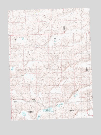
Bingham, NE USGS Topographic Map
Click on map above to begin viewing in our Map Viewer.

This topographic map contains these locations and features:
Feature Name Type Latitude Longitude GNIS ID View Map
Anderson LakeLakeN42.0029°W102.0835°826990View Map
BinghamPopulated PlaceN42.0211°W102.0885°827448View Map
BinghamLocaleN42.0211°W102.0885°1832259View Map
Bingham Congregational ChurchChurchN42.0214°W102.0871°1832257View Map
Bingham Post OfficePost OfficeN42.0211°W102.0885°1832260View Map
Bingham Public SchoolSchoolN42.0222°W102.0874°1832258View Map
Cover West RanchLocaleN42.0314°W102.0221°835053View Map
District 85 Bingham SchoolSchoolN42.0228°W102.0871°835054View Map
Edmondson RanchLocaleN42.0508°W102.1032°835052View Map
Finnegan LakeSwampN42.0927°W102.0540°829298View Map
Finnegan RanchLocaleN42.0680°W102.0894°835049View Map
Larkin ValleyValleyN42.0039°W102.0244°830620View Map
McCarty LakeLakeN42.0075°W102.1053°831109View Map
Powles RanchLocaleN42.0241°W102.1199°835051View Map
Sandcut (historical)LocaleN42.0197°W102.0043°1836398View Map
Sellers RanchLocaleN42.0903°W102.1046°835048View Map
Willy LakeLakeN42.0108°W102.0693°834792View Map
Willy RanchLocaleN42.0153°W102.0544°835050View Map

Note: Coordinates in the location and feature list above are referenced to NAD83 datum.


Copyright (C) 2008-2025 Ryan Niemi / Sunset Dynamics ... All Rights Reserved