TopoQuest Logo
Do you find TopoQuest useful?
Help keep TopoQuest running and adding new maps/features by donating!
Bitcoin:  19c7KJd3qBynnjoSw5npx9KScwjBe4ifkT
Litecoin:  LXs6TkuXGGXo1vDsWCkWVdjQX94eUKd6ui
Home View Maps Find Maps Find Places Resources & Links


Kenilworth, Montana Topographic Map

USGS Map Title: Kenilworth, MT
USGS Map MRC: 48110B4
DRG (GeoTIFF) Download: o48110b4.tif


Neighboring USGS Topographic Map Quads:


  Rocky Coulee SE, MT  
48110C5
 

  Fourteenmile Coulee SW, MT  
48110C4
 

  Fourteenmile Coulee SE, MT  
48110C3
 

  Discovery Butte, MT  
48110B5
 

  Kenilworth, MT  
48110B4
 

  Kenilworth NE, MT  
48110B3
 

  Day School, MT  
48110A5
 

  Kenilworth SW, MT  
48110A4
 

  Boggs Island, MT  
48110A3


Map MRC Location:

N49°
W111°
N49°
W110°
H8 H7 H6 H5 H4 H3 H2 H1
G8 G7 G6 G5 G4 G3 G2 G1
F8 F7 F6 F5 F4 F3 F2 F1
E8 E7 E6 E5 E4 E3 E2 E1
D8 D7 D6 D5 D4 D3 D2 D1
C8 C7 C6 C5 C4 C3 C2 C1
B8 B7 B6 B5 B4 B3 B2 B1
A8 A7 A6 A5 A4 A3 A2 A1
N48°
W111°
N48°
W110°

Kenilworth, MT USGS 1:24K Topographic Map Preview:
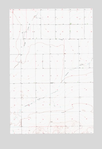
Kenilworth, MT USGS Topographic Map
Click on map above to begin viewing in our Map Viewer.

This topographic map contains these locations and features:
Feature Name Type Latitude Longitude GNIS ID View Map
28N10E02DD__01 WellWellN48.2080°W110.4013°1634122View Map
28N10E02DDDB01 WellWellN48.2083°W110.3980°1634123View Map
28N10E03AB__01 WellWellN48.2189°W110.4277°1634209View Map
28N10E07DA__01 WellWellN48.1969°W110.4855°1634024View Map
28N10E09DB__01 WellWellN48.1969°W110.4486°1634023View Map
28N10E10AB__01 WellWellN48.2041°W110.4277°1634092View Map
28N10E10BA__01 WellWellN48.2041°W110.4330°1634093View Map
28N10E12DA__01 WellWellN48.1969°W110.3802°1634022View Map
28N10E12DBDD01 WellWellN48.1947°W110.3819°1634004View Map
28N10E13BA__01 WellWellN48.1897°W110.3908°1633981View Map
28N10E14AB__01 WellWellN48.1897°W110.4066°1633982View Map
28N10E14CC__01 WellWellN48.1789°W110.4172°1633876View Map
28N10E14DD__01 WellWellN48.1789°W110.4013°1633875View Map
28N10E15AD__01 WellWellN48.1861°W110.4224°1633947View Map
28N10E15CC__01 WellWellN48.1789°W110.4383°1633877View Map
28N10E17AA__01 WellWellN48.1897°W110.4644°1633983View Map
28N10E17DD__01 WellWellN48.1789°W110.4644°1633878View Map
28N10E19BA__01 WellWellN48.1750°W110.4961°1633849View Map
28N10E20DD__01 WellWellN48.1641°W110.4644°1633774View Map
28N10E23BB__01 WellWellN48.1750°W110.4172°1633848View Map
28N10E23CC__01 WellWellN48.1641°W110.4172°1633773View Map
28N10E25BB__01 WellWellN48.1605°W110.3960°826852View Map
28N10E25BBBA01 WellWellN48.1522°W110.3958°826764View Map
28N10E27BB__01 WellWellN48.1605°W110.4383°826853View Map
28N10E28AB__01 WellWellN48.1605°W110.4485°826854View Map
28N10E29AA__01 WellWellN48.1605°W110.4644°826855View Map
29N10E25CC__01 WellWellN48.2372°W110.3858°1634334View Map
29N10E26BA__01 WellWellN48.2480°W110.4019°1634401View Map
29N10E26CC__01 WellWellN48.2372°W110.4072°1634335View Map
29N10E28CB__01 WellWellN48.2408°W110.4499°1634363View Map
29N10E28CBBD01 WellWellN48.2397°W110.4513°1634353View Map
29N10E29AC__01 WellWellN48.2444°W110.4608°1634378View Map
29N10E29ACDC01 WellWellN48.2425°W110.4611°1634377View Map
29N10E31DA__01 WellWellN48.2264°W110.4769°1634257View Map
29N10E31DA__02 WellWellN48.2264°W110.4769°1634258View Map
KenilworthPopulated PlaceN48.1755°W110.4405°772980View Map
Kenilworth CemeteryCemeteryN48.2191°W110.4196°772981View Map
Kenilworth Post Office (historical)Post OfficeN48.1755°W110.4405°1750152View Map
Kenilworth School (historical)SchoolN48.1755°W110.4405°1750151View Map

Note: Coordinates in the location and feature list above are referenced to NAD83 datum.


Copyright (C) 2008-2025 Ryan Niemi / Sunset Dynamics ... All Rights Reserved