TopoQuest Logo
Do you find TopoQuest useful?
Help keep TopoQuest running and adding new maps/features by donating!
Bitcoin:  19c7KJd3qBynnjoSw5npx9KScwjBe4ifkT
Litecoin:  LXs6TkuXGGXo1vDsWCkWVdjQX94eUKd6ui
Home View Maps Find Maps Find Places Resources & Links


Kent, Oregon Topographic Map

USGS Map Title: Kent, OR
USGS Map MRC: 45120B6
DRG (GeoTIFF) Download: o45120b6.tif


Neighboring USGS Topographic Map Quads:


  Grass Valley, OR  
45120C7
 

  Rosebush, OR  
45120C6
 

  Indian Cove, OR  
45120C5
 

  Bronx Canyon, OR  
45120B7
 

  Kent, OR  
45120B6
 

  Horseshoe Bend, OR  
45120B5
 

  Shaniko, OR  
45120A7
 

  Macken Canyon, OR  
45120A6
 

  Bath Canyon, OR  
45120A5


Map MRC Location:

N46°
W121°
N46°
W120°
H8 H7 H6 H5 H4 H3 H2 H1
G8 G7 G6 G5 G4 G3 G2 G1
F8 F7 F6 F5 F4 F3 F2 F1
E8 E7 E6 E5 E4 E3 E2 E1
D8 D7 D6 D5 D4 D3 D2 D1
C8 C7 C6 C5 C4 C3 C2 C1
B8 B7 B6 B5 B4 B3 B2 B1
A8 A7 A6 A5 A4 A3 A2 A1
N45°
W121°
N45°
W120°

Kent, OR USGS 1:24K Topographic Map Preview:
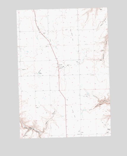
Kent, OR USGS Topographic Map
Click on map above to begin viewing in our Map Viewer.

This topographic map contains these locations and features:
Feature Name Type Latitude Longitude GNIS ID View Map
Borstel PondReservoirN45.2224°W120.7105°1129592View Map
Crocker SpringSpringN45.2481°W120.6364°1119553View Map
Daugherty Family CemeteryCemeteryN45.1493°W120.6332°1157400View Map
Decker Ranch Airstrip (historical)AirportN45.1665°W120.6678°1131740View Map
Holman SpringSpringN45.1309°W120.6273°1121926View Map
KentPopulated PlaceN45.1951°W120.6942°1122693View Map
Kent IOOF CemeteryCemeteryN45.2137°W120.7067°1157140View Map
Kent Post OfficePost OfficeN45.1938°W120.6923°1165476View Map
Rock Corral CanyonValleyN45.1335°W120.7381°1126140View Map
Spears CanyonValleyN45.1307°W120.7225°1127379View Map
WilcoxLocaleN45.1285°W120.6678°1129040View Map
Wilcox CanyonValleyN45.1565°W120.6381°1129041View Map
Wilcox CemeteryCemeteryN45.1559°W120.6864°1129593View Map
Wilson DamDamN45.1874°W120.7243°1133724View Map
Wilson ReservoirReservoirN45.1880°W120.7229°1129205View Map
Wilson Reservoir Number TwoReservoirN45.2131°W120.6987°1129594View Map

Note: Coordinates in the location and feature list above are referenced to NAD83 datum.


Copyright (C) 2008-2025 Ryan Niemi / Sunset Dynamics ... All Rights Reserved