TopoQuest Logo
Do you find TopoQuest useful?
Help keep TopoQuest running and adding new maps/features by donating!
Bitcoin:  19c7KJd3qBynnjoSw5npx9KScwjBe4ifkT
Litecoin:  LXs6TkuXGGXo1vDsWCkWVdjQX94eUKd6ui
Home View Maps Find Maps Find Places Resources & Links


Kern Peak, California Topographic Map

USGS Map Title: Kern Peak, CA
USGS Map MRC: 36118C3
DRG (GeoTIFF) Download: o36118c3.tif


Neighboring USGS Topographic Map Quads:


  Chagoopa Falls, CA  
36118D4
 

  Johnson Peak, CA  
36118D3
 

  Cirque Peak, CA  
36118D2
 

  Kern Lake, CA  
36118C4
 

  Kern Peak, CA  
36118C3
 

  Templeton Mountain, CA  
36118C2
 

  Hockett Peak, CA  
36118B4
 

  Casa Vieja Meadows, CA  
36118B3
 

  Monache Mountain, CA  
36118B2


Map MRC Location:

N37°
W119°
N37°
W118°
H8 H7 H6 H5 H4 H3 H2 H1
G8 G7 G6 G5 G4 G3 G2 G1
F8 F7 F6 F5 F4 F3 F2 F1
E8 E7 E6 E5 E4 E3 E2 E1
D8 D7 D6 D5 D4 D3 D2 D1
C8 C7 C6 C5 C4 C3 C2 C1
B8 B7 B6 B5 B4 B3 B2 B1
A8 A7 A6 A5 A4 A3 A2 A1
N36°
W119°
N36°
W118°

Kern Peak, CA USGS 1:24K Topographic Map Preview:
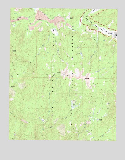
Kern Peak, CA USGS Topographic Map
Click on map above to begin viewing in our Map Viewer.

This topographic map contains these locations and features:
Feature Name Type Latitude Longitude GNIS ID View Map
Bear MeadowFlatN36.3327°W118.2923°269742View Map
Chinquapin BasinBasinN36.3114°W118.3689°255906View Map
Cold MeadowsFlatN36.2841°W118.2995°270536View Map
Golden Trout WildernessReserveN36.3128°W118.3221°2035551View Map
Groundhog MeadowsFlatN36.3660°W118.3079°253242View Map
Indian HeadSummitN36.2683°W118.2834°243818View Map
Johnson CreekStreamN36.3738°W118.3451°271805View Map
Kern PeakSummitN36.3077°W118.2876°244274View Map
Kern Peak LookoutLocaleN36.3088°W118.2879°276215View Map
Kern Peak StringerStreamN36.3560°W118.2681°244275View Map
Kern RidgeRidgeN36.2771°W118.3686°1667594View Map
Left StringerStreamN36.3658°W118.3559°244717View Map
Little Whitney MeadowFlatN36.3702°W118.3462°255627View Map
Natural BridgeArchN36.3591°W118.3748°1667602View Map
Overlook MountainSummitN36.3338°W118.3720°251941View Map
Ramshaw MeadowsFlatN36.3497°W118.2551°273184View Map
Red HillSummitN36.3547°W118.2809°251940View Map
Redrocks MeadowsFlatN36.2694°W118.2720°248096View Map
Right StringerStreamN36.3574°W118.3262°248185View Map
Right Stringer PassGapN36.3236°W118.3493°251939View Map
River SpringSpringN36.2533°W118.2778°248232View Map
Saddle Camp PassGapN36.3005°W118.3626°251937View Map
Sidehill MeadowFlatN36.2688°W118.3348°249426View Map
Three RocksSummitN36.3130°W118.3340°251938View Map
Toowa RangeRidgeN36.2994°W118.2590°274159View Map
Tunnel Forest Service StationLocaleN36.3666°W118.2887°1655179View Map
Volcanic CreekStreamN36.3655°W118.3562°276266View Map
Volcano MeadowFlatN36.3547°W118.3251°251113View Map
West StringerStreamN36.2605°W118.3368°251380View Map
West Stringer SaddleGapN36.3130°W118.3218°251381View Map

Note: Coordinates in the location and feature list above are referenced to NAD83 datum.


Copyright (C) 2008-2025 Ryan Niemi / Sunset Dynamics ... All Rights Reserved