TopoQuest Logo
Do you find TopoQuest useful?
Help keep TopoQuest running and adding new maps/features by donating!
Bitcoin:  19c7KJd3qBynnjoSw5npx9KScwjBe4ifkT
Litecoin:  LXs6TkuXGGXo1vDsWCkWVdjQX94eUKd6ui
Home View Maps Find Maps Find Places Resources & Links


Kerrick, Minnesota Topographic Map

USGS Map Title: Kerrick, MN
USGS Map MRC: 46092C5
DRG (GeoTIFF) Download: o46092c5.tif


Neighboring USGS Topographic Map Quads:


  Hanging Horn Lake, MN  
46092D6
 

  Nickerson, MN  
46092D5
 

  Holyoke, MN  
46092D4
 

  Bruno, MN  
46092C6
 

  Kerrick, MN  
46092C5
 

  Holyoke SW, MN  
46092C4
 

  Askov Lookout Tower, MN  
46092B6
 

  Duxbury, MN  
46092B5
 

  Ox Creek, MN  
46092B4


Map MRC Location:

N47°
W93°
N47°
W92°
H8 H7 H6 H5 H4 H3 H2 H1
G8 G7 G6 G5 G4 G3 G2 G1
F8 F7 F6 F5 F4 F3 F2 F1
E8 E7 E6 E5 E4 E3 E2 E1
D8 D7 D6 D5 D4 D3 D2 D1
C8 C7 C6 C5 C4 C3 C2 C1
B8 B7 B6 B5 B4 B3 B2 B1
A8 A7 A6 A5 A4 A3 A2 A1
N46°
W93°
N46°
W92°

Kerrick, MN USGS 1:24K Topographic Map Preview:
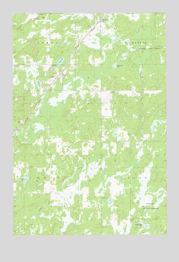
Kerrick, MN USGS Topographic Map
Click on map above to begin viewing in our Map Viewer.

This topographic map contains these locations and features:
Feature Name Type Latitude Longitude GNIS ID View Map
Anderson-Berger Park and CampgroundLocaleN46.3722°W92.5522°2069975View Map
Bartels LakeLakeN46.2814°W92.6149°639656View Map
Catholic CemeteryCemeteryN46.3728°W92.5553°2069860View Map
City of KerrickCivilN46.3386°W92.5843°2395520View Map
DuquettePopulated PlaceN46.3697°W92.5533°642988View Map
Hicks LakeLakeN46.3353°W92.6038°644932View Map
Jackie Berger Memorial ParkParkN46.3722°W92.5558°2069896View Map
KerrickPopulated PlaceN46.3388°W92.5858°646119View Map
KerrickLocaleN46.3383°W92.5897°2069977View Map
Kerrick Fire and RescueBuildingN46.3407°W92.5875°2666617View Map
Kerrick Post OfficePost OfficeN46.3399°W92.5860°2069978View Map
Lake MargaretLakeN46.3476°W92.5860°647515View Map
Larsons CreekStreamN46.3549°W92.5235°646512View Map
Saint Michaels CemeteryCemeteryN46.3447°W92.5949°650914View Map
Township of BrunoCivilN46.2881°W92.6142°663690View Map
Walthausen LakeLakeN46.3451°W92.5416°653753View Map

Note: Coordinates in the location and feature list above are referenced to NAD83 datum.


Copyright (C) 2008-2025 Ryan Niemi / Sunset Dynamics ... All Rights Reserved