TopoQuest Logo
Do you find TopoQuest useful?
Help keep TopoQuest running and adding new maps/features by donating!
Bitcoin:  19c7KJd3qBynnjoSw5npx9KScwjBe4ifkT
Litecoin:  LXs6TkuXGGXo1vDsWCkWVdjQX94eUKd6ui
Home View Maps Find Maps Find Places Resources & Links


Kilgore NW, Texas Topographic Map

USGS Map Title: Kilgore NW, TX
USGS Map MRC: 32094D8
DRG (GeoTIFF) Download: o32094d8.tif


Neighboring USGS Topographic Map Quads:


  Big Sandy, TX  
32095E1
 

  Gladewater, TX  
32094E8
 

  White Oak, TX  
32094E7
 

  Starrville, TX  
32095D1
 

  Kilgore NW, TX  
32094D8
 

  Kilgore NE, TX  
32094D7
 

  Hope Pond, TX  
32095C1
 

  Kilgore SW, TX  
32094C8
 

  Kilgore SE, TX  
32094C7


Map MRC Location:

N33°
W95°
N33°
W94°
H8 H7 H6 H5 H4 H3 H2 H1
G8 G7 G6 G5 G4 G3 G2 G1
F8 F7 F6 F5 F4 F3 F2 F1
E8 E7 E6 E5 E4 E3 E2 E1
D8 D7 D6 D5 D4 D3 D2 D1
C8 C7 C6 C5 C4 C3 C2 C1
B8 B7 B6 B5 B4 B3 B2 B1
A8 A7 A6 A5 A4 A3 A2 A1
N32°
W95°
N32°
W94°

Kilgore NW, TX USGS 1:24K Topographic Map Preview:
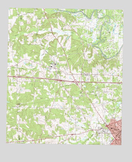
Kilgore NW, TX USGS Topographic Map
Click on map above to begin viewing in our Map Viewer.

This topographic map contains these locations and features:
Feature Name Type Latitude Longitude GNIS ID View Map
Belle CreekStreamN32.4438°W94.9744°1330384View Map
Bethel Baptist ChurchChurchN32.3957°W94.8797°2019596View Map
Big Caney CreekStreamN32.3940°W94.9022°1330575View Map
Black LakeLakeN32.4791°W94.8889°1330765View Map
C B Dansby SchoolSchoolN32.3902°W94.8863°1331788View Map
Deadman CurveLocaleN32.4754°W94.9705°1334147View Map
Elder SchoolSchoolN32.3896°W94.8977°1335300View Map
First Pentecostal ChurchChurchN32.3929°W94.8766°2019542View Map
Goodman CemeteryCemeteryN32.4038°W94.9891°1336709View Map
Goodman MountainSummitN32.4110°W94.9880°1336710View Map
Gourdneck BranchStreamN32.4701°W94.9991°1373879View Map
Helton CreekStreamN32.3757°W94.9230°1337587View Map
Horseshoe LakeLakeN32.4720°W94.9036°1338133View Map
Joy ChurchChurchN32.4476°W94.9905°1338893View Map
KilgorePopulated PlaceN32.3863°W94.8758°1339101View Map
Kilgore Baptist ChurchChurchN32.3763°W94.8810°2019555View Map
Liberty CityPopulated PlaceN32.4454°W94.9486°1339886View Map
Liberty City Census Designated PlaceCensusN32.4502°W94.9438°2408607View Map
Liberty City DivisionCivilN32.4313°W94.9062°1939158View Map
Lincoln Springs ChurchChurchN32.4935°W94.9880°1339956View Map
Little Caney CreekStreamN32.4776°W94.9411°1340042View Map
Merrills LakeLakeN32.4837°W94.8849°1341389View Map
Moody CreekStreamN32.4971°W94.9044°1341850View Map
Moriah CemeteryCemeteryN32.4082°W94.9210°1341919View Map
Mount Pleasant CemeteryCemeteryN32.4229°W94.9185°1342097View Map
North Chapel ChurchChurchN32.4407°W94.9163°1342706View Map
North Chapel SchoolSchoolN32.4390°W94.9152°1342707View Map
Prairie CreekStreamN32.4665°W94.9083°1344494View Map
Rock Springs SchoolSchoolN32.4988°W94.9716°1345405View Map
Rocky CreekStreamN32.4684°W94.9137°1345449View Map
Sabine Elementary SchoolSchoolN32.4485°W94.9486°2005458View Map
Sabine High SchoolSchoolN32.4463°W94.9527°1345803View Map
Sabine SchoolSchoolN32.4485°W94.9486°1345805View Map
Saints Chapel ChurchChurchN32.4401°W94.9141°1346136View Map
Sandot CreekStreamN32.3796°W94.9419°1346570View Map
Strong Memorial CemeteryCemeteryN32.4246°W94.9063°1348007View Map
Twin LakesLakeN32.4783°W94.8827°1348951View Map
West View Church of ChristChurchN32.3863°W94.8808°2019589View Map

Note: Coordinates in the location and feature list above are referenced to NAD83 datum.


Copyright (C) 2008-2024 Ryan Niemi / Sunset Dynamics ... All Rights Reserved