TopoQuest Logo
Do you find TopoQuest useful?
Help keep TopoQuest running and adding new maps/features by donating!
Bitcoin:  19c7KJd3qBynnjoSw5npx9KScwjBe4ifkT
Litecoin:  LXs6TkuXGGXo1vDsWCkWVdjQX94eUKd6ui
Home View Maps Find Maps Find Places Resources & Links


Kimberly, Idaho Topographic Map

USGS Map Title: Kimberly, ID
USGS Map MRC: 42114E3
DRG (GeoTIFF) Download: o42114e3.tif


Neighboring USGS Topographic Map Quads:


  Falls City, ID  
42114F4
 

  Twin Falls NE, ID  
42114F3
 

  Hunt, ID  
42114F2
 

  Twin Falls, ID  
42114E4
 

  Kimberly, ID  
42114E3
 

  Eden, ID  
42114E2
 

  Hub Butte, ID  
42114D4
 

  Stricker Butte, ID  
42114D3
 

  Murtaugh, ID  
42114D2


Map MRC Location:

N43°
W115°
N43°
W114°
H8 H7 H6 H5 H4 H3 H2 H1
G8 G7 G6 G5 G4 G3 G2 G1
F8 F7 F6 F5 F4 F3 F2 F1
E8 E7 E6 E5 E4 E3 E2 E1
D8 D7 D6 D5 D4 D3 D2 D1
C8 C7 C6 C5 C4 C3 C2 C1
B8 B7 B6 B5 B4 B3 B2 B1
A8 A7 A6 A5 A4 A3 A2 A1
N42°
W115°
N42°
W114°

Kimberly, ID USGS 1:24K Topographic Map Preview:
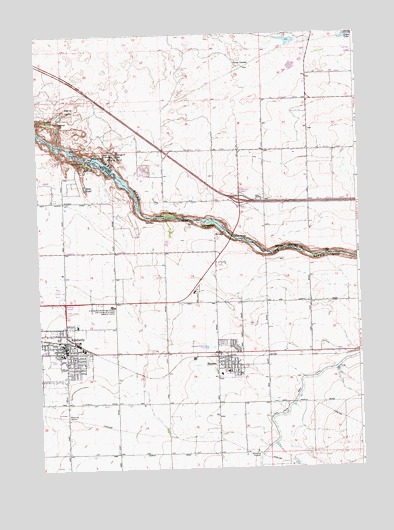
Kimberly, ID USGS Topographic Map
Click on map above to begin viewing in our Map Viewer.

This topographic map contains these locations and features:
Feature Name Type Latitude Longitude GNIS ID View Map
Ambulance Service of Magic Valley Regional Medical Center Station 3BuildingN42.5555°W114.3064°2642842View Map
BillsPopulated PlaceN42.5321°W114.2864°396123View Map
Box CanyonValleyN42.5869°W114.3456°371665View Map
C-55 SpillCanalN42.5764°W114.3318°2568105View Map
C-SpillCanalN42.6191°W114.2658°2568124View Map
City of HansenCivilN42.5314°W114.3012°2410697View Map
City of KimberlyCivilN42.5332°W114.3700°2411543View Map
Devils CorralLocaleN42.6038°W114.3620°372389View Map
Echo LakeLakeN42.5813°W114.3563°395844View Map
Fairbanks AirfieldAirportN42.5878°W114.3328°2443843View Map
Goose LakeReservoirN42.6239°W114.2539°372884View Map
HansenPopulated PlaceN42.5307°W114.3010°396610View Map
Hansen BridgeBridgeN42.5666°W114.2998°372982View Map
Hansen City HallBuildingN42.5305°W114.3014°395752View Map
Hansen Elementary SchoolSchoolN42.5273°W114.3044°395753View Map
Hansen Junior - Senior High SchoolSchoolN42.5283°W114.3019°395754View Map
Hansen Junior-Senior High SchoolSchoolN42.5280°W114.3017°401493View Map
Hansen Police DepartmentBuildingN42.5298°W114.3012°2722475View Map
Hanson Post OfficePost OfficeN42.5336°W114.3015°2766819View Map
Heidemann DairyLocaleN42.5175°W114.3289°2741226View Map
KimberlyPopulated PlaceN42.5338°W114.3648°396743View Map
Kimberly City HallBuildingN42.5352°W114.3648°395766View Map
Kimberly City Police DepartmentBuildingN42.5379°W114.3623°2722388View Map
Kimberly DivisionCivilN42.5244°W114.3381°1936746View Map
Kimberly Elementary SchoolSchoolN42.5317°W114.3662°395767View Map
Kimberly Elementary SchoolSchoolN42.5316°W114.3661°401510View Map
Kimberly High SchoolSchoolN42.5332°W114.3667°395769View Map
Kimberly High SchoolSchoolN42.5321°W114.3738°401512View Map
Kimberly Junior High SchoolSchoolN42.5332°W114.3661°395768View Map
Kimberly Middle SchoolSchoolN42.5330°W114.3661°401507View Map
Kimberly Post OfficePost OfficeN42.5351°W114.3651°2766830View Map
KLIX-AM (Twin Falls)TowerN42.5516°W114.3684°401863View Map
Lateral C-33CanalN42.5776°W114.2969°2568927View Map
Lateral C-39CanalN42.5887°W114.2620°2568928View Map
Lateral C-40CanalN42.5998°W114.2715°2568929View Map
Lateral C-44CanalN42.5734°W114.2978°2568930View Map
Lateral C-48CanalN42.5843°W114.3188°2568931View Map
Lateral C-52CanalN42.5940°W114.2965°2568933View Map
Lateral C-55CanalN42.5789°W114.3151°2568936View Map
Redcap CornerLocaleN42.5480°W114.3648°395817View Map
Rock Creek Fire Department Station 1BuildingN42.5377°W114.3624°2619316View Map
Rock Creek Fire Department Station 3BuildingN42.5301°W114.3008°2619016View Map
SpringtownLocaleN42.5696°W114.3120°376355View Map
Tipperary CornerPopulated PlaceN42.5788°W114.2964°397262View Map
Twin FallsFallsN42.5902°W114.3539°375624View Map
Twin Falls DamDamN42.5882°W114.3575°398656View Map
United States Department of Agriculture and University of Idaho Research CenterLocaleN42.5469°W114.3467°395809View Map
United States Department of Agriculture and University of Idaho Research CenterLocaleN42.5466°W114.3464°399727View Map
Vineyard LakeReservoirN42.5905°W114.3450°375701View Map

Note: Coordinates in the location and feature list above are referenced to NAD83 datum.


Copyright (C) 2008-2024 Ryan Niemi / Sunset Dynamics ... All Rights Reserved