TopoQuest Logo
Do you find TopoQuest useful?
Help keep TopoQuest running and adding new maps/features by donating!
Bitcoin:  19c7KJd3qBynnjoSw5npx9KScwjBe4ifkT
Litecoin:  LXs6TkuXGGXo1vDsWCkWVdjQX94eUKd6ui
Home View Maps Find Maps Find Places Resources & Links


Barber Coulee, Montana Topographic Map

USGS Map Title: Barber Coulee, MT
USGS Map MRC: 47108G1
DRG (GeoTIFF) Download: o47108g1.tif


Neighboring USGS Topographic Map Quads:


  Veseth Reservoir, MT  
47108H2
 

  Holzhey Reservoir, MT  
47108H1
 

  Emond Ranch, MT  
47107H8
 

  Dry Fork Ridge, MT  
47108G2
 

  Barber Coulee, MT  
47108G1
 

  Dione Reservoir, MT  
47107G8
 

  Lake Reservoir, MT  
47108F2
 

  Karsten Coulee, MT  
47108F1
 

  Pea Ridge, MT  
47107F8


Map MRC Location:

N48°
W109°
N48°
W108°
H8 H7 H6 H5 H4 H3 H2 H1
G8 G7 G6 G5 G4 G3 G2 G1
F8 F7 F6 F5 F4 F3 F2 F1
E8 E7 E6 E5 E4 E3 E2 E1
D8 D7 D6 D5 D4 D3 D2 D1
C8 C7 C6 C5 C4 C3 C2 C1
B8 B7 B6 B5 B4 B3 B2 B1
A8 A7 A6 A5 A4 A3 A2 A1
N47°
W109°
N47°
W108°

Barber Coulee, MT USGS 1:24K Topographic Map Preview:
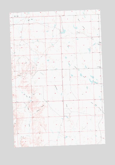
Barber Coulee, MT USGS Topographic Map
Click on map above to begin viewing in our Map Viewer.

This topographic map contains these locations and features:
Feature Name Type Latitude Longitude GNIS ID View Map
24N28E12AA__01 WellWellN47.8622°W108.0596°825118View Map
24N28E12DAB_01 WellWellN47.7692°W108.0623°824891View Map
24N28E27AA__01 WellWellN47.8186°W108.1023°825019View Map
24N29E07BD__01 WellWellN47.8583°W108.0490°825109View Map
24N29E16BC__01 WellWellN47.8439°W108.0115°825091View Map
24N29E30BD__01 WellWellN47.8147°W108.0490°825009View Map
Anderson School (historical)SchoolN47.8439°W108.0232°1721961View Map
Barber CouleeValleyN47.7794°W108.1001°768502View Map
Beam LakeLakeN47.8677°W108.0974°768568View Map
Lazy JD Number 12 DamDamN47.7583°W108.0523°797951View Map
None DamDamN47.8600°W108.0357°796456View Map
R Pankratz Number 1 DamDamN47.8383°W108.0223°797950View Map
Roth Number 1 DamDamN47.8150°W108.0307°796454View Map
Roth Number 2 DamDamN47.8083°W108.0157°796455View Map
Scott CouleeValleyN47.8553°W108.0235°776303View Map
Second Creek SchoolSchoolN47.8211°W108.0023°776331View Map
Second Telegraph DamDamN47.8550°W108.0523°798293View Map
Shed LakeLakeN47.8713°W108.1159°776422View Map
South Phillips DivisionCivilN47.7933°W108.0700°1940689View Map
West Fork Dry Fork CreekStreamN47.7867°W108.1065°778240View Map
William Knight Number 1 DamDamN47.8250°W108.0457°797895View Map
William Knight Number 2 DamDamN47.8317°W108.0507°797896View Map

Note: Coordinates in the location and feature list above are referenced to NAD83 datum.


Copyright (C) 2008-2025 Ryan Niemi / Sunset Dynamics ... All Rights Reserved