TopoQuest Logo
Do you find TopoQuest useful?
Help keep TopoQuest running and adding new maps/features by donating!
Bitcoin:  19c7KJd3qBynnjoSw5npx9KScwjBe4ifkT
Litecoin:  LXs6TkuXGGXo1vDsWCkWVdjQX94eUKd6ui
Home View Maps Find Maps Find Places Resources & Links


Kline, Colorado Topographic Map

USGS Map Title: Kline, CO
USGS Map MRC: 37108B1
DRG (GeoTIFF) Download: o37108b1.tif


Neighboring USGS Topographic Map Quads:


  Thompson Park, CO  
37108C2
 

  Hesperus, CO  
37108C1
 

  Durango West, CO  
37107C8
 

  Mormon Reservoir, CO  
37108B2
 

  Kline, CO  
37108B1
 

  Basin Mountain, CO  
37107B8
 

  Redmesa, CO  
37108A2
 

  Pinkerton Mesa, CO  
37108A1
 

  Long Mountain, CO  
37107A8


Map MRC Location:

N38°
W109°
N38°
W108°
H8 H7 H6 H5 H4 H3 H2 H1
G8 G7 G6 G5 G4 G3 G2 G1
F8 F7 F6 F5 F4 F3 F2 F1
E8 E7 E6 E5 E4 E3 E2 E1
D8 D7 D6 D5 D4 D3 D2 D1
C8 C7 C6 C5 C4 C3 C2 C1
B8 B7 B6 B5 B4 B3 B2 B1
A8 A7 A6 A5 A4 A3 A2 A1
N37°
W109°
N37°
W108°

Kline, CO USGS 1:24K Topographic Map Preview:
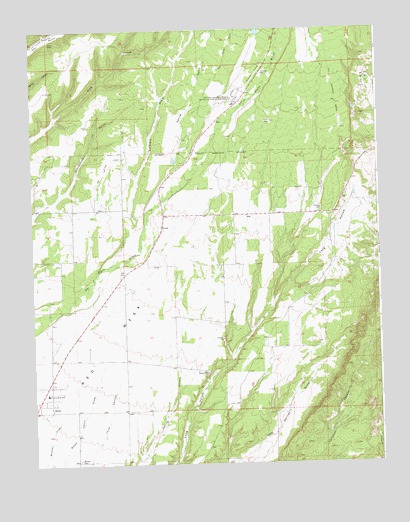
Kline, CO USGS Topographic Map
Click on map above to begin viewing in our Map Viewer.

This topographic map contains these locations and features:
Feature Name Type Latitude Longitude GNIS ID View Map
Big Stick DitchCanalN37.2208°W108.0840°202651View Map
BreenPopulated PlaceN37.1925°W108.0779°179274View Map
Colorado State University San Juan Basin Branch Agricultural Experimental StationLocaleN37.2294°W108.0506°179276View Map
Dunn MineMineN37.2467°W108.1181°1734475View Map
Fort Lewis Mesa Elementary SchoolSchoolN37.1451°W108.1203°179280View Map
Fort Lewis Mesa Fire Protection District Station 1BuildingN37.1402°W108.1224°2667319View Map
Fort Lewis Mesa Fire Protection District Station 2BuildingN37.2332°W108.0489°2667320View Map
KlinePopulated PlaceN37.1442°W108.1195°179281View Map
KLLV-AM (Breen)TowerN37.1839°W108.0823°203969View Map
Marvel CemeteryCemeteryN37.1264°W108.1096°179282View Map
Red MesaSummitN37.2128°W108.0528°179277View Map
Soldiers DrawValleyN37.1830°W108.0962°179137View Map
Spring GulchValleyN37.2072°W108.0757°179139View Map
Wheeler MineMineN37.2467°W108.1095°1734476View Map

Note: Coordinates in the location and feature list above are referenced to NAD83 datum.


Copyright (C) 2008-2024 Ryan Niemi / Sunset Dynamics ... All Rights Reserved