TopoQuest Logo
Do you find TopoQuest useful?
Help keep TopoQuest running and adding new maps/features by donating!
Bitcoin:  19c7KJd3qBynnjoSw5npx9KScwjBe4ifkT
Litecoin:  LXs6TkuXGGXo1vDsWCkWVdjQX94eUKd6ui
Home View Maps Find Maps Find Places Resources & Links


Knowlesville, New York Topographic Map

USGS Map Title: Knowlesville, NY
USGS Map MRC: 43078B3
DRG (GeoTIFF) Download: o43078b3.tif


Neighboring USGS Topographic Map Quads:


  Ashwood, NY  
43078C3
 

  Kent, NY  
43078C2


  Knowlesville, NY  
43078B3
 

  Albion, NY  
43078B2


  Oakfield, NY  
43078A3
 

  Batavia North, NY  
43078A2


Map MRC Location:

N44°
W79°
N44°
W78°
H8 H7 H6 H5 H4 H3 H2 H1
G8 G7 G6 G5 G4 G3 G2 G1
F8 F7 F6 F5 F4 F3 F2 F1
E8 E7 E6 E5 E4 E3 E2 E1
D8 D7 D6 D5 D4 D3 D2 D1
C8 C7 C6 C5 C4 C3 C2 C1
B8 B7 B6 B5 B4 B3 B2 B1
A8 A7 A6 A5 A4 A3 A2 A1
N43°
W79°
N43°
W78°

Knowlesville, NY USGS 1:24K Topographic Map Preview:
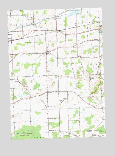
Knowlesville, NY USGS Topographic Map
Click on map above to begin viewing in our Map Viewer.

This topographic map contains these locations and features:
Feature Name Type Latitude Longitude GNIS ID View Map
Albion Reservoir Number TwoReservoirN43.2250°W78.2511°942248View Map
Bates Road BridgeBridgeN43.2301°W78.3706°2614869View Map
Beals Road BridgeBridgeN43.2337°W78.3557°2614871View Map
Bethel Baptist ChurchChurchN43.2213°W78.3558°2615593View Map
Boyce FarmsLocaleN43.1736°W78.3533°2712189View Map
Burma WoodsPopulated PlaceN43.1820°W78.2542°972285View Map
Christian CemeteryCemeteryN43.2162°W78.2841°946627View Map
Eagle Harbor StationPopulated PlaceN43.2359°W78.2539°948919View Map
East ShelbyPopulated PlaceN43.1706°W78.3253°949243View Map
East Shelby CemeteryCemeteryN43.1612°W78.3067°949244View Map
East Shelby Volunteer Fire CompanyBuildingN43.1700°W78.3250°2700859View Map
Faith Covenant FellowshipChurchN43.2260°W78.3519°2615912View Map
Fletcher Chapel CemeteryCemeteryN43.1605°W78.3706°2516243View Map
H and R FarmsLocaleN43.1519°W78.2614°2712180View Map
Hageman Farm CemeteryCemeteryN43.2076°W78.3492°2516248View Map
Hugh Lane FarmLocaleN43.2203°W78.2631°2712132View Map
KnowlesvillePopulated PlaceN43.2420°W78.3106°954790View Map
Knowlesville AirportAirportN43.2207°W78.3129°978105View Map
Knowlesville CemeteryCemeteryN43.2405°W78.3091°2516245View Map
Knowlesville Post OfficePost OfficeN43.2421°W78.3108°2617991View Map
Knowlesville StationPopulated PlaceN43.2281°W78.3070°954791View Map
Knowlesville United Methodist ChurchChurchN43.2408°W78.3109°2616611View Map
Maple Ridge AirportAirportN43.2032°W78.3541°978143View Map
Maple Ridge CemeteryCemeteryN43.2085°W78.3440°2516244View Map
Meadowbrook FarmsLocaleN43.1836°W78.3525°2712190View Map
Medina Business ParkLocaleN43.2083°W78.3720°2667556View Map
Medina ReservoirReservoirN43.1831°W78.3731°956906View Map
Mill Stream FarmsLocaleN43.1797°W78.2508°2712175View Map
MillvillePopulated PlaceN43.2076°W78.3247°957360View Map
Millville CemeteryCemeteryN43.1903°W78.3236°957361View Map
Millville Methodist ChurchChurchN43.2080°W78.3239°2616722View Map
Orchard Manor Residential Health Care FacilityBuildingN43.2145°W78.3715°2614738View Map
Pettit FarmsLocaleN43.2358°W78.3667°2712200View Map
Pine HillSummitN43.1826°W78.2689°960468View Map
Pine Hill AirportAirportN43.1738°W78.2737°977883View Map
Pine Hill CemeteryCemeteryN43.1853°W78.2697°2516247View Map
Presbyterian Road BridgeBridgeN43.2486°W78.2767°2614971View Map
School Number 12 (historical)SchoolN43.1692°W78.3261°2367675View Map
School Number 15 (historical)SchoolN43.1637°W78.2992°975112View Map
School Number 3 (historical)SchoolN43.2031°W78.2828°975284View Map
School Number 3 (historical)SchoolN43.2189°W78.2614°975285View Map
School Number 5 (historical)SchoolN43.1406°W78.3256°975439View Map
School Number 5 (historical)SchoolN43.2301°W78.3409°975442View Map
School Number 6 (historical)SchoolN43.1812°W78.3625°975502View Map
School Number 6 (historical)SchoolN43.1823°W78.2684°975503View Map
School Number 7 (historical)SchoolN43.1275°W78.2911°2108367View Map
School Number 8 (historical)SchoolN43.2033°W78.2542°2367674View Map
School Number 8 (historical)SchoolN43.1862°W78.3250°975604View Map
School Number 9 (historical)SchoolN43.1481°W78.3709°975655View Map
Sunrich FarmsLocaleN43.1436°W78.2542°2712185View Map
Swart Culver CemeteryCemeteryN43.1642°W78.3575°966893View Map
Toussaint FarmsLocaleN43.2325°W78.3428°2712208View Map
West BarrePopulated PlaceN43.1528°W78.2536°969091View Map
West Barre CemeteryCemeteryN43.1536°W78.2517°2516246View Map
West Barre United Methodist ChurchChurchN43.1520°W78.2529°2617189View Map
Wild Rose FarmLocaleN43.2458°W78.2519°2712187View Map
Willows Adult HomeBuildingN43.2149°W78.3728°2614852View Map
Zelazny AirportAirportN43.1580°W78.3569°978295View Map

Note: Coordinates in the location and feature list above are referenced to NAD83 datum.


Copyright (C) 2008-2024 Ryan Niemi / Sunset Dynamics ... All Rights Reserved