TopoQuest Logo
Do you find TopoQuest useful?
Help keep TopoQuest running and adding new maps/features by donating!
Bitcoin:  19c7KJd3qBynnjoSw5npx9KScwjBe4ifkT
Litecoin:  LXs6TkuXGGXo1vDsWCkWVdjQX94eUKd6ui
Home View Maps Find Maps Find Places Resources & Links


Kofa Butte, Arizona Topographic Map

USGS Map Title: Kofa Butte, AZ
USGS Map MRC: 33113C8
DRG (GeoTIFF) Download: o33113c8.tif


Neighboring USGS Topographic Map Quads:


  Livingston Hills, AZ  
33114D1
 

  Owl Head, AZ  
33113D8
 

  Cholla Tank, AZ  
33113D7
 

  Palm Canyon, AZ  
33114C1
 

  Kofa Butte, AZ  
33113C8
 

  Hoodoo Well, AZ  
33113C7
 

  Kofa Deep Well, AZ  
33114B1
 

  Charlie Died Tank, AZ  
33113B8
 

  Engesser Pass, AZ  
33113B7


Map MRC Location:

N34°
W114°
N34°
W113°
H8 H7 H6 H5 H4 H3 H2 H1
G8 G7 G6 G5 G4 G3 G2 G1
F8 F7 F6 F5 F4 F3 F2 F1
E8 E7 E6 E5 E4 E3 E2 E1
D8 D7 D6 D5 D4 D3 D2 D1
C8 C7 C6 C5 C4 C3 C2 C1
B8 B7 B6 B5 B4 B3 B2 B1
A8 A7 A6 A5 A4 A3 A2 A1
N33°
W114°
N33°
W113°

Kofa Butte, AZ USGS 1:24K Topographic Map Preview:
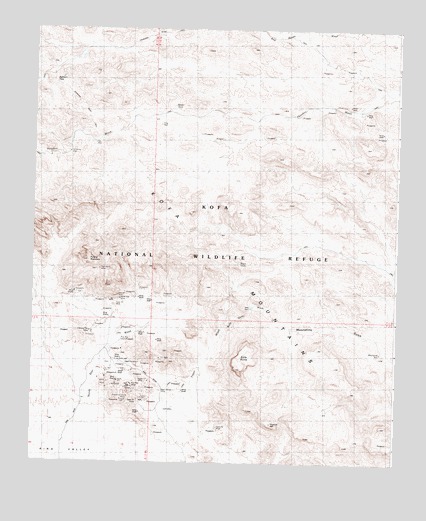
Kofa Butte, AZ USGS Topographic Map
Click on map above to begin viewing in our Map Viewer.

This topographic map contains these locations and features:
Feature Name Type Latitude Longitude GNIS ID View Map
Baker MineMineN33.2742°W113.9747°24161View Map
Big Horn PassGapN33.3595°W113.9935°24137View Map
Black Dahlia MineMineN33.2709°W113.9555°1502View Map
C O D MineMineN33.3534°W113.8922°23497View Map
Deep WellWellN33.2656°W113.9769°23517View Map
Dry WellWellN33.3675°W113.9847°23522View Map
Eagle MineMineN33.2742°W113.9608°4236View Map
Evening Star MineMineN33.2878°W113.9802°4518View Map
High Henry MineMineN33.3059°W113.9769°5792View Map
I X L MineMineN33.3686°W113.9238°23545View Map
King of Arizona MineMineN33.2692°W113.9669°6693View Map
King WellWellN33.3475°W113.9569°6703View Map
Kofa ButteSummitN33.2773°W113.9294°6747View Map
Kofa DamDamN33.2945°W113.9252°6749View Map
Kofa Dam WashStreamN33.2878°W113.9344°6750View Map
Kofa MountainsSummitN33.3300°W113.9535°6755View Map
Kofa National Wildlife RefugeParkN33.2533°W113.9900°2765361View Map
Mid WellWellN33.3420°W113.9788°7972View Map
Moonshine TankReservoirN33.2823°W113.8805°24138View Map
Natural ArchArchN33.2981°W113.9706°2628313View Map
North Star MineMineN33.2970°W113.9699°8766View Map
North Star WashStreamN33.2542°W113.9799°8768View Map
North Star WellWellN33.2556°W113.9888°8769View Map
Polaris MountainSummitN33.3084°W113.9813°9619View Map
Raven TankReservoirN33.3523°W113.9522°24139View Map
Rob Roy MineMineN33.2725°W113.9644°10354View Map
Rob Roy WellWellN33.2861°W113.9688°10355View Map
Wilbanks CabinLocaleN33.3398°W113.9877°13745View Map
Wilbanks WellWellN33.3395°W113.9888°24136View Map
Yaqui TanksReservoirN33.3075°W113.9291°14037View Map
Yaqui WashStreamN33.2573°W113.9530°14038View Map

Note: Coordinates in the location and feature list above are referenced to NAD83 datum.


Copyright (C) 2008-2025 Ryan Niemi / Sunset Dynamics ... All Rights Reserved