TopoQuest Logo
Do you find TopoQuest useful?
Help keep TopoQuest running and adding new maps/features by donating!
Bitcoin:  19c7KJd3qBynnjoSw5npx9KScwjBe4ifkT
Litecoin:  LXs6TkuXGGXo1vDsWCkWVdjQX94eUKd6ui
Home View Maps Find Maps Find Places Resources & Links


Afton, Michigan Topographic Map

USGS Map Title: Afton, MI
USGS Map MRC: 45084C4
DRG (GeoTIFF) Download: o45084c4.tif


Neighboring USGS Topographic Map Quads:


  Indian River, MI  
45084D5
 

  Legrand, MI  
45084D4
 

  Hangore Heights, MI  
45084D3
 

  Wolverine, MI  
45084C5
 

  Afton, MI  
45084C4
 

  Tower, MI  
45084C3
 

  Green Timbers, MI  
45084B5
 

  Hardwood Lake, MI  
45084B4
 

  Silver Lake, MI  
45084B3


Map MRC Location:

N46°
W85°
N46°
W84°
H8 H7 H6 H5 H4 H3 H2 H1
G8 G7 G6 G5 G4 G3 G2 G1
F8 F7 F6 F5 F4 F3 F2 F1
E8 E7 E6 E5 E4 E3 E2 E1
D8 D7 D6 D5 D4 D3 D2 D1
C8 C7 C6 C5 C4 C3 C2 C1
B8 B7 B6 B5 B4 B3 B2 B1
A8 A7 A6 A5 A4 A3 A2 A1
N45°
W85°
N45°
W84°

Afton, MI USGS 1:24K Topographic Map Preview:
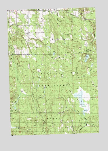
Afton, MI USGS Topographic Map
Click on map above to begin viewing in our Map Viewer.

This topographic map contains these locations and features:
Feature Name Type Latitude Longitude GNIS ID View Map
AftonPopulated PlaceN45.3739°W84.4967°1617405View Map
Afton Post Office (historical)Post OfficeN45.3739°W84.4967°2369426View Map
Dog LakeLakeN45.2848°W84.4003°624742View Map
Fingerboard CornerPopulated PlaceN45.3736°W84.4503°1617556View Map
Free ChurchChurchN45.3700°W84.4706°626450View Map
Gokee CreekStreamN45.3389°W84.3828°626925View Map
Lake SixteenLakeN45.3300°W84.4356°638037View Map
Little Pigeon RiverStreamN45.2922°W84.4856°630728View Map
Lost LakeLakeN45.3101°W84.4079°631097View Map
MacAndrews LakeLakeN45.2775°W84.4930°631262View Map
McIntosh CreekStreamN45.2875°W84.4511°631916View Map
Osmun LakeLakeN45.3249°W84.3893°634142View Map
Osmun Lake Lookout TowerTowerN45.3239°W84.3839°1623549View Map
Township of WalkerCivilN45.3293°W84.4284°1627208View Map
Walker Township CemeteryCemeteryN45.3444°W84.4306°2369438View Map
Weed CreekStreamN45.3339°W84.3781°1615964View Map
West McMasters CreekStreamN45.2611°W84.3914°1616149View Map
Wilkes CreekStreamN45.3495°W84.4981°1616478View Map

Note: Coordinates in the location and feature list above are referenced to NAD83 datum.


Copyright (C) 2008-2025 Ryan Niemi / Sunset Dynamics ... All Rights Reserved