TopoQuest Logo
Do you find TopoQuest useful?
Help keep TopoQuest running and adding new maps/features by donating!
Bitcoin:  19c7KJd3qBynnjoSw5npx9KScwjBe4ifkT
Litecoin:  LXs6TkuXGGXo1vDsWCkWVdjQX94eUKd6ui
Home View Maps Find Maps Find Places Resources & Links


La Monte, Missouri Topographic Map

USGS Map Title: La Monte, MO
USGS Map MRC: 38093G4
DRG (GeoTIFF) Download: o38093g4.tif


Neighboring USGS Topographic Map Quads:


  Concordia, MO  
38093H5
 

  Sweet Springs, MO  
38093H4
 

  Houstonia, MO  
38093H3
 

  Knob Noster, MO  
38093G5
 

  La Monte, MO  
38093G4
 

  Hughesville, MO  
38093G3
 

  Burtville, MO  
38093F5
 

  Green Ridge North, MO  
38093F4
 

  Sedalia West, MO  
38093F3


Map MRC Location:

N39°
W94°
N39°
W93°
H8 H7 H6 H5 H4 H3 H2 H1
G8 G7 G6 G5 G4 G3 G2 G1
F8 F7 F6 F5 F4 F3 F2 F1
E8 E7 E6 E5 E4 E3 E2 E1
D8 D7 D6 D5 D4 D3 D2 D1
C8 C7 C6 C5 C4 C3 C2 C1
B8 B7 B6 B5 B4 B3 B2 B1
A8 A7 A6 A5 A4 A3 A2 A1
N38°
W94°
N38°
W93°

La Monte, MO USGS 1:24K Topographic Map Preview:
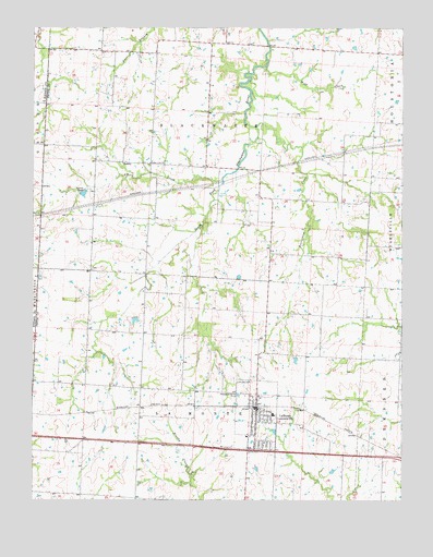
La Monte, MO USGS Topographic Map
Click on map above to begin viewing in our Map Viewer.

This topographic map contains these locations and features:
Feature Name Type Latitude Longitude GNIS ID View Map
Beaverdam CreekStreamN38.8489°W93.4247°729703View Map
Bleak Mound SchoolSchoolN38.8303°W93.4241°741696View Map
City of La MonteCivilN38.7720°W93.4237°2395567View Map
County Line ChurchChurchN38.8395°W93.4608°716383View Map
East Prairie Grove School (historical)SchoolN38.7861°W93.4638°741701View Map
Eden Valley School (historical)SchoolN38.8689°W93.4677°741698View Map
Elk CreekStreamN38.8347°W93.4363°717453View Map
Higgins School (historical)SchoolN38.8695°W93.4160°741697View Map
La MontePopulated PlaceN38.7742°W93.4252°736313View Map
La Monte CemeteryCemeteryN38.7822°W93.4321°720720View Map
La Monte Community Volunteer Fire DepartmentBuildingN38.7755°W93.4240°2621664View Map
La Monte Elementary SchoolSchoolN38.7727°W93.4189°2545217View Map
La Monte High SchoolSchoolN38.7719°W93.4189°2545305View Map
La Monte Police DepartmentBuildingN38.7641°W93.4279°2752343View Map
La Monte Post OfficePost OfficeN38.7737°W93.4242°2782788View Map
Oak Point SchoolSchoolN38.8286°W93.3869°741695View Map
Rowletta (historical)LocaleN38.8717°W93.4416°745013View Map
Smith Lake DamDamN38.7983°W93.4652°763318View Map
StokleyPopulated PlaceN38.8395°W93.4697°741297View Map
Sunny Dell School (historical)SchoolN38.8245°W93.4705°741699View Map
Township of BlackwaterCivilN38.8749°W93.4407°767159View Map
Township of La MonteCivilN38.7649°W93.4456°767170View Map
West Prairie Grove School (historical)SchoolN38.7914°W93.4822°741700View Map
Wolf CreekStreamN38.8647°W93.4213°729041View Map

Note: Coordinates in the location and feature list above are referenced to NAD83 datum.


Copyright (C) 2008-2025 Ryan Niemi / Sunset Dynamics ... All Rights Reserved