TopoQuest Logo
Do you find TopoQuest useful?
Help keep TopoQuest running and adding new maps/features by donating!
Bitcoin:  19c7KJd3qBynnjoSw5npx9KScwjBe4ifkT
Litecoin:  LXs6TkuXGGXo1vDsWCkWVdjQX94eUKd6ui
Home View Maps Find Maps Find Places Resources & Links


La Parra Ranch SE, Texas Topographic Map

USGS Map Title: La Parra Ranch SE, TX
USGS Map MRC: 27097A5
DRG (GeoTIFF) Download: o27097a5.tif


Neighboring USGS Topographic Map Quads:


  La Parra Ranch, TX  
27097B6
 

  La Parra Ranch NE, TX  
27097B5
 

  Yarborough Pass, TX  
27097B3
 

  La Parra Ranch SW, TX  
27097A6
 

  La Parra Ranch SE, TX  
27097A5
 

  Potrero Cortado, TX  
27097A4
 

  San Pedro Ranch, TX  
26097H6
 

  Maria Estella Well, TX  
26097H5
 

  Potrero Lopeno NW, TX  
26097H4


Map MRC Location:

N28°
W98°
N28°
W97°
H8 H7 H6 H5 H4 H3 H2 H1
G8 G7 G6 G5 G4 G3 G2 G1
F8 F7 F6 F5 F4 F3 F2 F1
E8 E7 E6 E5 E4 E3 E2 E1
D8 D7 D6 D5 D4 D3 D2 D1
C8 C7 C6 C5 C4 C3 C2 C1
B8 B7 B6 B5 B4 B3 B2 B1
A8 A7 A6 A5 A4 A3 A2 A1
N27°
W98°
N27°
W97°

La Parra Ranch SE, TX USGS 1:24K Topographic Map Preview:
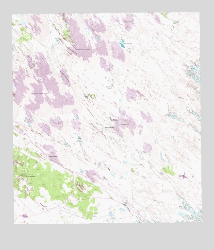
La Parra Ranch SE, TX USGS Topographic Map
Click on map above to begin viewing in our Map Viewer.

This topographic map contains these locations and features:
Feature Name Type Latitude Longitude GNIS ID View Map
Agua Negra Artesian WellWellN27.0276°W97.5114°1329265View Map
Agujon WellLocaleN27.0814°W97.5583°1329278View Map
Chaparral WindmillLocaleN27.0756°W97.5736°1332652View Map
El Chico Ron Artesian WellWellN27.1189°W97.5178°1335174View Map
El Reparo Artesian WellWellN27.1239°W97.5458°1335262View Map
Escribano Artesian WellWellN27.0114°W97.5522°1335504View Map
Los Indios RanchLocaleN27.0287°W97.6167°1340606View Map
Los Indios WellLocaleN27.0292°W97.6172°1340607View Map
Mestena Artesian WellWellN27.0745°W97.5147°1341428View Map
Nopal WellWellN27.0114°W97.6055°1342662View Map
Noria de la Compania WellWellN27.0351°W97.5461°1342664View Map
Palmito WellWellN27.0964°W97.5969°1343476View Map
Ramirez Artesian WellWellN27.0495°W97.5794°1344731View Map
San Juan Artesian WellWellN27.0056°W97.5733°1346396View Map
Santa Elena Artesian WellWellN27.0617°W97.5580°1346637View Map
Santa Elena TrapFlatN27.0589°W97.5600°1346640View Map
Sarita Artesian WellWellN27.1067°W97.5500°1346707View Map

Note: Coordinates in the location and feature list above are referenced to NAD83 datum.


Copyright (C) 2008-2025 Ryan Niemi / Sunset Dynamics ... All Rights Reserved