TopoQuest Logo
Do you find TopoQuest useful?
Help keep TopoQuest running and adding new maps/features by donating!
Bitcoin:  19c7KJd3qBynnjoSw5npx9KScwjBe4ifkT
Litecoin:  LXs6TkuXGGXo1vDsWCkWVdjQX94eUKd6ui
Home View Maps Find Maps Find Places Resources & Links


LaPorte East, Indiana Topographic Map

USGS Map Title: LaPorte East, IN
USGS Map MRC: 41086E6
DRG (GeoTIFF) Download: o41086e6.tif


Neighboring USGS Topographic Map Quads:


  Michigan City East, IN  
41086F7
 

  Springville, IN  
41086F6
 

  New Carlisle, IN  
41086F5
 

  LaPorte West, IN  
41086E7
 

  LaPorte East, IN  
41086E6
 

  Stillwell, IN  
41086E5
 

  Hanna, IN  
41086D7
 

  Kingsford Heights, IN  
41086D6
 

  Hamlet, IN  
41086D5


Map MRC Location:

N42°
W87°
N42°
W86°
H8 H7 H6 H5 H4 H3 H2 H1
G8 G7 G6 G5 G4 G3 G2 G1
F8 F7 F6 F5 F4 F3 F2 F1
E8 E7 E6 E5 E4 E3 E2 E1
D8 D7 D6 D5 D4 D3 D2 D1
C8 C7 C6 C5 C4 C3 C2 C1
B8 B7 B6 B5 B4 B3 B2 B1
A8 A7 A6 A5 A4 A3 A2 A1
N41°
W87°
N41°
W86°

LaPorte East, IN USGS 1:24K Topographic Map Preview:
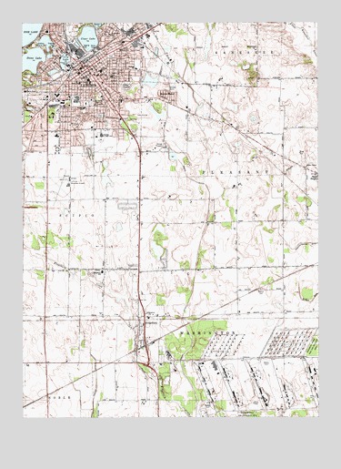
LaPorte East, IN USGS Topographic Map
Click on map above to begin viewing in our Map Viewer.

This topographic map contains these locations and features:
Feature Name Type Latitude Longitude GNIS ID View Map
Allesee ParkParkN41.6042°W86.6886°450410View Map
City of La PorteCivilN41.6077°W86.7137°2395570View Map
Clark FieldParkN41.5956°W86.7172°450419View Map
Clear LakeLakeN41.6200°W86.7218°450420View Map
Grace ChurchChurchN41.6006°W86.6975°450431View Map
Hailmann Elementary SchoolSchoolN41.6106°W86.7020°450432View Map
Handley Elementary SchoolSchoolN41.5981°W86.7239°450433View Map
Kesling Junior High SchoolSchoolN41.5892°W86.7164°450441View Map
KingsburyPopulated PlaceN41.5275°W86.7000°450442View Map
Kingsbury CreekStreamN41.5439°W86.7236°450443View Map
Kingsbury Elementary SchoolSchoolN41.5462°W86.7164°450444View Map
Kingsbury Industrial ParkLocaleN41.5084°W86.6667°450492View Map
Kingsbury Ordnance Plant (historical)MilitaryN41.5233°W86.6364°2650334View Map
Kingsbury Volunteer Fire DepartmentBuildingN41.5268°W86.7006°2626294View Map
La Porte County Sheriff's OfficeBuildingN41.6121°W86.7230°2758325View Map
La Porte Fire Department Station 1BuildingN41.5914°W86.7289°2625963View Map
La Porte Fire Department Station 3BuildingN41.6225°W86.6948°2625652View Map
La Porte High SchoolSchoolN41.6014°W86.7267°450496View Map
La Porte HospitalHospitalN41.6107°W86.7252°2660460View Map
La Porte Municipal AirportAirportN41.5715°W86.7375°450500View Map
La Porte Police DepartmentBuildingN41.6067°W86.7177°2758091View Map
LaPortePopulated PlaceN41.6106°W86.7225°450449View Map
LaPorte CountyCivilN41.5490°W86.7424°450507View Map
Lily LakeLakeN41.6128°W86.7319°450452View Map
Lincoln Elementary SchoolSchoolN41.6098°W86.7167°450453View Map
Maple SchoolSchoolN41.6164°W86.7086°450457View Map
Memorial ParkParkN41.6245°W86.7250°450458View Map
Monroe ManorPopulated PlaceN41.6012°W86.6884°450460View Map
Park Elementary SchoolSchoolN41.6062°W86.7256°447396View Map
Park SchoolSchoolN41.6059°W86.7259°450463View Map
Patton CemeteryCemeteryN41.6050°W86.7061°450464View Map
Paul F Boston Junior High SchoolSchoolN41.6070°W86.7222°450412View Map
Pine LakeLakeN41.6215°W86.7494°450465View Map
Riley Elementary SchoolSchoolN41.6139°W86.7339°450471View Map
Saint John Lutheran SchoolSchoolN41.6003°W86.7084°450475View Map
Saint Johns CemeteryCemeteryN41.5999°W86.7207°450474View Map
Saint Josephs CemeteryCemeteryN41.5999°W86.7206°450476View Map
Saint Peters ChurchChurchN41.6084°W86.7181°450477View Map
Salem ChapelChurchN41.5789°W86.6300°450478View Map
Scipio Township Volunteer Fire Department Station 2BuildingN41.5692°W86.7322°2626433View Map
South LaPortePopulated PlaceN41.5750°W86.7397°450493View Map
Stone LakeLakeN41.6142°W86.7451°1669484View Map
Town of KingsburyCivilN41.5302°W86.6974°2397018View Map
Township of PleasantCivilN41.5769°W86.6411°453747View Map
Township of WashingtonCivilN41.5211°W86.6500°454004View Map
Travis DitchCanalN41.5503°W86.6764°450486View Map
Washington SchoolSchoolN41.6212°W86.7131°450489View Map

Note: Coordinates in the location and feature list above are referenced to NAD83 datum.


Copyright (C) 2008-2025 Ryan Niemi / Sunset Dynamics ... All Rights Reserved