TopoQuest Logo
Do you find TopoQuest useful?
Help keep TopoQuest running and adding new maps/features by donating!
Bitcoin:  19c7KJd3qBynnjoSw5npx9KScwjBe4ifkT
Litecoin:  LXs6TkuXGGXo1vDsWCkWVdjQX94eUKd6ui
Home View Maps Find Maps Find Places Resources & Links


La Vernia, Texas Topographic Map

USGS Map Title: La Vernia, TX
USGS Map MRC: 29098C1
DRG (GeoTIFF) Download: o29098c1.tif


Neighboring USGS Topographic Map Quads:


  Saint Hedwig, TX  
29098D2
 

  New Berlin, TX  
29098D1
 

  Thomas Springs, TX  
29097D8
 

  La Vernia SW, TX  
29098C2
 

  La Vernia, TX  
29098C1
 

  Alum, TX  
29097C8
 

  Floresville, TX  
29098B2
 

  Marcelinas Hills, TX  
29098B1
 

  Stockdale, TX  
29097B8


Map MRC Location:

N30°
W99°
N30°
W98°
H8 H7 H6 H5 H4 H3 H2 H1
G8 G7 G6 G5 G4 G3 G2 G1
F8 F7 F6 F5 F4 F3 F2 F1
E8 E7 E6 E5 E4 E3 E2 E1
D8 D7 D6 D5 D4 D3 D2 D1
C8 C7 C6 C5 C4 C3 C2 C1
B8 B7 B6 B5 B4 B3 B2 B1
A8 A7 A6 A5 A4 A3 A2 A1
N29°
W99°
N29°
W98°

La Vernia, TX USGS 1:24K Topographic Map Preview:
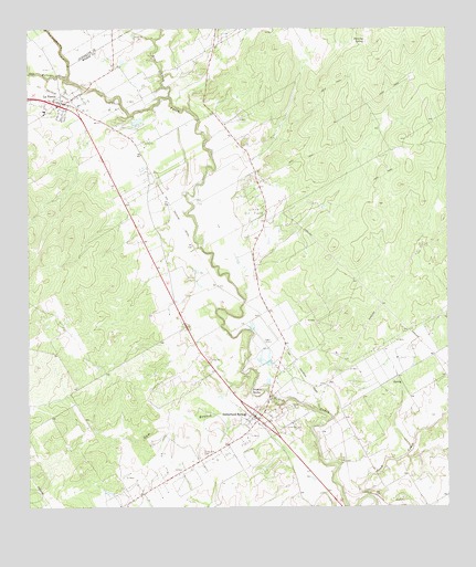
La Vernia, TX USGS Topographic Map
Click on map above to begin viewing in our Map Viewer.

This topographic map contains these locations and features:
Feature Name Type Latitude Longitude GNIS ID View Map
Alum CreekStreamN29.2536°W98.0239°1351056View Map
City of La VerniaCivilN29.3542°W98.1221°2411585View Map
Dagen LakeReservoirN29.2702°W98.0870°1864424View Map
Dagen Lake DamDamN29.2702°W98.0870°1864423View Map
Denning SpringSpringN29.3717°W98.0244°1355917View Map
Dry Hollow CreekStreamN29.3613°W98.1128°1373482View Map
Elm CreekStreamN29.3575°W98.0831°1373635View Map
Gum BranchStreamN29.2852°W98.0603°1358510View Map
K Oil FieldOilfieldN29.2597°W98.0700°1360479View Map
La VerniaPopulated PlaceN29.3563°W98.1156°1360813View Map
La Vernia Alternative SchoolSchoolN29.3577°W98.1114°2009319View Map
La Vernia City HallBuildingN29.3555°W98.1149°2754048View Map
La Vernia DivisionCivilN29.3285°W98.0850°1938913View Map
La Vernia Elementary SchoolSchoolN29.3586°W98.1097°2009320View Map
La Vernia High SchoolSchoolN29.3580°W98.1108°2009321View Map
La Vernia Middle SchoolSchoolN29.3541°W98.1197°2009322View Map
La Vernia Police DepartmentBuildingN29.3555°W98.1149°2739385View Map
La Vernia Volunteer Ambulance ServiceBuildingN29.3441°W98.1052°2656206View Map
La Vernia Volunteer Fire DepartmentBuildingN29.3454°W98.1049°2552644View Map
Linne Oil FieldOilfieldN29.3288°W98.0578°1361243View Map
Sulphur SpringSpringN29.2805°W98.0564°1369365View Map
Sutherland CemeteryCemeteryN29.2644°W98.0733°1369437View Map
Sutherland SpringsPopulated PlaceN29.2733°W98.0567°1369438View Map
Sutherland SpringsSpringN29.2919°W98.0586°1998269View Map
Sutherland Springs Post OfficePost OfficeN29.2749°W98.0559°2731234View Map
Sutherland Springs Volunteer Fire DepartmentBuildingN29.2741°W98.0588°2552449View Map
Whitehall MansionBuildingN29.3152°W98.0581°2032459View Map

Note: Coordinates in the location and feature list above are referenced to NAD83 datum.


Copyright (C) 2008-2024 Ryan Niemi / Sunset Dynamics ... All Rights Reserved