TopoQuest Logo
Do you find TopoQuest useful?
Help keep TopoQuest running and adding new maps/features by donating!
Bitcoin:  19c7KJd3qBynnjoSw5npx9KScwjBe4ifkT
Litecoin:  LXs6TkuXGGXo1vDsWCkWVdjQX94eUKd6ui
Home View Maps Find Maps Find Places Resources & Links


Lacamp, Louisiana Topographic Map

USGS Map Title: Lacamp, LA
USGS Map MRC: 31092B8
DRG (GeoTIFF) Download: o31092b8.tif


Neighboring USGS Topographic Map Quads:


  Simpson North, LA  
31093C1
 

  Temple, LA  
31092C8
 

  Jericho, LA  
31092C7
 

  Simpson South, LA  
31093B1
 

  Lacamp, LA  
31092B8
 

  Sieper, LA  
31092B7
 

  Birds Creek, LA  
31093A1
 

  Fullerton Lake, LA  
31092A8
 

  Afeman, LA  
31092A7


Map MRC Location:

N32°
W93°
N32°
W92°
H8 H7 H6 H5 H4 H3 H2 H1
G8 G7 G6 G5 G4 G3 G2 G1
F8 F7 F6 F5 F4 F3 F2 F1
E8 E7 E6 E5 E4 E3 E2 E1
D8 D7 D6 D5 D4 D3 D2 D1
C8 C7 C6 C5 C4 C3 C2 C1
B8 B7 B6 B5 B4 B3 B2 B1
A8 A7 A6 A5 A4 A3 A2 A1
N31°
W93°
N31°
W92°

Lacamp, LA USGS 1:24K Topographic Map Preview:
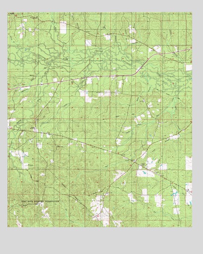
Lacamp, LA USGS Topographic Map
Click on map above to begin viewing in our Map Viewer.

This topographic map contains these locations and features:
Feature Name Type Latitude Longitude GNIS ID View Map
Ball BranchStreamN31.2277°W92.9243°553341View Map
Billy CreekStreamN31.2041°W92.8838°547088View Map
Boggy BranchStreamN31.1702°W92.8946°533293View Map
Clear Runner BranchStreamN31.1880°W92.9868°533994View Map
Collins BranchStreamN31.1671°W92.9974°534045View Map
Evans BranchStreamN31.2132°W92.9043°534849View Map
Flactor Baptist ChurchChurchN31.1880°W92.9807°554420View Map
Floctaw CreekStreamN31.2210°W92.9696°554440View Map
Gordie BranchStreamN31.2296°W92.9579°547406View Map
Greys CreekStreamN31.2221°W92.9432°535423View Map
Hicks CrossingPopulated PlaceN31.2277°W92.9404°543292View Map
Hicks High SchoolSchoolN31.1821°W92.9819°554706View Map
Hicks Lookout TowerTowerN31.1724°W92.9665°558781View Map
LacampPopulated PlaceN31.1638°W92.9146°554959View Map
Lacamp ChurchChurchN31.1569°W92.8996°536251View Map
Lacamp Church of GodChurchN31.1616°W92.9099°557089View Map
Lacamp Post OfficePost OfficeN31.1660°W92.9215°1631378View Map
Lacamp Volunteer Fire Department Station 15BuildingN31.1674°W92.9233°2672817View Map
Laurel Hill Baptist ChurchChurchN31.1985°W92.9077°555000View Map
Laurel Hill CemeteryCemeteryN31.1991°W92.9082°550025View Map
Lick BranchStreamN31.2088°W92.9849°536436View Map
Long BranchStreamN31.1788°W92.8832°536684View Map
Mayo CemeteryCemeteryN31.2135°W92.9818°536955View Map
Mill CreekStreamN31.2121°W92.8768°537102View Map
Mims CreekStreamN31.2243°W92.9438°547722View Map
North Fork Mill CreekStreamN31.1882°W92.8999°537730View Map
Oak Grove CemeteryCemeteryN31.1446°W92.9326°550047View Map
Oak Grove ChurchChurchN31.1449°W92.9329°537780View Map
Peavey BranchStreamN31.2277°W92.9210°538039View Map
Pine Island CemeteryCemeteryN31.2466°W92.9813°538187View Map
Schoolhouse CreekStreamN31.2182°W92.9724°539216View Map
Scott CemeteryCemeteryN31.2093°W92.9554°539230View Map
Spring BranchStreamN31.2293°W92.9929°539576View Map
Twomile BranchStreamN31.2221°W92.9165°548102View Map
Vincent CreekStreamN31.1880°W92.9865°540174View Map
Ward EightCivilN31.1830°W92.9815°545254View Map
Yellow BranchStreamN31.2174°W92.8813°556480View Map

Note: Coordinates in the location and feature list above are referenced to NAD83 datum.


Copyright (C) 2008-2025 Ryan Niemi / Sunset Dynamics ... All Rights Reserved