TopoQuest Logo
Do you find TopoQuest useful?
Help keep TopoQuest running and adding new maps/features by donating!
Bitcoin:  19c7KJd3qBynnjoSw5npx9KScwjBe4ifkT
Litecoin:  LXs6TkuXGGXo1vDsWCkWVdjQX94eUKd6ui
Home View Maps Find Maps Find Places Resources & Links


Lake Charles SW, Louisiana Topographic Map

USGS Map Title: Lake Charles SW, LA
USGS Map MRC: 30093A2
DRG (GeoTIFF) Download: o30093a2.tif


Neighboring USGS Topographic Map Quads:


  Westlake, LA  
30093B3
 

  Lake Charles, LA  
30093B2
 

  Iowa, LA  
30093B1
 

  Moss Lake, LA  
30093A3
 

  Lake Charles SW, LA  
30093A2
 

  Lake Charles SE, LA  
30093A1


Map MRC Location:

N31°
W94°
N31°
W93°
H8 H7 H6 H5 H4 H3 H2 H1
G8 G7 G6 G5 G4 G3 G2 G1
F8 F7 F6 F5 F4 F3 F2 F1
E8 E7 E6 E5 E4 E3 E2 E1
D8 D7 D6 D5 D4 D3 D2 D1
C8 C7 C6 C5 C4 C3 C2 C1
B8 B7 B6 B5 B4 B3 B2 B1
A8 A7 A6 A5 A4 A3 A2 A1
N30°
W94°
N30°
W93°

Lake Charles SW, LA USGS 1:24K Topographic Map Preview:
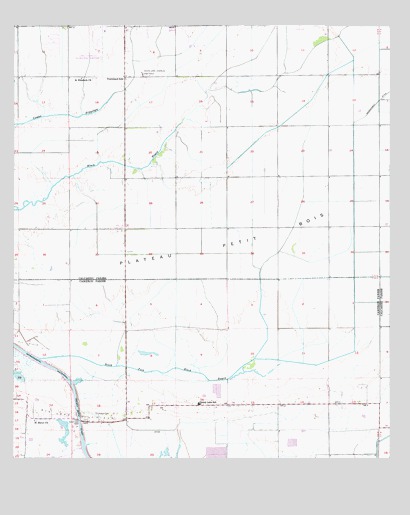
Lake Charles SW, LA USGS Topographic Map
Click on map above to begin viewing in our Map Viewer.

This topographic map contains these locations and features:
Feature Name Type Latitude Longitude GNIS ID View Map
Big Lake Oil FieldOilfieldN30.0224°W93.2479°553655View Map
Cameron Parish Library Grand Lake BranchBuildingN30.0162°W93.1937°2603044View Map
Cameron Parish Sheriff's DepartmentBuildingN30.0164°W93.1625°2334165View Map
Cameron Parish Sheriff's DepartmentBuildingN30.0515°W93.2136°2334229View Map
Fire Protection District 2 Ward 3BuildingN30.0695°W93.2128°2332537View Map
Grand Lake Faith TempleChurchN30.0129°W93.2091°2601812View Map
Grand Lake High SchoolSchoolN30.0161°W93.1881°1629651View Map
Grand Lake School (historical)SchoolN30.0094°W93.2463°550937View Map
Grand Lake Volunteer Fire DepartmentBuildingN30.0157°W93.1939°2332610View Map
Grand Lake Ward FourCivilN30.0102°W93.1690°558842View Map
Gulf Stream Manor Mobile Home ParkPopulated PlaceN30.0932°W93.2091°2600413View Map
Hebert CemeteryCemeteryN30.0135°W93.2221°535599View Map
Herbert Trailer ParkPopulated PlaceN30.0135°W93.2272°2600418View Map
Lake Charles Office HeliportAirportN30.1144°W93.2121°1632818View Map
Lake Charles Regional AirportAirportN30.1236°W93.2204°1632808View Map
Parish Governing Authority District 7CivilN30.1011°W93.1888°1930179View Map
PrairielandPopulated PlaceN30.1102°W93.2132°551346View Map
Prairieland Community ChurchChurchN30.1105°W93.2129°551347View Map
Prairieland SchoolSchoolN30.1099°W93.2135°538390View Map
Saint Elizabeth ChurchChurchN30.1102°W93.2277°538836View Map
Saint Marys ChurchChurchN30.0110°W93.2429°538983View Map
South Fork Black BayouStreamN30.0291°W93.2410°539495View Map
South Lake Charles Gas FieldOilfieldN30.1119°W93.2074°539500View Map
South Lake Charles Oil FieldOilfieldN30.1113°W93.1457°551366View Map
Sweet Lake FerryLocaleN30.0116°W93.2282°539763View Map
Vineyard Christian Fellowship ChurchChurchN30.0560°W93.2121°2602952View Map

Note: Coordinates in the location and feature list above are referenced to NAD83 datum.


Copyright (C) 2008-2025 Ryan Niemi / Sunset Dynamics ... All Rights Reserved