TopoQuest Logo
Do you find TopoQuest useful?
Help keep TopoQuest running and adding new maps/features by donating!
Bitcoin:  19c7KJd3qBynnjoSw5npx9KScwjBe4ifkT
Litecoin:  LXs6TkuXGGXo1vDsWCkWVdjQX94eUKd6ui
Home View Maps Find Maps Find Places Resources & Links


Lake Chicot, Louisiana Topographic Map

USGS Map Title: Lake Chicot, LA
USGS Map MRC: 30091A4
DRG (GeoTIFF) Download: o30091a4.tif


Neighboring USGS Topographic Map Quads:


  Grand River, LA  
30091B4
 

  Bayou Sorrel, LA  
30091B3


  Lake Chicot, LA  
30091A4
 

  Pigeon, LA  
30091A3
 

  Charenton, LA  
29091H5
 

  Centerville NW, LA  
29091H4
 

  Centerville NE, LA  
29091H3


Map MRC Location:

N31°
W92°
N31°
W91°
H8 H7 H6 H5 H4 H3 H2 H1
G8 G7 G6 G5 G4 G3 G2 G1
F8 F7 F6 F5 F4 F3 F2 F1
E8 E7 E6 E5 E4 E3 E2 E1
D8 D7 D6 D5 D4 D3 D2 D1
C8 C7 C6 C5 C4 C3 C2 C1
B8 B7 B6 B5 B4 B3 B2 B1
A8 A7 A6 A5 A4 A3 A2 A1
N30°
W92°
N30°
W91°

Lake Chicot, LA USGS 1:24K Topographic Map Preview:
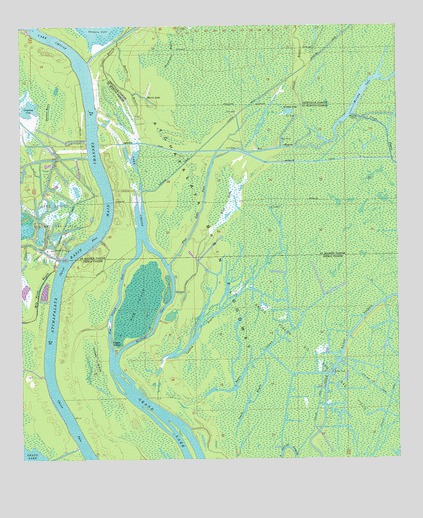
Lake Chicot, LA USGS Topographic Map
Click on map above to begin viewing in our Map Viewer.

This topographic map contains these locations and features:
Feature Name Type Latitude Longitude GNIS ID View Map
Bayou CheneStreamN30.1235°W91.4976°559900View Map
Bayou CowanGutN30.0291°W91.4223°532545View Map
Bayou HebertStreamN30.0910°W91.4604°559981View Map
Bayou NimrodLakeN30.0739°W91.4897°551537View Map
Bayou Pigeon Oil and Gas FieldOilfieldN30.0174°W91.3937°532723View Map
Bee BayouStreamN30.0871°W91.4354°560128View Map
Cannon BayouStreamN30.1094°W91.3807°533756View Map
Catfish BayouGutN30.0391°W91.4398°560379View Map
Chicot PassCanalN30.0308°W91.4907°560416View Map
Crossing CoveLakeN30.0682°W91.4602°560418View Map
Deadman BayouLakeN30.1008°W91.4904°560606View Map
Deadman Cove (historical)BayN30.1146°W91.4893°551513View Map
Eagle IslandIslandN30.0338°W91.4698°534687View Map
Flat LakeSwampN30.0755°W91.4316°560763View Map
Flat Lake PassChannelN30.0713°W91.4401°560764View Map
Florida CanalCanalN30.1013°W91.4257°560769View Map
Grassy LakeLakeN30.1006°W91.4110°560891View Map
Hog IslandIslandN30.0444°W91.4621°535699View Map
Hog Island PassChannelN30.0494°W91.4673°560979View Map
Indigo BayouStreamN30.0908°W91.4082°1627326View Map
Keelboat PassChannelN30.0413°W91.4548°1627386View Map
Lake Chicot Oil and Gas FieldOilfieldN30.0705°W91.4912°1627429View Map
Lake Murphy Oil FieldOilfieldN30.0941°W91.4071°1629532View Map
Morris LakeLakeN30.1049°W91.4588°555376View Map
Murphy LakeLakeN30.1066°W91.3857°1627739View Map
Newcomer BayouStreamN30.1110°W91.4521°537657View Map
Tarleton BayouStreamN30.1238°W91.4954°1628332View Map
Turkey IslandSwampN30.0074°W91.4632°540038View Map
Yanks BayouGutN30.1169°W91.4704°1628534View Map

Note: Coordinates in the location and feature list above are referenced to NAD83 datum.


Copyright (C) 2008-2025 Ryan Niemi / Sunset Dynamics ... All Rights Reserved