TopoQuest Logo
Do you find TopoQuest useful?
Help keep TopoQuest running and adding new maps/features by donating!
Bitcoin:  19c7KJd3qBynnjoSw5npx9KScwjBe4ifkT
Litecoin:  LXs6TkuXGGXo1vDsWCkWVdjQX94eUKd6ui
Home View Maps Find Maps Find Places Resources & Links


Lake Fork, Idaho Topographic Map

USGS Map Title: Lake Fork, ID
USGS Map MRC: 44116G1
DRG (GeoTIFF) Download: o44116g1.tif


Neighboring USGS Topographic Map Quads:


  Meadows, ID  
44116H2
 

  McCall, ID  
44116H1
 

  Fitsum Summit, ID  
44115H8
 

  No Business Mountain, ID  
44116G2
 

  Lake Fork, ID  
44116G1
 

  Paddy Flat, ID  
44115G8
 

  Lone Tree, ID  
44116F2
 

  Donnelly, ID  
44116F1
 

  Sloans Point, ID  
44115F8


Map MRC Location:

N45°
W117°
N45°
W116°
H8 H7 H6 H5 H4 H3 H2 H1
G8 G7 G6 G5 G4 G3 G2 G1
F8 F7 F6 F5 F4 F3 F2 F1
E8 E7 E6 E5 E4 E3 E2 E1
D8 D7 D6 D5 D4 D3 D2 D1
C8 C7 C6 C5 C4 C3 C2 C1
B8 B7 B6 B5 B4 B3 B2 B1
A8 A7 A6 A5 A4 A3 A2 A1
N44°
W117°
N44°
W116°

Lake Fork, ID USGS 1:24K Topographic Map Preview:
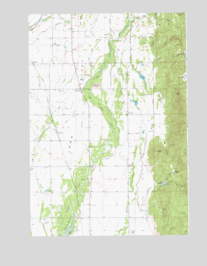
Lake Fork, ID USGS Topographic Map
Click on map above to begin viewing in our Map Viewer.

This topographic map contains these locations and features:
Feature Name Type Latitude Longitude GNIS ID View Map
ArchabalPopulated PlaceN44.8468°W116.1221°396048View Map
Bear Air AirportAirportN44.7846°W116.0680°2443819View Map
Bear GulchValleyN44.8071°W116.0254°377147View Map
Bell School (historical)SchoolN44.7963°W116.0482°399511View Map
Boulder DitchCanalN44.8438°W116.0554°378094View Map
Cold CreekStreamN44.8288°W116.0290°379508View Map
Cruzen DitchCanalN44.8157°W116.0943°380114View Map
Cruzen PondLakeN44.7754°W116.1129°380115View Map
Finn CemeteryCemeteryN44.8186°W116.0465°381692View Map
Flying A Ranch AirportAirportN44.8182°W116.0680°2443817View Map
Grouse KnollSummitN44.7971°W116.0246°382748View Map
Hatties CreekStreamN44.8699°W116.0465°382961View Map
Hollenbeak DamDamN44.8416°W116.0443°398733View Map
Hughes DamDamN44.7785°W116.0210°398730View Map
Jug CreekStreamN44.8546°W116.0032°384035View Map
Jug Creek DamDamN44.8416°W116.0010°398728View Map
Jussila-Bow DamDamN44.8232°W116.0376°398727View Map
Lake ForkPopulated PlaceN44.8327°W116.0848°396759View Map
Lake Irrigation District CanalCanalN44.8660°W116.1107°384382View Map
Louie CreekStreamN44.8505°W116.0243°386197View Map
Lower Jug Creek ReservoirReservoirN44.8501°W116.0011°397880View Map
Mahala DitchCanalN44.8080°W116.0546°386374View Map
Meadow CreekStreamN44.8602°W116.0587°386702View Map
Melton ReservoirReservoirN44.7790°W116.0194°397903View Map
NorwoodPopulated PlaceN44.8085°W116.1032°396973View Map
Poorman CreekStreamN44.8749°W116.0087°388739View Map
Poro DamDamN44.8521°W116.0012°398724View Map
Roseberry DitchCanalN44.7768°W116.0404°389608View Map
Shaws SpringSpringN44.8727°W116.0348°390169View Map
SpinkPopulated PlaceN44.7902°W116.0482°399510View Map
Spink Barker DitchCanalN44.8396°W116.0612°391110View Map
Spink CemeteryCemeteryN44.7962°W116.0447°391111View Map
Splan AirportAirportN44.8073°W116.0510°2443818View Map
Stover CreekStreamN44.7571°W116.0479°391516View Map
Stover MeadowFlatN44.7855°W116.0098°391517View Map
Upper Jug Creek ReservoirReservoirN44.8392°W116.0001°392635View Map
Westside Lake Fork DitchCanalN44.8102°W116.0837°375845View Map
Wilhelm CreekStreamN44.8068°W116.0360°393450View Map

Note: Coordinates in the location and feature list above are referenced to NAD83 datum.


Copyright (C) 2008-2024 Ryan Niemi / Sunset Dynamics ... All Rights Reserved