TopoQuest Logo
Do you find TopoQuest useful?
Help keep TopoQuest running and adding new maps/features by donating!
Bitcoin:  19c7KJd3qBynnjoSw5npx9KScwjBe4ifkT
Litecoin:  LXs6TkuXGGXo1vDsWCkWVdjQX94eUKd6ui
Home View Maps Find Maps Find Places Resources & Links


Lake Helen, Wyoming Topographic Map

USGS Map Title: Lake Helen, WY
USGS Map MRC: 44107C2
DRG (GeoTIFF) Download: o44107c2.tif


Neighboring USGS Topographic Map Quads:


  Shell Lake, WY  
44107D3
 

  Cloud Peak, WY  
44107D2
 

  Willow Park Reservoir, WY  
44107D1
 

  Lake Solitude, WY  
44107C3
 

  Lake Helen, WY  
44107C2
 

  Lake Angeline, WY  
44107C1
 

  Brokenback Narrows, WY  
44107B3
 

  Meadowlark Lake, WY  
44107B2
 

  Powder River Pass, WY  
44107B1


Map MRC Location:

N45°
W108°
N45°
W107°
H8 H7 H6 H5 H4 H3 H2 H1
G8 G7 G6 G5 G4 G3 G2 G1
F8 F7 F6 F5 F4 F3 F2 F1
E8 E7 E6 E5 E4 E3 E2 E1
D8 D7 D6 D5 D4 D3 D2 D1
C8 C7 C6 C5 C4 C3 C2 C1
B8 B7 B6 B5 B4 B3 B2 B1
A8 A7 A6 A5 A4 A3 A2 A1
N44°
W108°
N44°
W107°

Lake Helen, WY USGS 1:24K Topographic Map Preview:
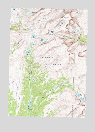
Lake Helen, WY USGS Topographic Map
Click on map above to begin viewing in our Map Viewer.

This topographic map contains these locations and features:
Feature Name Type Latitude Longitude GNIS ID View Map
Bald RidgeRidgeN44.2639°W107.2334°1602693View Map
Bomber MountainSummitN44.3600°W107.1740°1598289View Map
Elk ParkFlatN44.2627°W107.1826°1599593View Map
Florence CanyonValleyN44.3391°W107.1376°1599769View Map
Florence LakeLakeN44.3481°W107.1816°1599771View Map
Florence PassGapN44.3458°W107.1809°1599772View Map
Fortress LakesLakeN44.3394°W107.1984°1599804View Map
Golden LakesLakeN44.3558°W107.1703°1599971View Map
Gunboat LakeLakeN44.3365°W107.1935°1600139View Map
Lake HelenLakeN44.3235°W107.2199°1600286View Map
Lake MarionLakeN44.3335°W107.2143°1601257View Map
Lost Twin LakesLakeN44.2730°W107.1331°1601150View Map
Mather PeaksSummitN44.3242°W107.1467°1601282View Map
Medicine Cabin ParkFlatN44.3379°W107.1334°1601336View Map
Medicine ParkFlatN44.3427°W107.1481°1604644View Map
Middle Cloud Peak LakeLakeN44.3694°W107.2171°1601376View Map
Mirror LakeLakeN44.2844°W107.1723°1601490View Map
Mistymoon LakeLakeN44.3423°W107.2124°1601495View Map
Mistymoon TrailTrailN44.2897°W107.2178°1604642View Map
Powell CreekStreamN44.3391°W107.1376°1602293View Map
Powell LakesLakeN44.3480°W107.1464°1602294View Map
Summit LakeLakeN44.3733°W107.2448°1603433View Map
West Tensleep CampgroundLocaleN44.2580°W107.2153°1604645View Map
West Tensleep LakeLakeN44.2639°W107.2162°1604103View Map

Note: Coordinates in the location and feature list above are referenced to NAD83 datum.


Copyright (C) 2008-2024 Ryan Niemi / Sunset Dynamics ... All Rights Reserved