TopoQuest Logo
Do you find TopoQuest useful?
Help keep TopoQuest running and adding new maps/features by donating!
Bitcoin:  19c7KJd3qBynnjoSw5npx9KScwjBe4ifkT
Litecoin:  LXs6TkuXGGXo1vDsWCkWVdjQX94eUKd6ui
Home View Maps Find Maps Find Places Resources & Links


Lake Hurley, South Dakota Topographic Map

USGS Map Title: Lake Hurley, SD
USGS Map MRC: 45100A2
DRG (GeoTIFF) Download: o45100a2.tif


Neighboring USGS Topographic Map Quads:


  Four Bear Creek, SD  
45100B3
 

  Steamboat Creek, SD  
45100B2
 

  Lake Hurley NE, SD  
45100B1
 

  Patch Skin Buttes SE, SD  
45100A3
 

  Lake Hurley, SD  
45100A2
 

  Lake Hurley SE, SD  
45100A1
 

  Artichoke Butte NE, SD  
44100H3
 

  Agar NW, SD  
44100H2
 

  Agar NE, SD  
44100H1


Map MRC Location:

N46°
W101°
N46°
W100°
H8 H7 H6 H5 H4 H3 H2 H1
G8 G7 G6 G5 G4 G3 G2 G1
F8 F7 F6 F5 F4 F3 F2 F1
E8 E7 E6 E5 E4 E3 E2 E1
D8 D7 D6 D5 D4 D3 D2 D1
C8 C7 C6 C5 C4 C3 C2 C1
B8 B7 B6 B5 B4 B3 B2 B1
A8 A7 A6 A5 A4 A3 A2 A1
N45°
W101°
N45°
W100°

Lake Hurley, SD USGS 1:24K Topographic Map Preview:
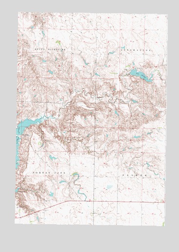
Lake Hurley, SD USGS Topographic Map
Click on map above to begin viewing in our Map Viewer.

This topographic map contains these locations and features:
Feature Name Type Latitude Longitude GNIS ID View Map
A Houck DamDamN45.1167°W100.2371°1260482View Map
Appomattox (historical)LocaleN45.0880°W100.1296°1263682View Map
C Iverson DamDamN45.0733°W100.1521°1260484View Map
C W Stewart DamDamN45.0517°W100.1521°1260485View Map
Eldore L Holzwarth DamDamN45.0166°W100.2187°1260491View Map
Forest City SchoolSchoolN45.0080°W100.2260°1255105View Map
Hurley DamDamN45.0883°W100.1537°1260256View Map
Jay A Lake Number 3 DamDamN45.0883°W100.2204°1260519View Map
Jay A Lake Number 4 DamDamN45.0950°W100.1921°1260521View Map
Jay A Lake Number 5 DamDamN45.0883°W100.1854°1260520View Map
Jay Lake DamDamN45.0733°W100.2337°1260486View Map
Lake HurleyReservoirN45.0888°W100.1470°1255721View Map
Little Cheyenne CreekStreamN45.0628°W100.2287°1256154View Map
Lone Star (historical)LocaleN45.1017°W100.1757°1263683View Map
T Holzwarth DamDamN45.0417°W100.2204°1260475View Map
Thed A Holzwarth DamDamN45.0250°W100.2137°1260490View Map
Township of Riverside (historical)CivilN45.1083°W100.2357°1268450View Map
Township of South RiversideCivilN45.1083°W100.2357°1268449View Map
Unorganized Territory of West PotterCivilN45.0522°W100.2060°1267644View Map
Whitlocks Bay Recreation AreaParkN45.0522°W100.2460°1258985View Map

Note: Coordinates in the location and feature list above are referenced to NAD83 datum.


Copyright (C) 2008-2025 Ryan Niemi / Sunset Dynamics ... All Rights Reserved