TopoQuest Logo
Do you find TopoQuest useful?
Help keep TopoQuest running and adding new maps/features by donating!
Bitcoin:  19c7KJd3qBynnjoSw5npx9KScwjBe4ifkT
Litecoin:  LXs6TkuXGGXo1vDsWCkWVdjQX94eUKd6ui
Home View Maps Find Maps Find Places Resources & Links


Lake Richie, Michigan Topographic Map

USGS Map Title: Lake Richie, MI
USGS Map MRC: 47088H6
DRG (GeoTIFF) Download: o47088h6.tif


Neighboring USGS Topographic Map Quads:


  Lake Richie, MI  
47088H6


Map MRC Location:

N48°
W89°
N48°
W88°
H8 H7 H6 H5 H4 H3 H2 H1
G8 G7 G6 G5 G4 G3 G2 G1
F8 F7 F6 F5 F4 F3 F2 F1
E8 E7 E6 E5 E4 E3 E2 E1
D8 D7 D6 D5 D4 D3 D2 D1
C8 C7 C6 C5 C4 C3 C2 C1
B8 B7 B6 B5 B4 B3 B2 B1
A8 A7 A6 A5 A4 A3 A2 A1
N47°
W89°
N47°
W88°

Lake Richie, MI USGS 1:24K Topographic Map Preview:
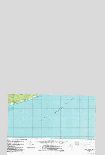
Lake Richie, MI USGS Topographic Map
Click on map above to begin viewing in our Map Viewer.

This topographic map contains these locations and features:
Feature Name Type Latitude Longitude GNIS ID View Map
Birch IsleIslandN48.0490°W88.6909°1618264View Map
Blueberry CoveBayN48.0107°W88.6751°1618265View Map
Chickenbone LakeLakeN48.0673°W88.7132°1618267View Map
Chippewa HarborBayN48.0268°W88.6592°1618268View Map
Chippewa Harbor CampgroundLocaleN48.0290°W88.6506°1618269View Map
Datolite MineMineN47.9913°W88.7423°1618270View Map
East Chickenbone Lake CampgroundLocaleN48.0731°W88.6944°1618461View Map
Greenstone BeachBeachN48.0002°W88.7056°1618274View Map
Hastings IslandIslandN48.0463°W88.6942°1618277View Map
Indian Portage TrailTrailN48.0496°W88.6956°1618281View Map
Intermediate LakeLakeN48.0307°W88.7272°1618282View Map
Lake DustinLakeN48.0043°W88.6975°1618271View Map
Lake GeorgeLakeN48.0075°W88.6862°1618273View Map
Lake LivermoreLakeN48.0647°W88.7084°1618288View Map
Lake MasonLakeN48.0369°W88.6374°1618289View Map
Lake RichieLakeN48.0438°W88.6954°1618302View Map
Lake Richie CampgroundLocaleN48.0514°W88.6875°1618460View Map
Lake Richie TrailTrailN48.0588°W88.6659°1618284View Map
Lake ScholtsLakeN48.0089°W88.6888°1618308View Map
Lake TheresaLakeN48.0346°W88.6308°1618312View Map
Lake WhittleseyLakeN48.0064°W88.7072°1618316View Map
LeSage LakeLakeN48.0552°W88.7090°1618285View Map
Little Greenstone BeachBeachN47.9929°W88.7309°1618287View Map
Moskey BasinBasinN48.0665°W88.6334°1618296View Map
Moskey Basin CampgroundLocaleN48.0635°W88.6454°1618297View Map
Vodrey HarborBayN47.9977°W88.7106°1618313View Map
Wallace LakeLakeN48.0572°W88.6288°1618315View Map
West Chickenbone Lake CampgroundLocaleN48.0635°W88.7251°1623728View Map
Wood LakeLakeN48.0035°W88.7442°1618317View Map

Note: Coordinates in the location and feature list above are referenced to NAD83 datum.


Copyright (C) 2008-2025 Ryan Niemi / Sunset Dynamics ... All Rights Reserved