TopoQuest Logo
Do you find TopoQuest useful?
Help keep TopoQuest running and adding new maps/features by donating!
Bitcoin:  19c7KJd3qBynnjoSw5npx9KScwjBe4ifkT
Litecoin:  LXs6TkuXGGXo1vDsWCkWVdjQX94eUKd6ui
Home View Maps Find Maps Find Places Resources & Links


Lake Thunderhead, Missouri Topographic Map

USGS Map Title: Lake Thunderhead, MO
USGS Map MRC: 40093E1
DRG (GeoTIFF) Download: o40093e1.tif


Neighboring USGS Topographic Map Quads:


  Seymour West, IA  
40093F2
 

  Seymour East, IA  
40093F1
 

  Centerville West, IA  
40092F8
 

  Saint John, MO  
40093E2
 

  Lake Thunderhead, MO  
40093E1
 

  Mendota, MO  
40092E8
 

  Pollock NW, MO  
40093D2
 

  Unionville West, MO  
40093D1
 

  Unionville East, MO  
40092D8


Map MRC Location:

N41°
W94°
N41°
W93°
H8 H7 H6 H5 H4 H3 H2 H1
G8 G7 G6 G5 G4 G3 G2 G1
F8 F7 F6 F5 F4 F3 F2 F1
E8 E7 E6 E5 E4 E3 E2 E1
D8 D7 D6 D5 D4 D3 D2 D1
C8 C7 C6 C5 C4 C3 C2 C1
B8 B7 B6 B5 B4 B3 B2 B1
A8 A7 A6 A5 A4 A3 A2 A1
N40°
W94°
N40°
W93°

Lake Thunderhead, MO USGS 1:24K Topographic Map Preview:
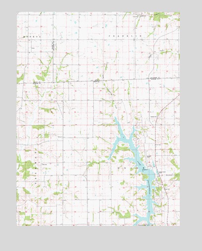
Lake Thunderhead, MO USGS Topographic Map
Click on map above to begin viewing in our Map Viewer.

This topographic map contains these locations and features:
Feature Name Type Latitude Longitude GNIS ID View Map
Brown School (historical)SchoolN40.5373°W93.0624°714789View Map
City LakeReservoirN40.5000°W93.0219°760803View Map
Delpha (historical)LocaleN40.5497°W93.0899°759907View Map
Fife School (historical)SchoolN40.5728°W93.0619°717908View Map
GenoaPopulated PlaceN40.6042°W93.1141°464557View Map
Genoa Post Office (historical)Post OfficeN40.6025°W93.1133°466522View Map
Lake Mahoney DamDamN40.5000°W93.0219°760802View Map
Lake ThunderheadReservoirN40.5306°W93.0171°760202View Map
Lake Thunderhead DamDamN40.5300°W93.0169°760201View Map
Livingston CemeteryCemeteryN40.6231°W93.0572°458537View Map
McKay School (historical)SchoolN40.5739°W93.0042°722133View Map
Mount Zion ChurchChurchN40.5517°W93.0897°758455View Map
Municipal Airport (historical)AirportN40.5403°W93.0260°758971View Map
Thornburg School (historical)SchoolN40.5003°W93.0091°733752View Map
Township of UnionCivilN40.5288°W93.0327°767246View Map
Union CemeteryCemeteryN40.5361°W93.1060°742970View Map
Union Church (historical)ChurchN40.5361°W93.1038°728005View Map
Unionville Municipal AirportAirportN40.5367°W93.0240°743065View Map
Waite School (historical)SchoolN40.5414°W93.0092°728245View Map
Welland Post Office (historical)Post OfficeN40.5945°W93.0013°1970145View Map
Wesley ChapelChurchN40.5472°W93.0188°728517View Map
Wolfe School (historical)SchoolN40.5120°W93.1074°729077View Map

Note: Coordinates in the location and feature list above are referenced to NAD83 datum.


Copyright (C) 2008-2024 Ryan Niemi / Sunset Dynamics ... All Rights Reserved