TopoQuest Logo
Do you find TopoQuest useful?
Help keep TopoQuest running and adding new maps/features by donating!
Bitcoin:  19c7KJd3qBynnjoSw5npx9KScwjBe4ifkT
Litecoin:  LXs6TkuXGGXo1vDsWCkWVdjQX94eUKd6ui
Home View Maps Find Maps Find Places Resources & Links


Lakin, Kansas Topographic Map

USGS Map Title: Lakin, KS
USGS Map MRC: 37101H3
DRG (GeoTIFF) Download: o37101h3.tif


Neighboring USGS Topographic Map Quads:


  Mattox Draw SW, KS  
38101A4
 

  Mattox Draw SE, KS  
38101A3
 

  Wolf SW, KS  
38101A2
 

  Lakin NW, KS  
37101H4
 

  Lakin, KS  
37101H3
 

  Deerfield, KS  
37101H2
 

  Lakin SW, KS  
37101G4
 

  Lakin SE, KS  
37101G3
 

  Deerfield SW, KS  
37101G2


Map MRC Location:

N38°
W102°
N38°
W101°
H8 H7 H6 H5 H4 H3 H2 H1
G8 G7 G6 G5 G4 G3 G2 G1
F8 F7 F6 F5 F4 F3 F2 F1
E8 E7 E6 E5 E4 E3 E2 E1
D8 D7 D6 D5 D4 D3 D2 D1
C8 C7 C6 C5 C4 C3 C2 C1
B8 B7 B6 B5 B4 B3 B2 B1
A8 A7 A6 A5 A4 A3 A2 A1
N37°
W102°
N37°
W101°

Lakin, KS USGS 1:24K Topographic Map Preview:
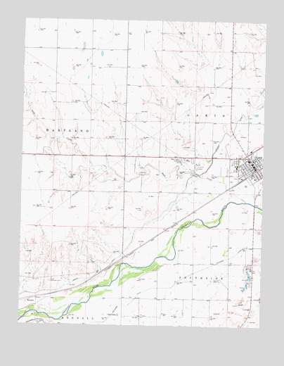
Lakin, KS USGS Topographic Map
Click on map above to begin viewing in our Map Viewer.

This topographic map contains these locations and features:
Feature Name Type Latitude Longitude GNIS ID View Map
City of LakinCivilN37.9397°W101.2587°2395615View Map
Clear LakeLakeN37.8795°W101.3246°471594View Map
First Baptist ChurchChurchN37.9418°W101.2572°2690274View Map
First Christian ChurchChurchN37.9401°W101.2573°2690275View Map
First Presbyterian ChurchChurchN37.9399°W101.2587°2690276View Map
HartlandPopulated PlaceN37.8872°W101.3721°484575View Map
Hartland CemeteryCemeteryN37.8930°W101.3592°471595View Map
Immanuel Lutheran ChurchChurchN37.9410°W101.2686°2690277View Map
Kearny County AirportAirportN37.9669°W101.2549°471591View Map
Kearny County CourthouseBuildingN37.9428°W101.2561°2625140View Map
Kearny County Emergency Medical ServicesBuildingN37.9469°W101.2523°2696426View Map
Kearny County FairgroundsLocaleN37.9396°W101.2848°2695105View Map
Kearny County Fire and RescueBuildingN37.9405°W101.2543°2111490View Map
Kearny County Health DepartmentBuildingN37.9430°W101.2557°2695022View Map
Kearny County Historical MuseumBuildingN37.9386°W101.2570°2694324View Map
Kearny County HospitalHospitalN37.9467°W101.2517°2499151View Map
Kearny County JailBuildingN37.9427°W101.2560°2504340View Map
Kearny County LibraryBuildingN37.9430°W101.2564°2694678View Map
Kearny County Sheriff's OfficeBuildingN37.9427°W101.2560°2504120View Map
LakinPopulated PlaceN37.9406°W101.2549°471593View Map
Lakin Administrative CenterBuildingN37.9410°W101.2555°2693177View Map
Lakin Assembly of God ChurchChurchN37.9358°W101.2546°2689311View Map
Lakin Church of ChristChurchN37.9465°W101.2535°2690278View Map
Lakin Country ClubLocaleN37.9404°W101.2823°2694516View Map
Lakin Elementary SchoolSchoolN37.9399°W101.2639°2427173View Map
Lakin Grade SchoolSchoolN37.9431°W101.2579°480827View Map
Lakin High SchoolSchoolN37.9403°W101.2640°480828View Map
Lakin Middle SchoolSchoolN37.9411°W101.2666°2427206View Map
Lakin Post OfficePost OfficeN37.9415°W101.2560°2693810View Map
Lakin Power PlantLocaleN37.9419°W101.2501°2692440View Map
Lakin United Methodist ChurchChurchN37.9436°W101.2552°2689464View Map
Louck ParkParkN37.9397°W101.2838°471592View Map
Saint Anthony's Catholic ChurchChurchN37.9462°W101.2557°2688759View Map
Sand CreekStreamN37.9261°W101.2593°471588View Map
Township of LakinCivilN37.9978°W101.2705°485281View Map
Victory Baptist ChurchChurchN37.9372°W101.2626°2690979View Map
Wesleyan ChurchChurchN37.9430°W101.2659°2690280View Map

Note: Coordinates in the location and feature list above are referenced to NAD83 datum.


Copyright (C) 2008-2025 Ryan Niemi / Sunset Dynamics ... All Rights Reserved