TopoQuest Logo
Do you find TopoQuest useful?
Help keep TopoQuest running and adding new maps/features by donating!
Bitcoin:  19c7KJd3qBynnjoSw5npx9KScwjBe4ifkT
Litecoin:  LXs6TkuXGGXo1vDsWCkWVdjQX94eUKd6ui
Home View Maps Find Maps Find Places Resources & Links


Lamar East, Colorado Topographic Map

USGS Map Title: Lamar East, CO
USGS Map MRC: 38102A5
DRG (GeoTIFF) Download: o38102a5.tif


Neighboring USGS Topographic Map Quads:


  Wiley, CO  
38102B6
 

  May Valley, CO  
38102B5
 

  Granada NW, CO  
38102B4
 

  Lamar West, CO  
38102A6
 

  Lamar East, CO  
38102A5
 

  Carlton, CO  
38102A4
 

  Cat Creek NW, CO  
37102H6
 

  Cat Creek NE, CO  
37102H5
 

  North Plum Creek NW, CO  
37102H4


Map MRC Location:

N39°
W103°
N39°
W102°
H8 H7 H6 H5 H4 H3 H2 H1
G8 G7 G6 G5 G4 G3 G2 G1
F8 F7 F6 F5 F4 F3 F2 F1
E8 E7 E6 E5 E4 E3 E2 E1
D8 D7 D6 D5 D4 D3 D2 D1
C8 C7 C6 C5 C4 C3 C2 C1
B8 B7 B6 B5 B4 B3 B2 B1
A8 A7 A6 A5 A4 A3 A2 A1
N38°
W103°
N38°
W102°

Lamar East, CO USGS 1:24K Topographic Map Preview:
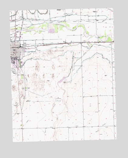
Lamar East, CO USGS Topographic Map
Click on map above to begin viewing in our Map Viewer.

This topographic map contains these locations and features:
Feature Name Type Latitude Longitude GNIS ID View Map
City of LamarCivilN38.0739°W102.6155°2411617View Map
Clay CreekStreamN38.1000°W102.5257°195685View Map
Clay Creek SchoolSchoolN38.0922°W102.5566°195573View Map
ClucasLocaleN38.0922°W102.5196°195575View Map
Colorado State Patrol Lamar Troop Office 2CBuildingN38.0954°W102.6159°2735542View Map
Fairmount CemeteryCemeteryN38.0509°W102.6068°195579View Map
Hyde CanalCanalN38.1131°W102.5755°195570View Map
KLMR-AM (Lamar)TowerN38.1147°W102.6216°204035View Map
KSEC-FM (Lamar)TowerN38.0361°W102.5999°204161View Map
LamarPopulated PlaceN38.0872°W102.6207°203835View Map
Lamar Fire Department Station 1BuildingN38.0844°W102.6185°2666952View Map
Lamar Fire Department Station 2 / Prowers County Rural Fire DepartmentBuildingN38.0913°W102.6165°2666974View Map
Lamar Police DepartmentBuildingN38.0846°W102.6185°2757288View Map
Lamar Post OfficePost OfficeN38.0869°W102.6208°2734606View Map
Lamar ReservoirsReservoirN38.0390°W102.6032°195581View Map
Lamar WaterworksLocaleN38.0389°W102.5699°195580View Map
MarkhamLocaleN38.1175°W102.6088°195568View Map
Markham ArroyoStreamN38.1164°W102.6091°195569View Map
Mike Higbee State Wildlife AreaParkN38.0833°W102.5269°196390View Map
Mount Olive CemeteryCemeteryN38.0508°W102.6091°195578View Map
Paradox SchoolSchoolN38.1217°W102.5221°195574View Map
Prowers County JailBuildingN38.0865°W102.6182°2735575View Map
Prowers County Sheriff's OfficeBuildingN38.0865°W102.6181°2757303View Map
Prowers Medical CenterHospitalN38.0705°W102.6100°2695605View Map
Riverside CemeteryCemeteryN38.0936°W102.6073°195571View Map
Southeast Colorado FairgroundsLocaleN38.0672°W102.6213°195576View Map
Vista Del Rio DitchCanalN38.1195°W102.5507°203836View Map
West FarmPopulated PlaceN38.0928°W102.5585°195572View Map
Willow Creek ParkLocaleN38.0750°W102.6144°195577View Map

Note: Coordinates in the location and feature list above are referenced to NAD83 datum.


Copyright (C) 2008-2025 Ryan Niemi / Sunset Dynamics ... All Rights Reserved